

STUDIO
Introduction to the studio will take place on Tuesday, September 15th, 2020, Design Studio HIL C 40.1 (tbc) at 10 am.
TEACHING TEAM
Prof. Christoph Girot, Fujan Fahmi, Julian Fischbacher, Benedikt Kowalewski, Luisa Overath
EXPERT
André Schmid, Martina Voser, Dr. Ilmar Hurxkxkens, Matthew Skjonsberg
STUDENTS
Rita Andrade Viegas, Stefan Bopp, Nöelle Bächler, Nicolas Carlier, Turi Colque Lajo, Aurore Delory, Leo Galler, Christoph Gerken, Jessica Jost, Louis Milhaud, Michael Nelson, Kim Nipkow, Noah Pasqualini, Florian Reisner, Joss Russek, Annina Schoop, Rino Sogno, Alexander Thöny, Rejina Velaj, Sandro Wegmüller, Andrin Zumsteg, Ralf Zwahlen
Forming a Dynamic Flood Plain
Analysis | Alexander Thöny, Sandro Wegmüller
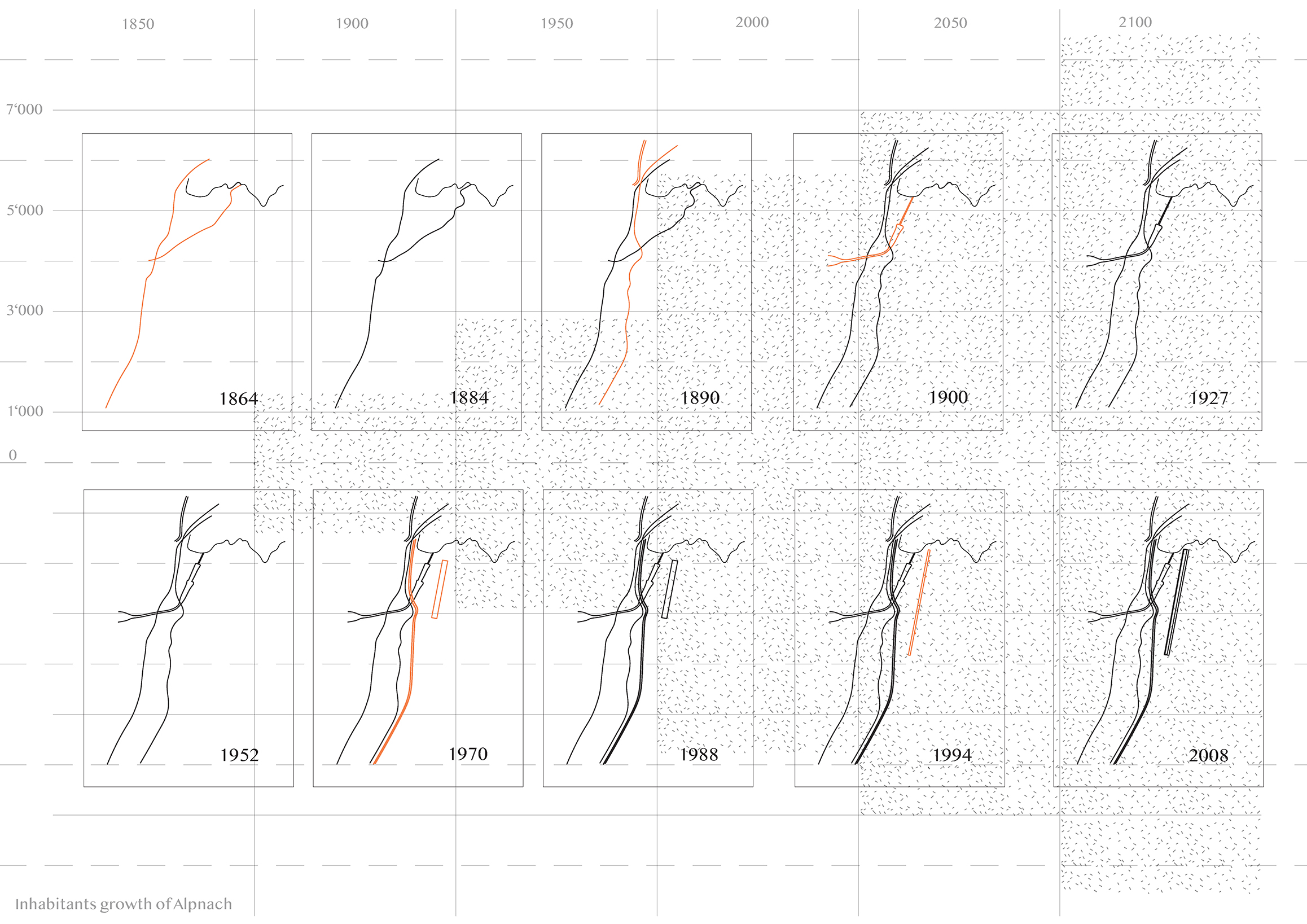
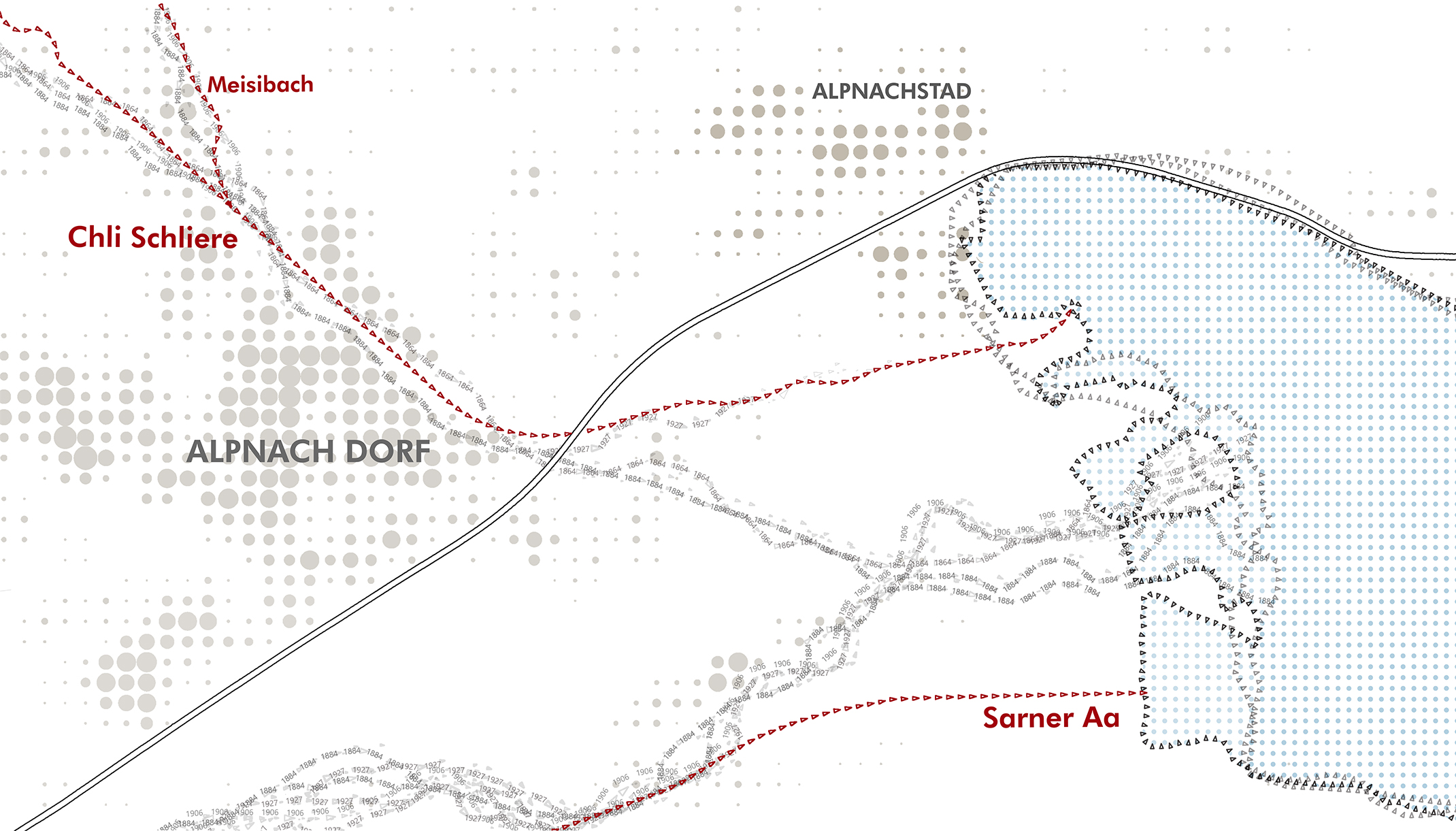
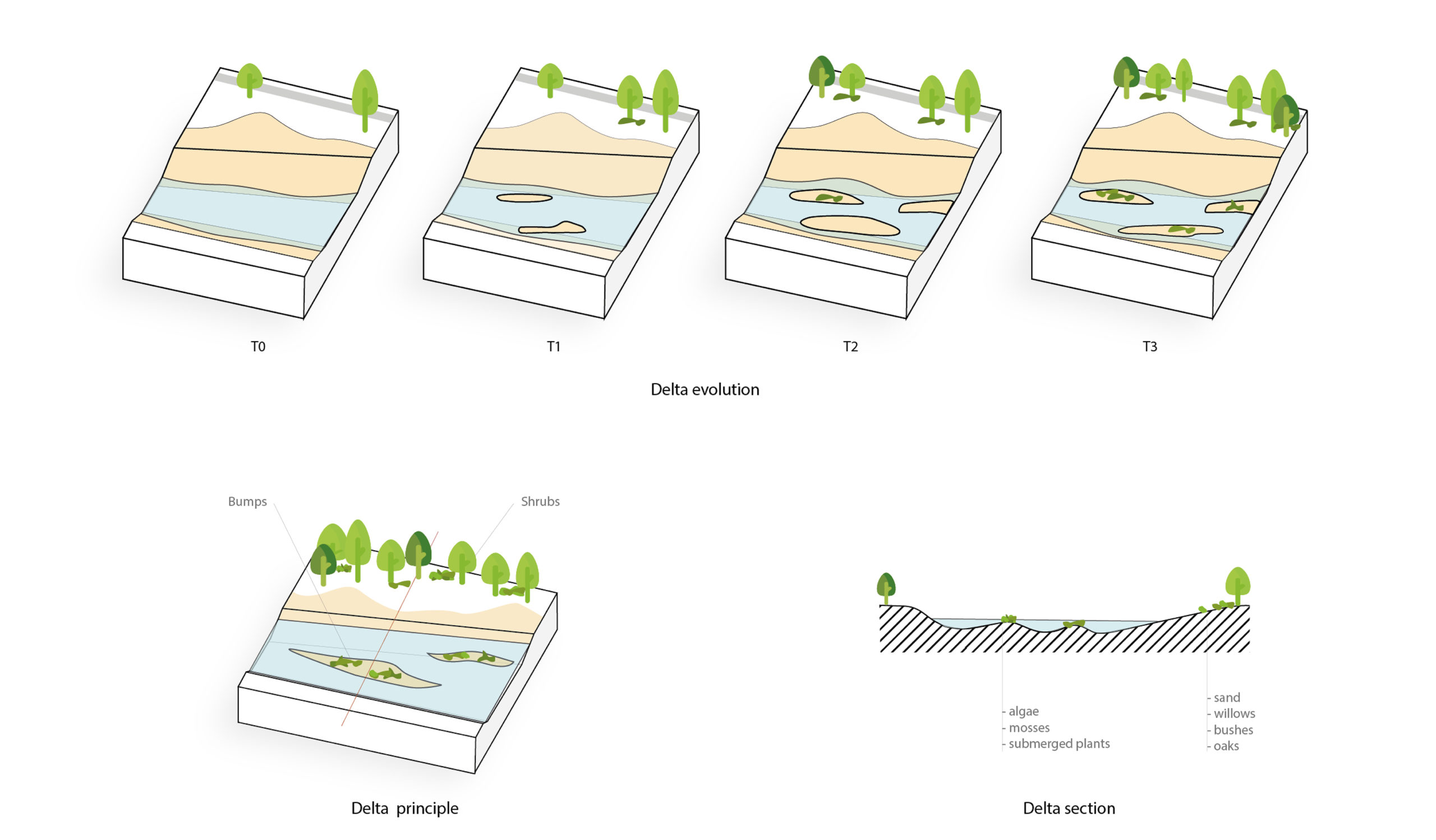
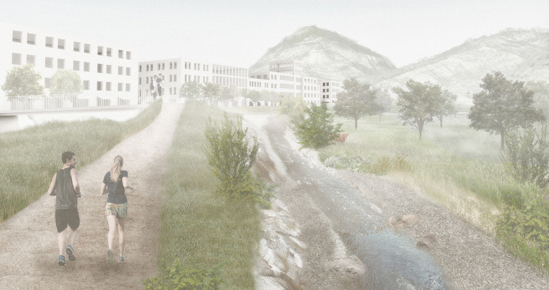
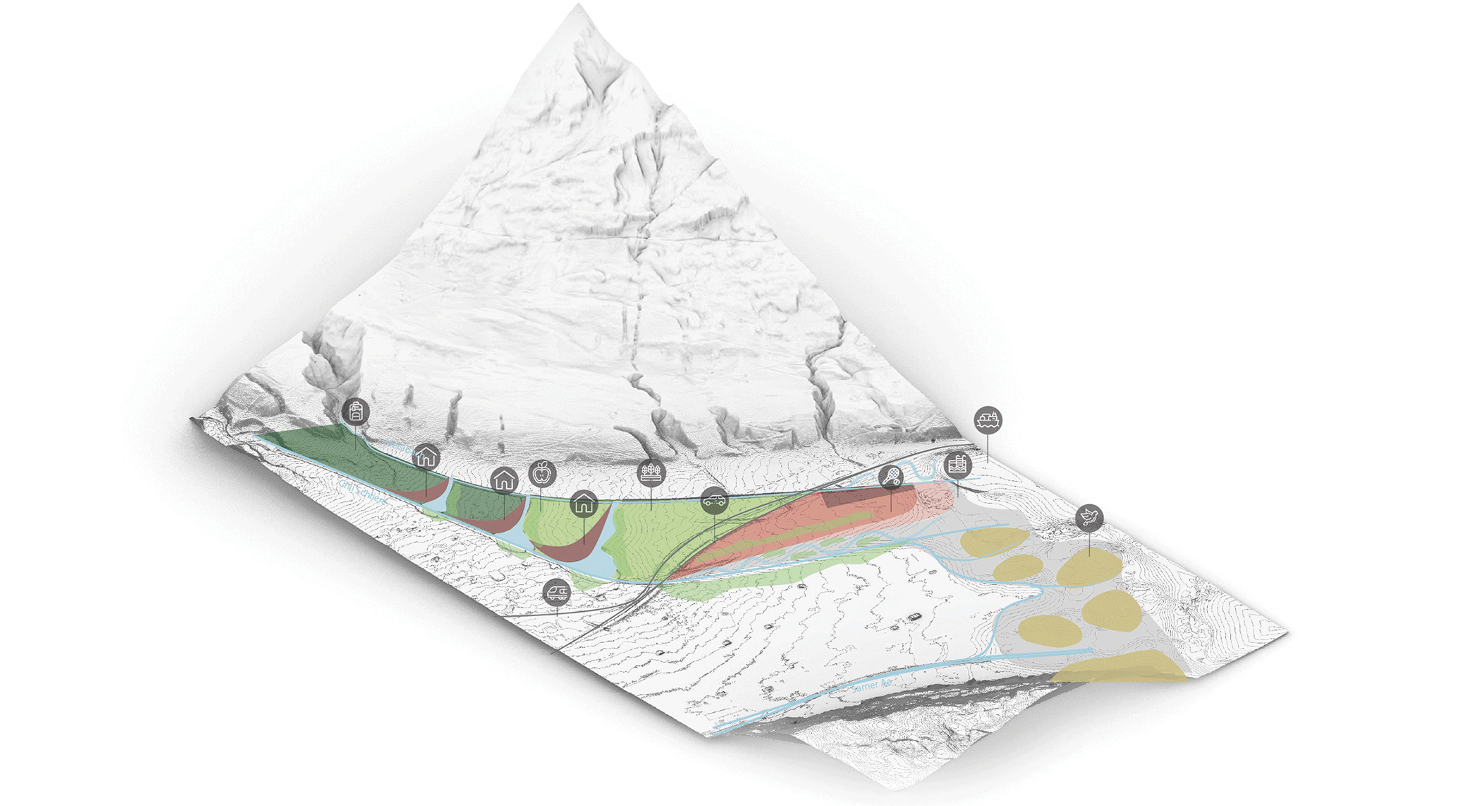
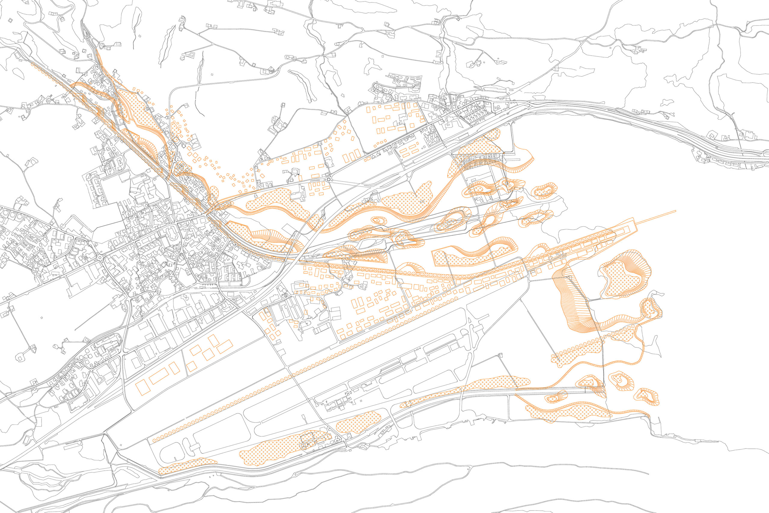
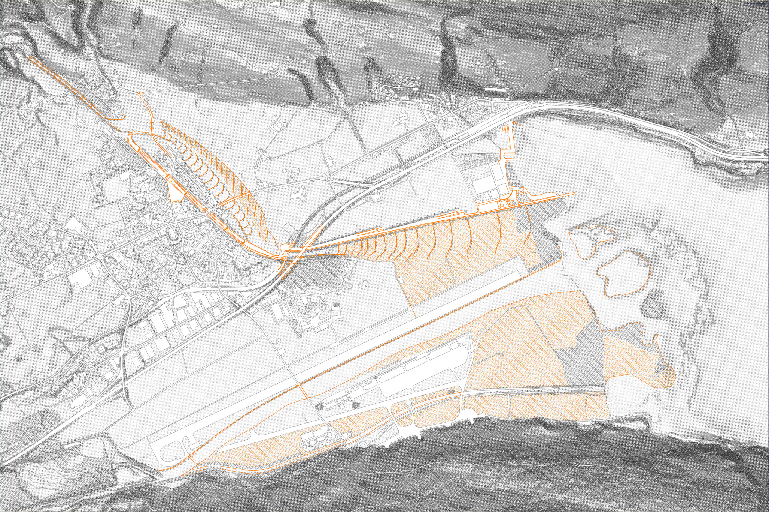
The main topic of the design course was the mitigation of periodic flood in the SarnerAa valley. With different digital tools and historic maps the students were able to analyze the problems, that are mainly created by two channeled Rivers -the Chli Schliere and the Sarner Aa. Based on hydrologic calculations of the late 19th cent. the channels today are merely able to contain the water in flood case. The catastrophic flood event of 2005 in Switzerland has shown this explicitly. This is an issue in many parts of the world in recent years, that can be seen as an effect of global climate change.
For Alpnach and Alpnachstad -two villages along the rivers – this results in officially defined danger zones, where construction is prohibited. For them the channeling of the rivers therefore does not only result in higher risk of flood, but also in separation of the landscape and limitation of potential future development. Furthermore instead of housing a variety of plantlife, the fertile soil on the steep river banks is covered with rocks that make it impossible for vegetation to grow. In the first part of the semester the students were asked to propose a different riverflow for the upper part of the River, that tries to deal with the identified problems. These proposals were then portrayed in a set of diagrams that helped to work with and explain their basic principles.
Analysis | Leo Galler, Florian Reisner; Aurore Delory, Rino Sogno
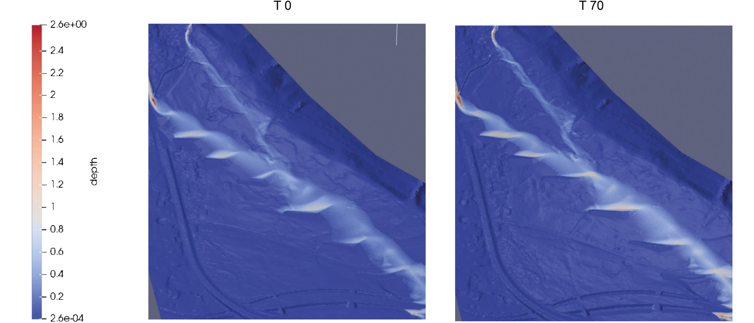
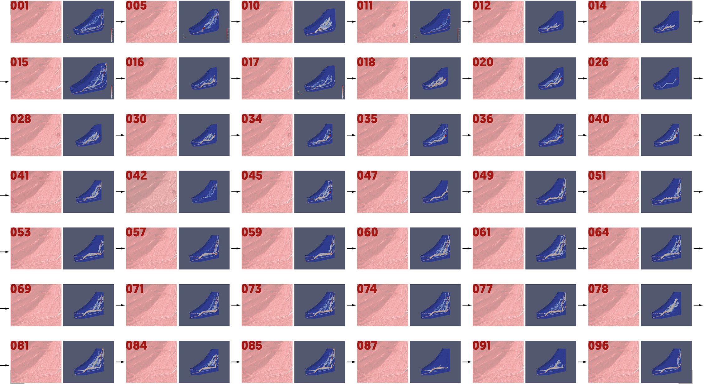
Simulation | Alexander Thöny, Sandro Wegmüller; Leo Galler, Florian Reisner
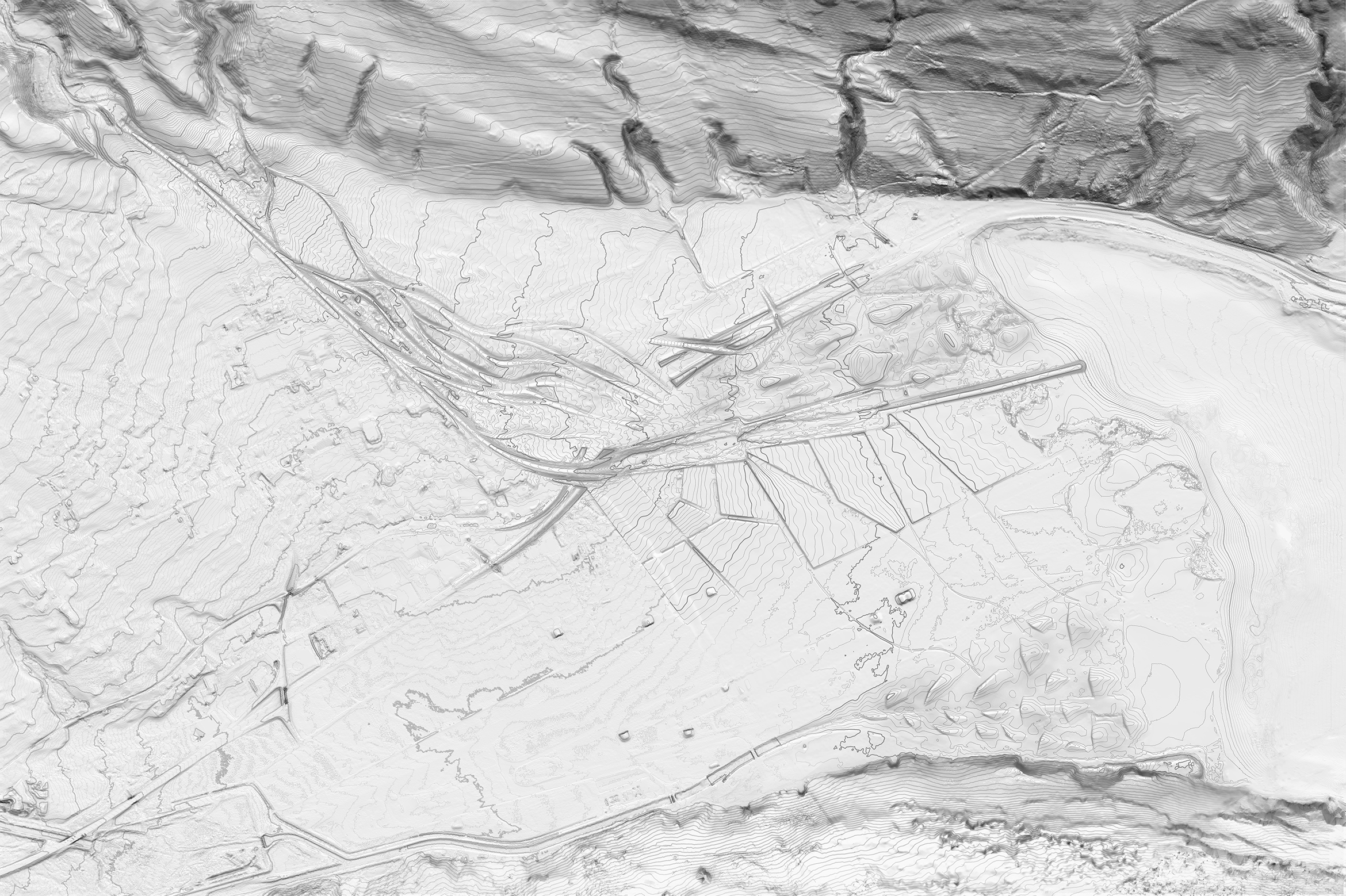
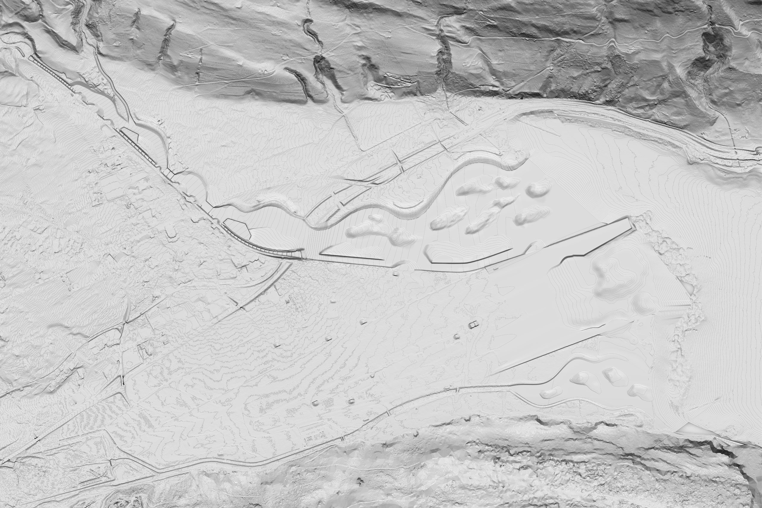
One of the tools was the possibility to simulate the water flow over the topography. The student teams were provided with a digital 3D model of the existing terrain as well as with methods to modify it. The idea of the course was to find a topography that can mitigate flood through an iterative process. The students were able to use the simulation, to learn how performative their modelled topography is and what the limits of their approach are. With these new understandings of the conditions they then were able to come back and modify the terrain accordingly. The main principle the chair is supporting is that, in contrary to a narrow channel, a wide river space could not only mitigate flood in a more resilient way, but would as well be able to provide spaces for vegetation, wildlife and people.
With these digital tools the students were able to develop their own strategies on how to modify river spaces in an informed way, that both considers the specific terrain- and river properties of the site. Another factor influencing the topographic interventions was the awareness of the ecologic responsibilities of landscape architecture. The studio tried to find ways to reduce the amount of grey energy mainly resulting from massive transfer of soil from one site to another.
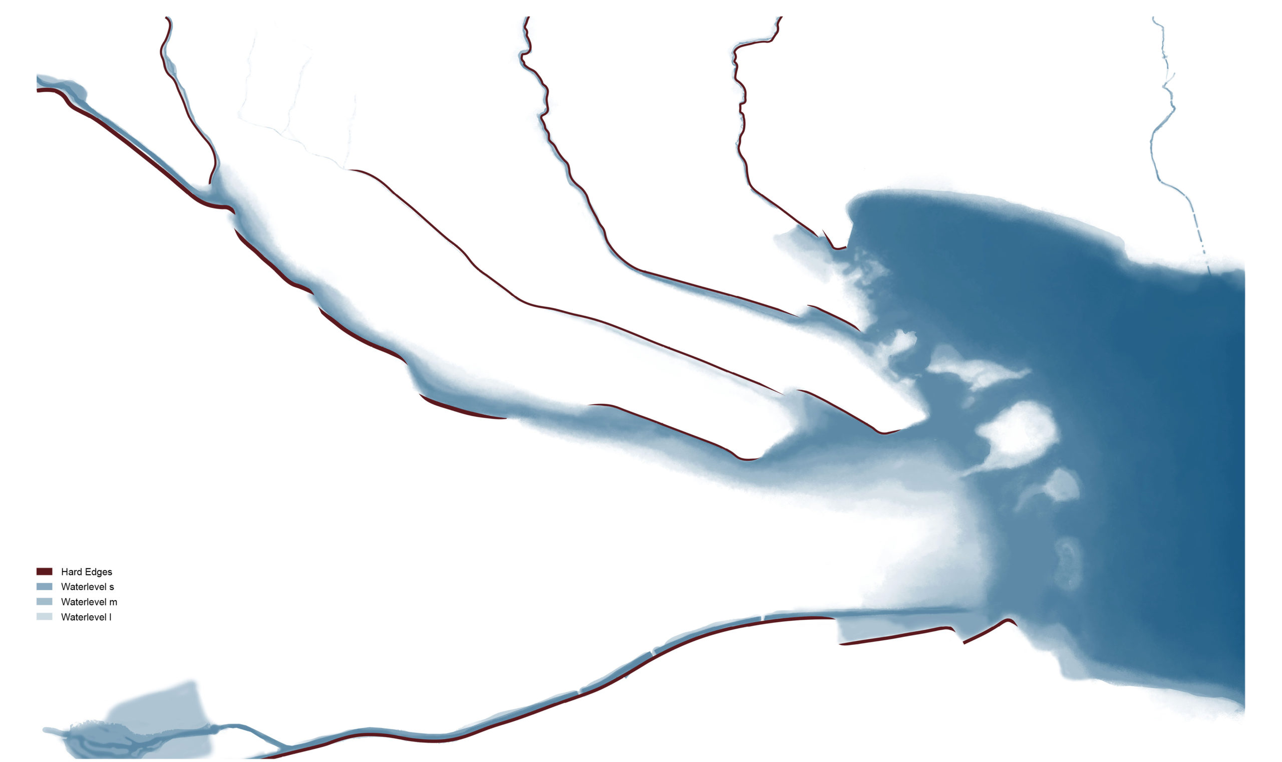
Dynamics of water levels | Joss Russek, Andrin Zumsteg; Stefan Bopp, Christoph Gerken; Nicolas Carlier, Turi Colque Lajo
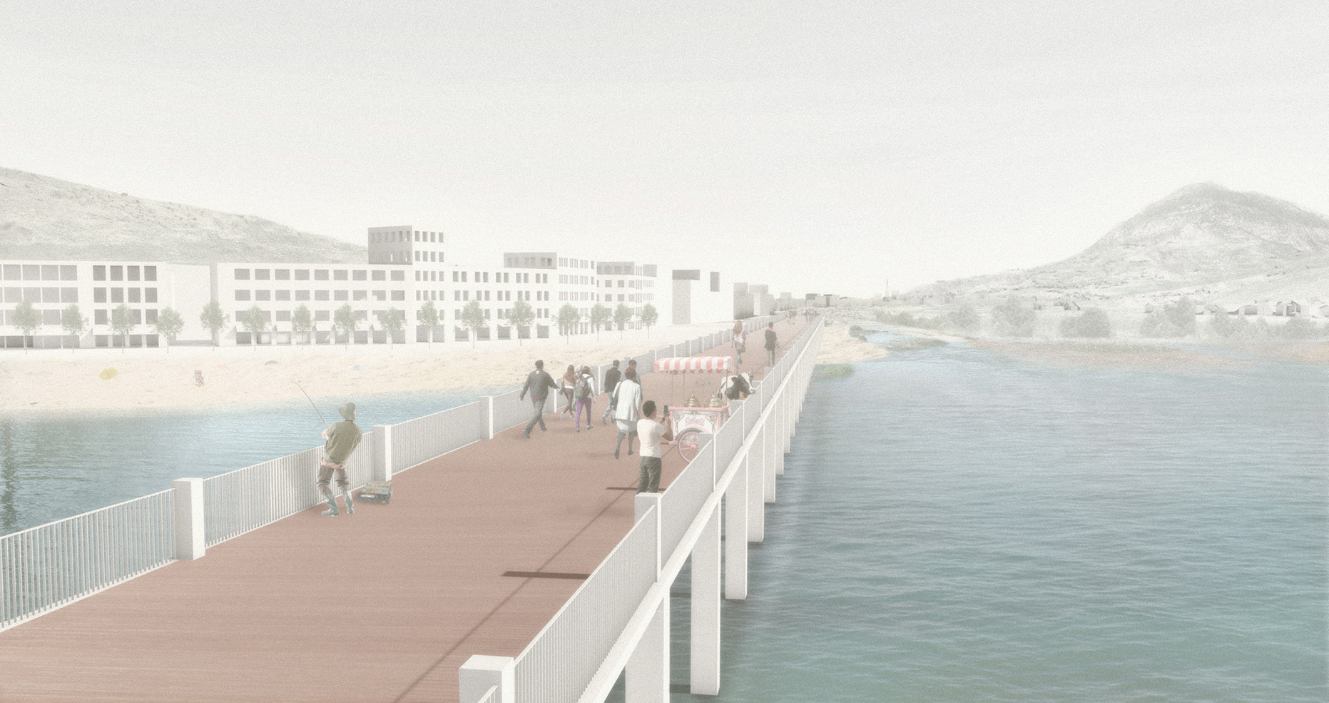
Amenities | Rita Andrade, Nöelle Bächler
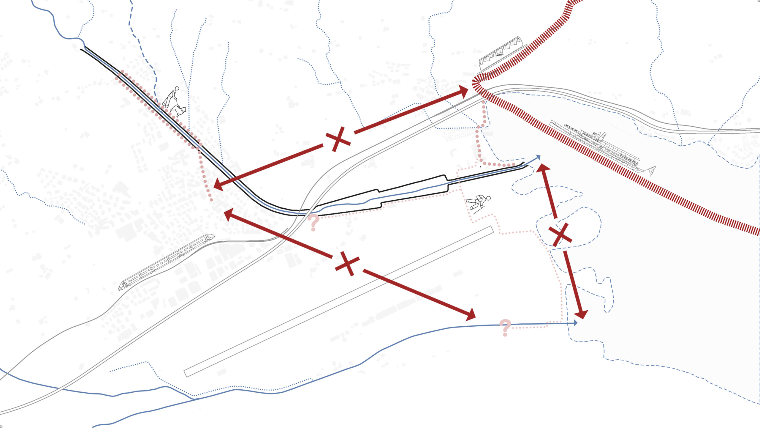
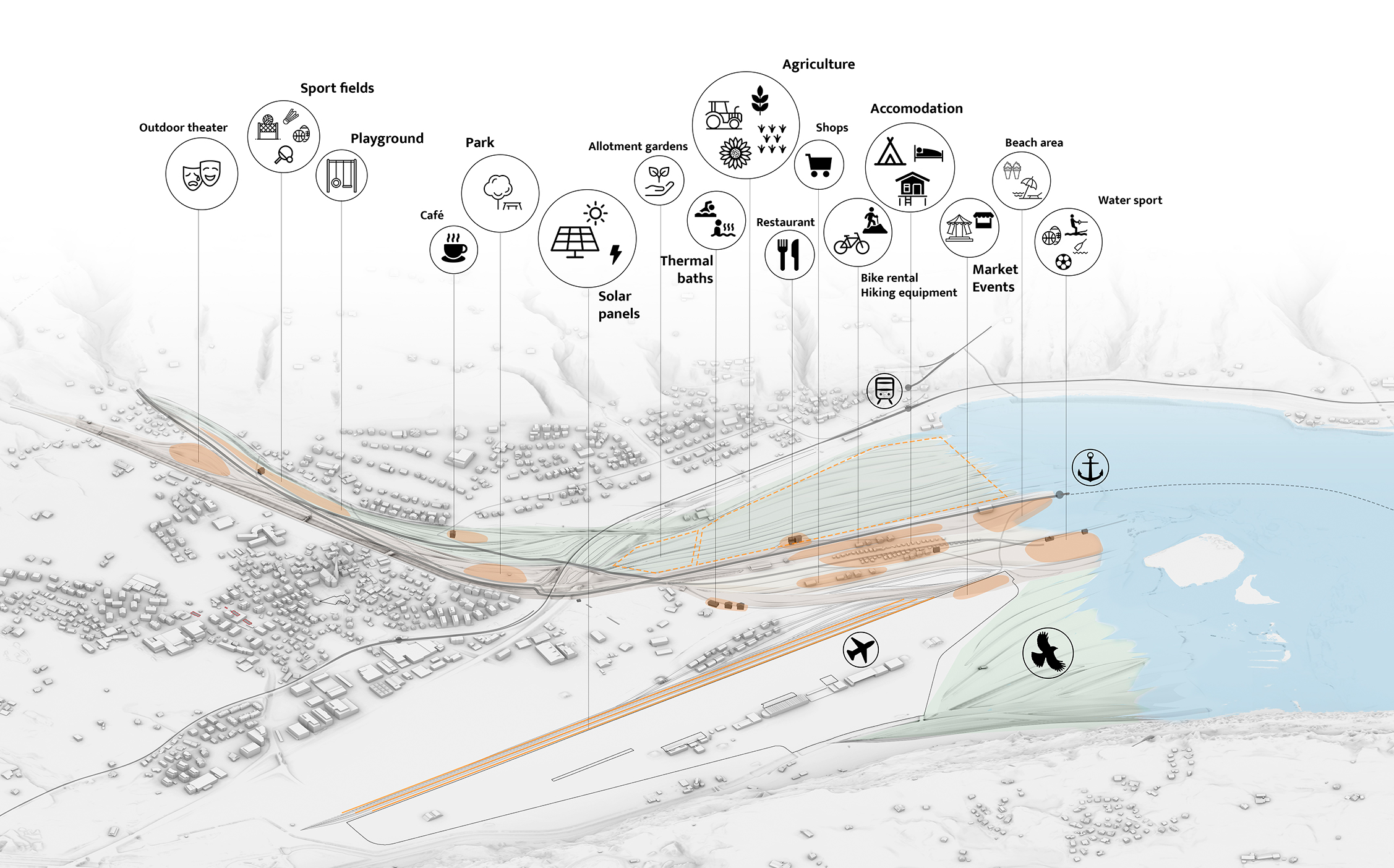
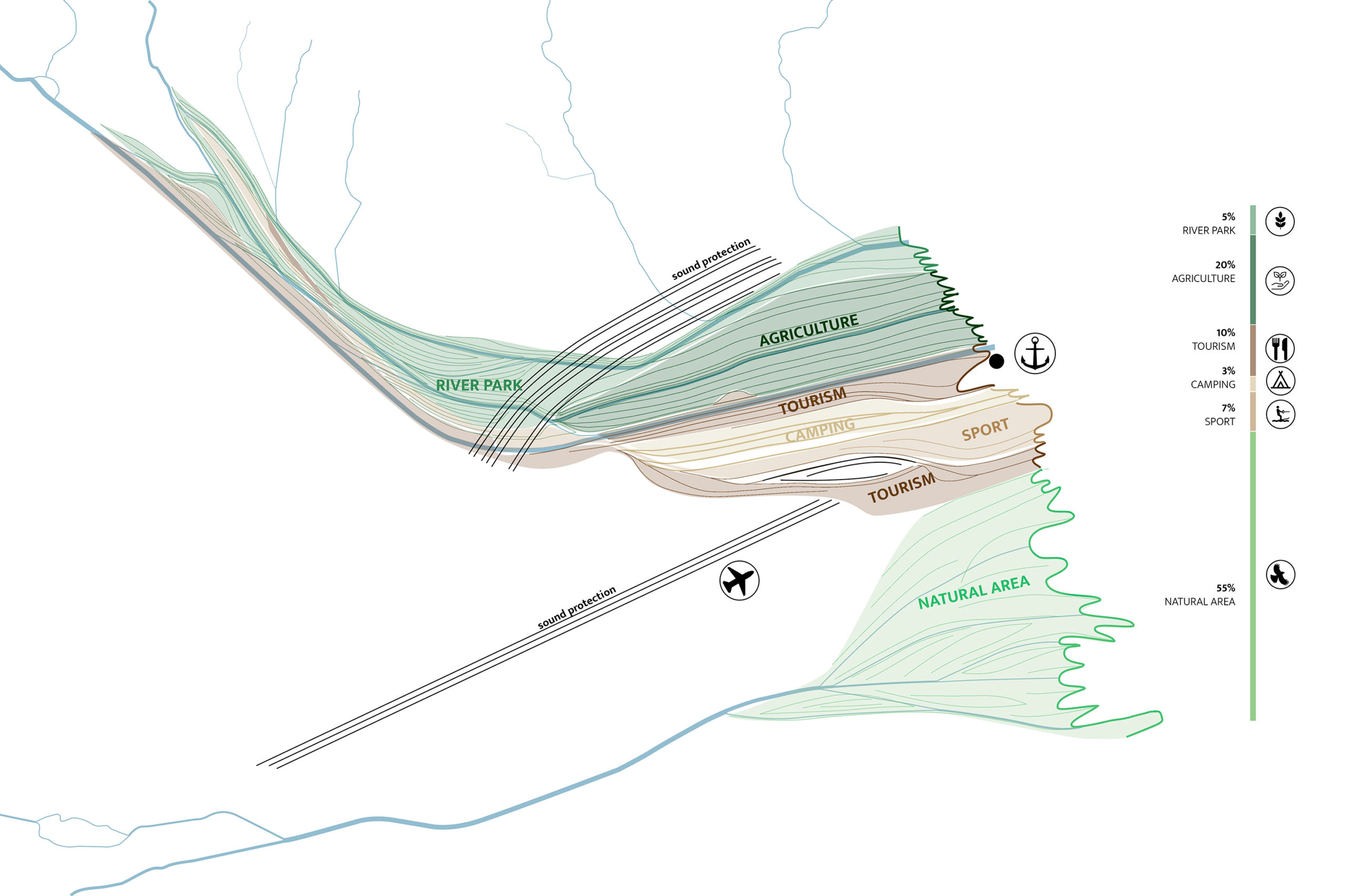
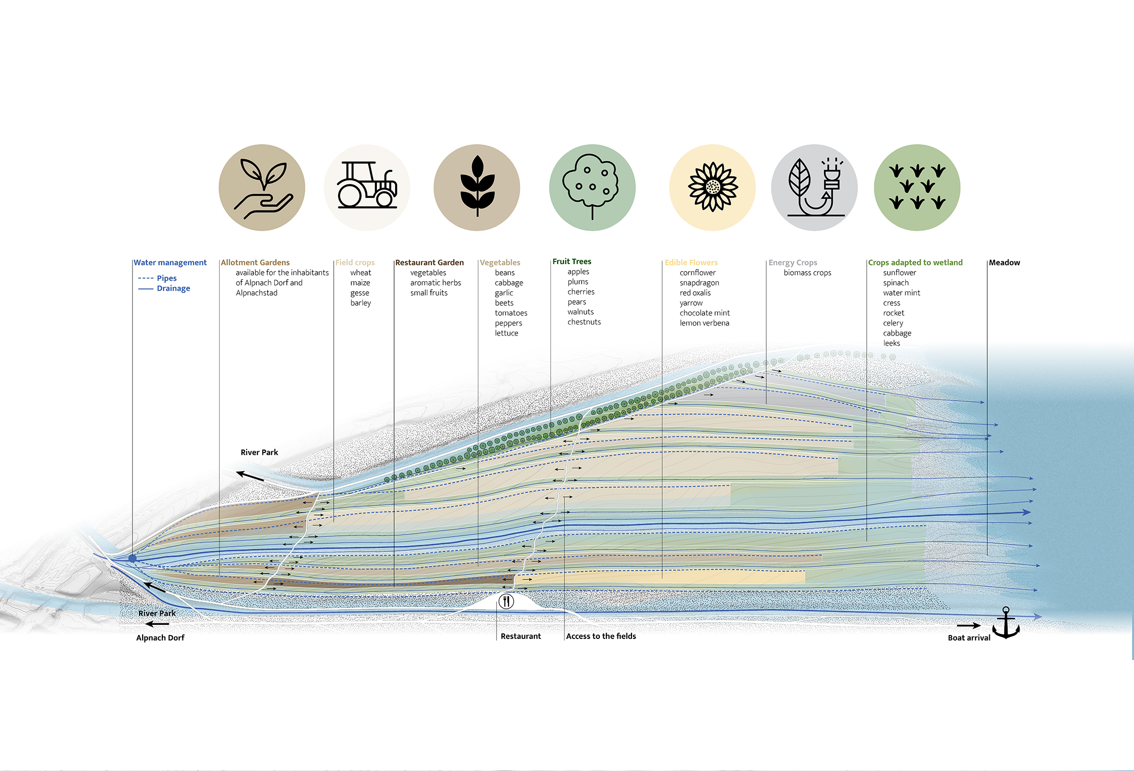
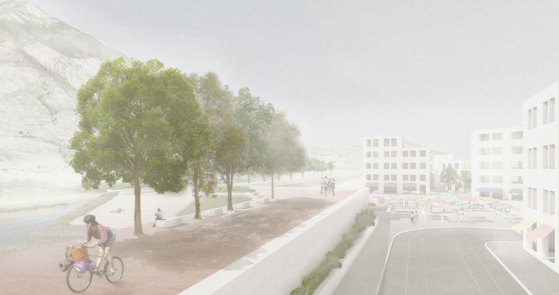
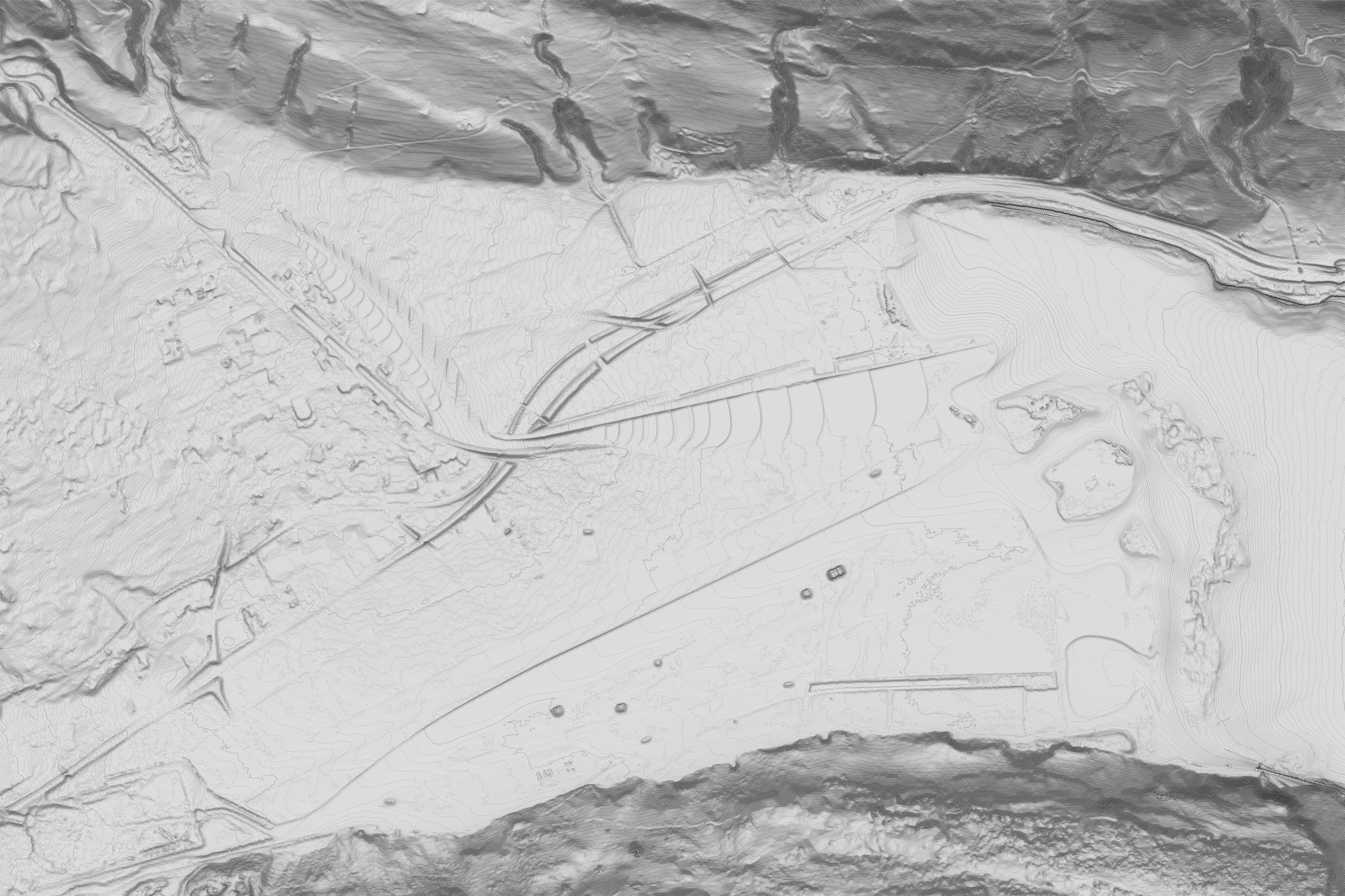
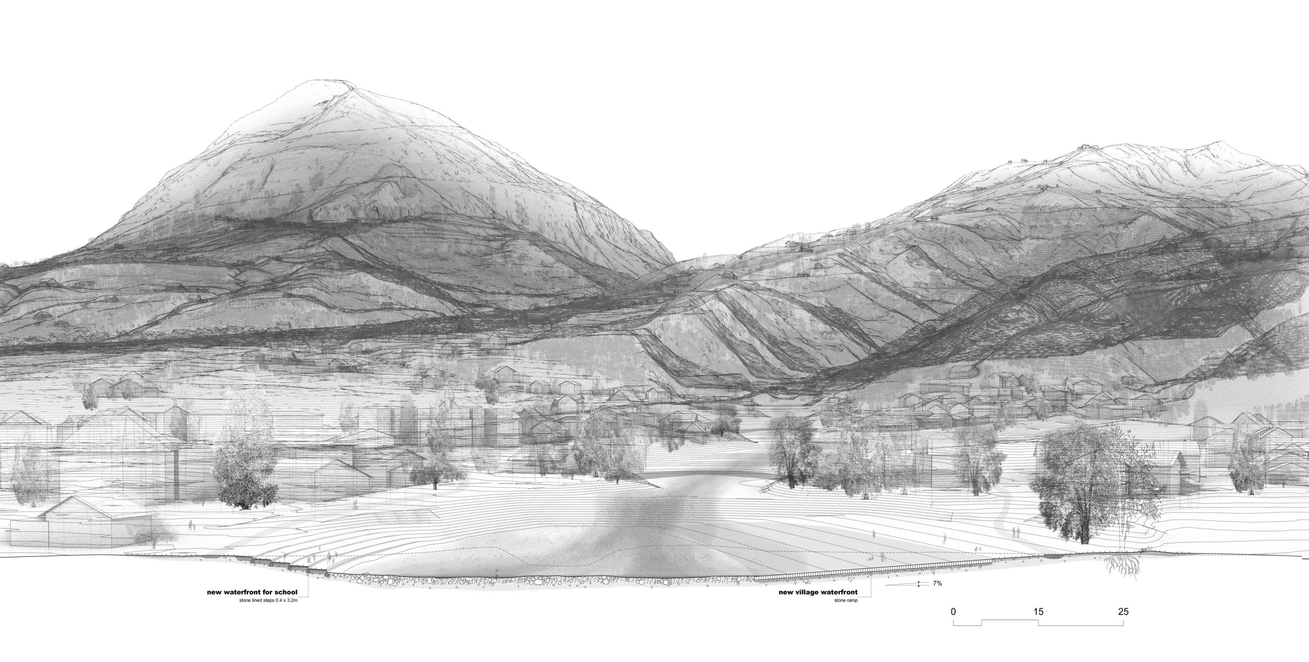
In the second part the studio was discussing on the lower part of the river and the riviera at the lake front. Rather flat, consisting of farm land and the airstrip of the local military base, the area lacks on a programmatical approach, that activates the potentials of the landscape. The students were asked to identify these potentials and use them for amenity proposals,
that closely interact both with the river and the lake, in order to form the Alpnach Riviera. They were free to use sections, perspectives, collages and diagrams to communicate, but also to test their approaches. The underlying idea was to connect the separated villages and give both access to the lake.
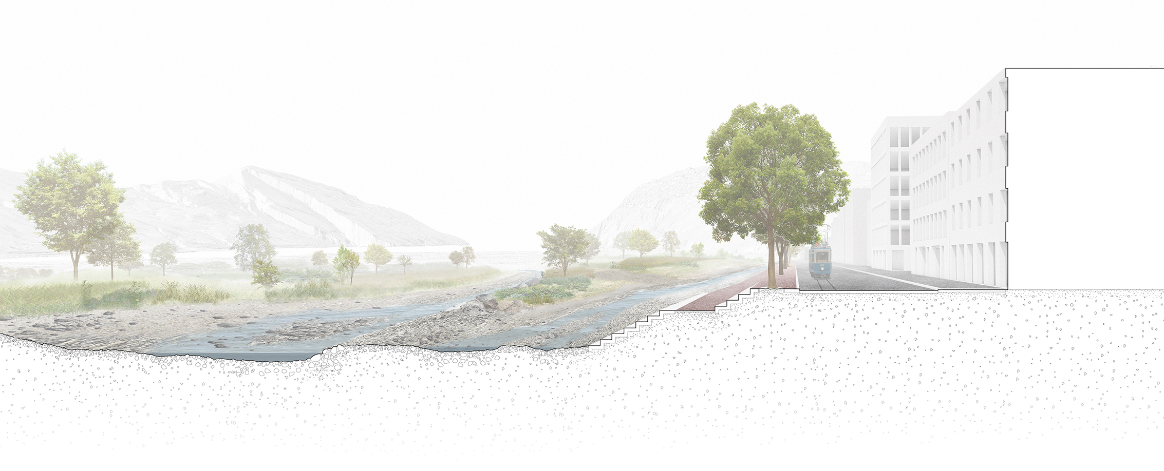
Section Perspective, Perspectives | Kim Nipkow, Ralf Zwahlen
Axonometry | Nicolas Carlier, Turi Colque Lajo

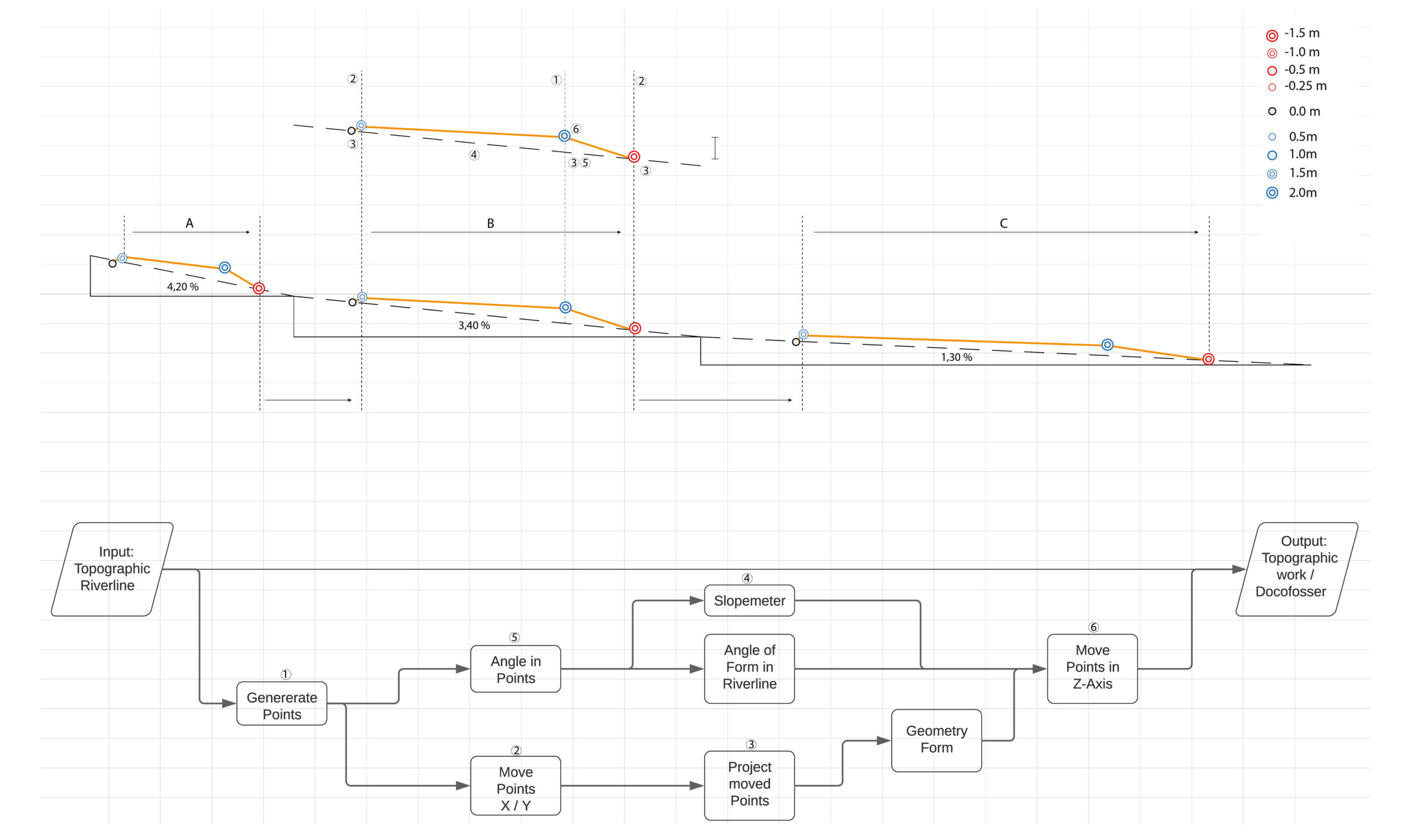
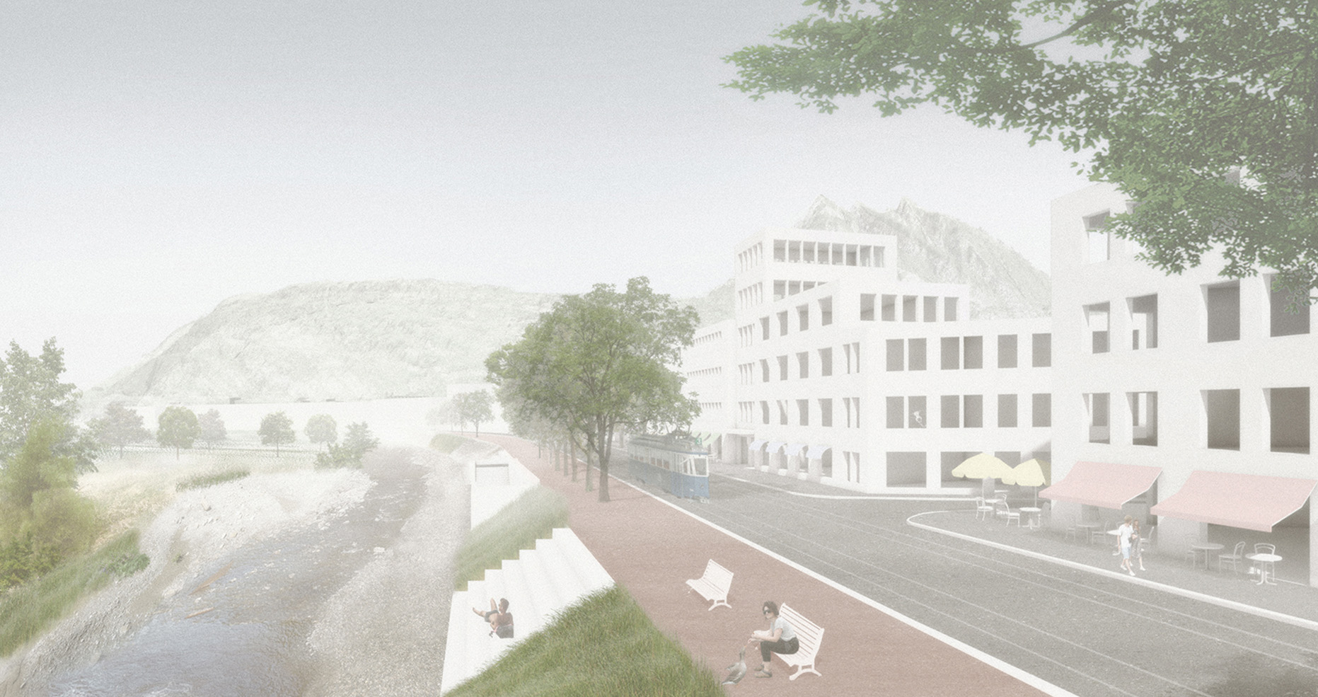
In the last design step the students started to refine their proposals, not only bringing together the upper and the lower part of the rivers, but also working on a smaller scale to understand in detail on how their interventions are constructed as well on how they shape the landscape on human scale. With the information of their 3D models, informed by their programmatic approaches as well as the river flow simulations, they were able to draw detailed construction plans, that show their principles and techniques.
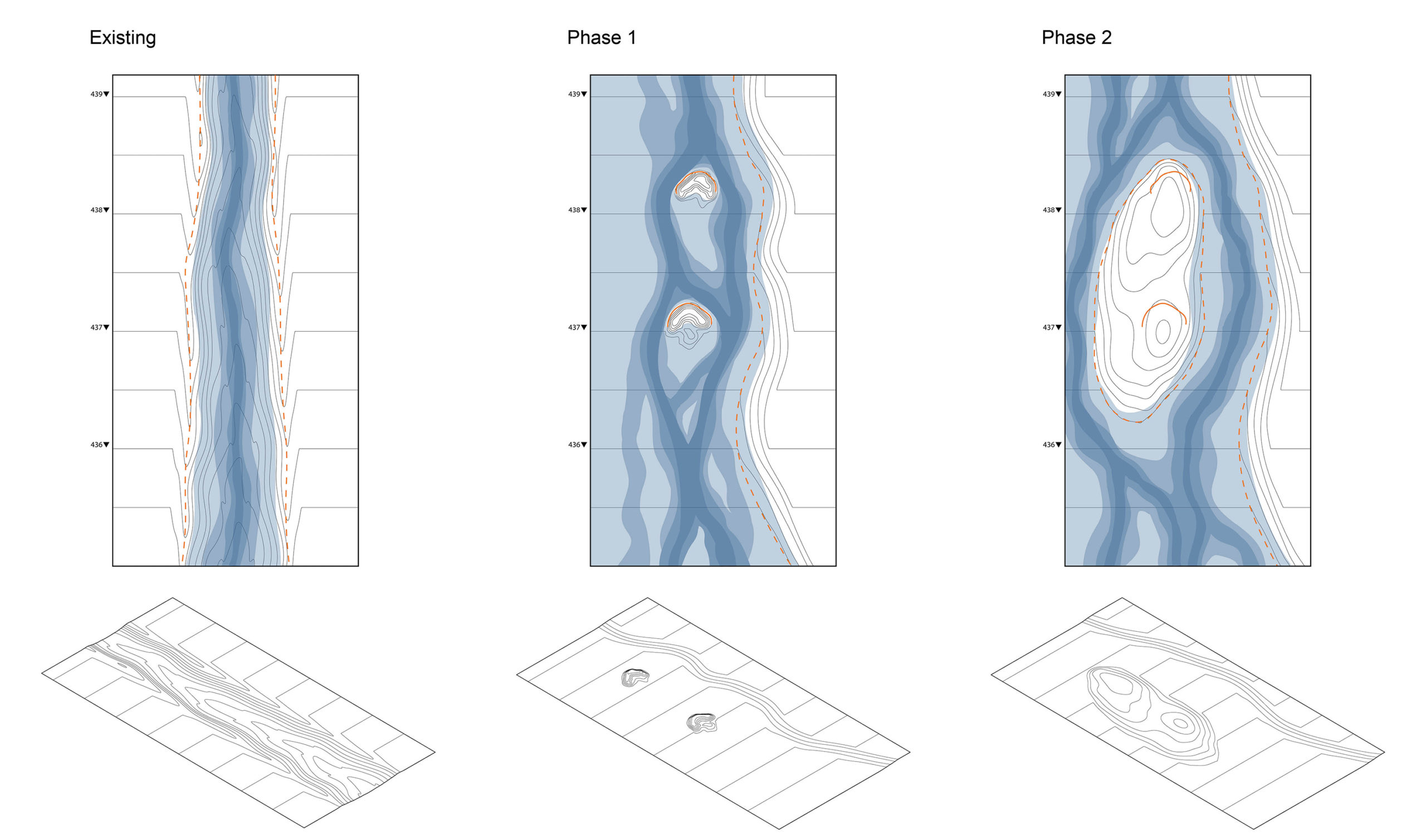
An important step for the studio was to show the dynamic evolution of the rivers over time. This understanding of the river as a dynamic landscape, rather than a static surface in our understanding is a key principle, that we wanted communicate to the students. This dimension of time in the design process we not only see restricted to river design, but as something that can be applied to various topics in both architecture and landscape design.
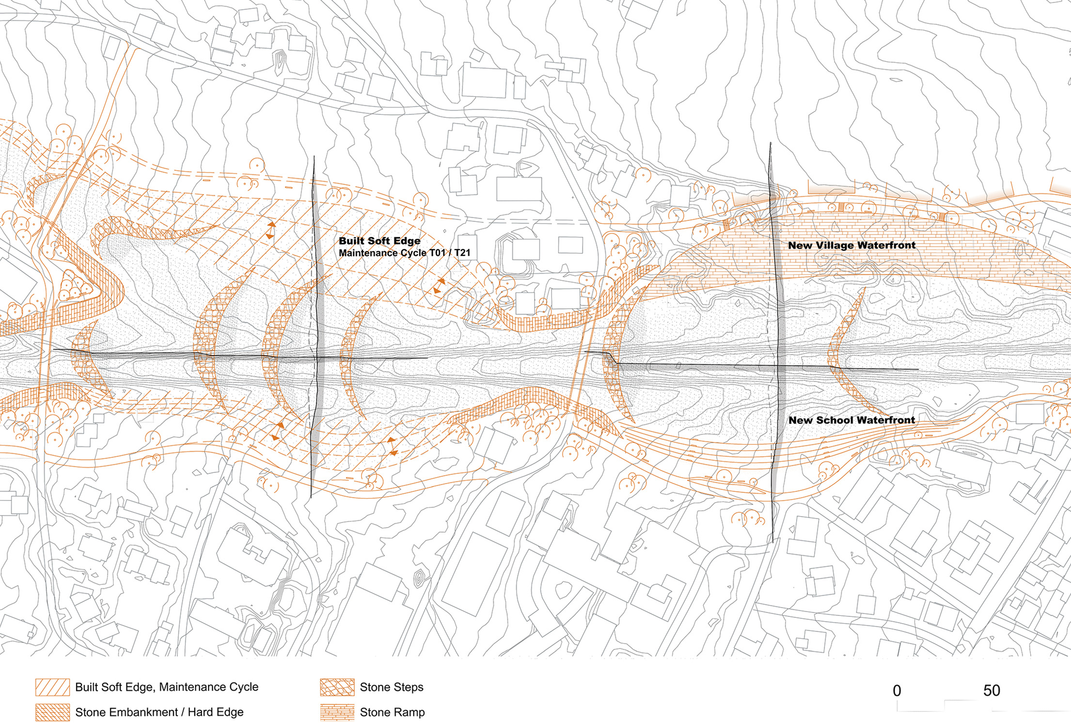
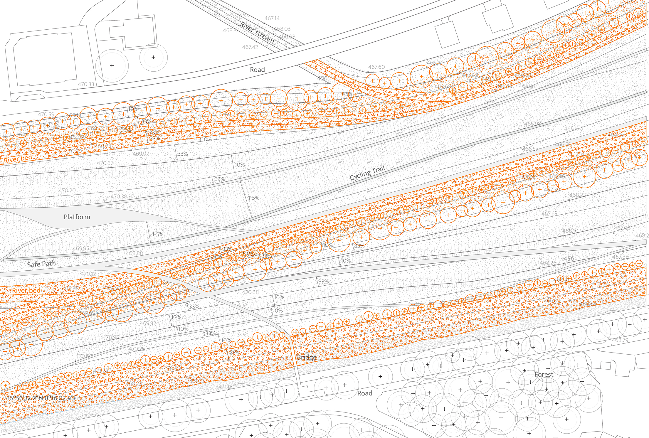
Construction Plan | Michael Nelson, Noah Pasqualini; Rita Andrade, Nöelle Bächler
Topographic and Construction Plan | Leo Galler, Florian Reisner
Perspective | Michael Nelson, Noah Pasqualini