
In the MAS LA year 2013/2014 the students were given a design task in the Linth Valley between Lake Zurich and Walensee!
The task of each MAS LA student was to generate a large-scale vision for the future Linth valley and explain their individual methodology of integrating the tools they have been learning during the year, in the design process. The Linth valley, named by the old river Linth, used to have major problems with flooding and malaria. Nowadays, is characterized by the strong infrastructural element of the Linthcanal and a complex secondary, drainage system.
The site’s location by the end of Zürichsee, and the great connectivity due to the highway, were major aspects that the students should take into consideration throughout the design process.
Fragmented Landscapes | A Project by Jacqueline Frizi & Sofia Prifti
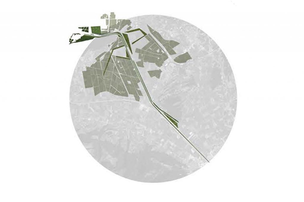
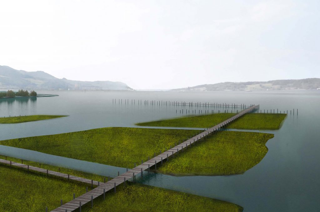
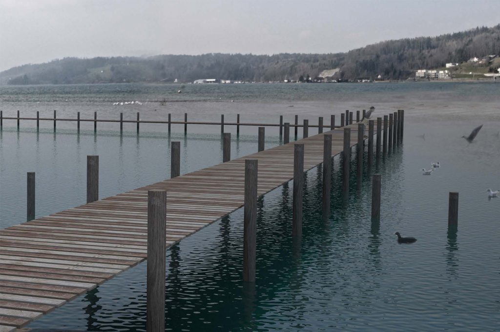
The following project, deals with a hybrid landscape of fragmented rural and urban characteristics, in the Linthebene area, by the end of Zürichsee. The dominant infrastructural water network, that divides the valley in two, as well as the parallel urban spines lacking perpendicular connections to the Linth canal, were perceived as the major problems in our design approach.Important fragments along the Linth such as the several natural reserve areas, the renaturalization of the old Linth river and the untouched nature-”jungle” on the waterfront were used as a starting point in our approach. In the same fragmented way our design intervention focuses on three different points of the site.
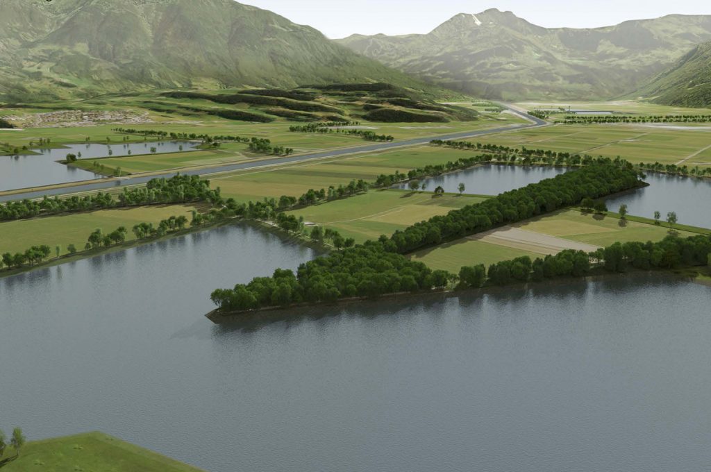
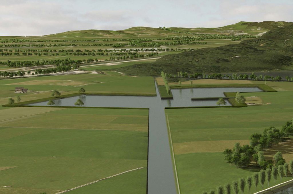
A main goal was to propose a new adaptive, according to its context, system that would solve the specific problems of each area and would in a larger scale connect the existing cities through a new network of pathways to the “new Linth”, unifying the design.Starting from Wallensee, the main approach was to regenerate and redesign the existing renaturalized area, in order to make it more accecible for the locals. Technically it would also function as a buffer zone in case of an extreme flooding scenario. Moreover, in the Kaltbrunner Riet, an artificially preserved natural reserve area a system of polders is designed, collecting the waters of the valley and leading them to the side canal and eventually to Zürichsee, to replace the pumping.
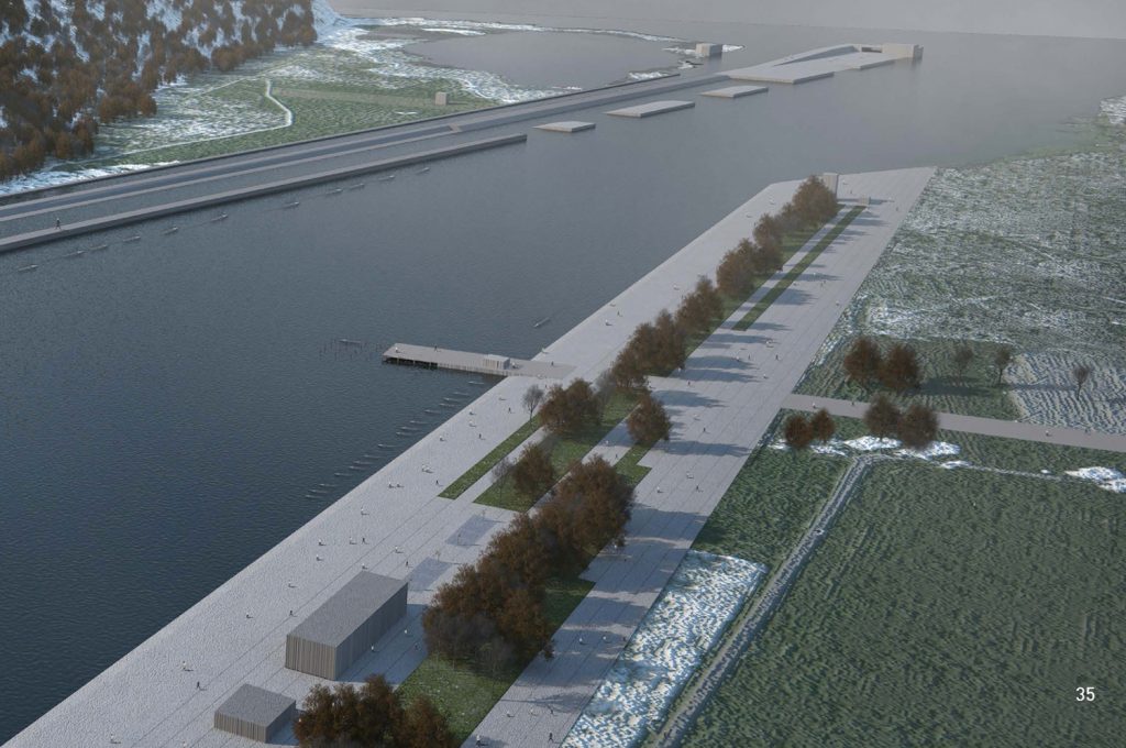
Last, our main focus was to redesign the watermouth of the area, that was completely degraded and unused. It would function as an attractor for the whole area of the Linthebene, creating a strong connection between the city of Schmerikon and the expanded Linth, bringing the locals closer to the new recreational character of the water. A parallel system of three worlds, starting from the city of Schmerikon, to the intermediate level of the cubic wetlands leading to the untouched, less accessible nature of the “jungle”, create a triptychon of transition from the hard to the soft edge.
Linth Water Park | A Project by Angelos Komninos & Argyro Theodoropoulou
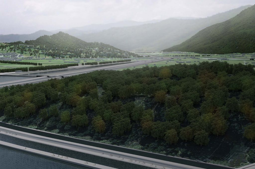
This project is about the design of a new water park along the Linth canal, from lake Wallen to the lake of Zurich. Considering the small height differences in the valley, the new park-design follows the micro-topographical traces of the old river along the canal. At the same time, the designing phase of the proposal is based on our attempts to solve the flooding problem of the nothern part of the valley and to connect the two opposite sides of the canal.
Through solving the infrastructural problem of the water network, this design approach creates a public space for the residents but at the same time attempts to establish the new water park as a pole of attraction and future developement.
Lakescapes, preserving agriculture | A Project by Alexandre Roulin & George Sarmaniotis
The high level of the water table in the Linth Valley in Switzerland and it’s consequences is the basic issue this project deals with. The main economical activity in the area is agriculture and is sustained through intensive drainage of the fields due to the fact that the water table is close or some times above the ground level, depending on the period of the year. The result of this action is the shrinking of the ground, which in the very near future will lead to the complete sinking of the ground surface turning the grass fields into swamps.
In order to prevent the above course and preserve agriculture as a main activity in the area, this project focuses on a solution that proposes two main actions connected topologically and economically in an balanced way.
The first action is the digging of the most problematic areas, as far as concern the proximity to water table, and the second is the use of the digging material to fill the less endangered parts of the valley, neighboring the previous areas, in order to be secured without the need of intensive drainage. The result of those two actions will be the raise of the ground level by creating lakes.