Städte sind grossräumige Landschaften mit komplexen Situationen und Infrastrukturen über und unter dem Boden. Virtual Reality (VR) bietet die Möglichkeit, Stadtlandschaften als gemessenen Raum in seiner vollen Komplexität auf andere Weise erlebbar zu machen.
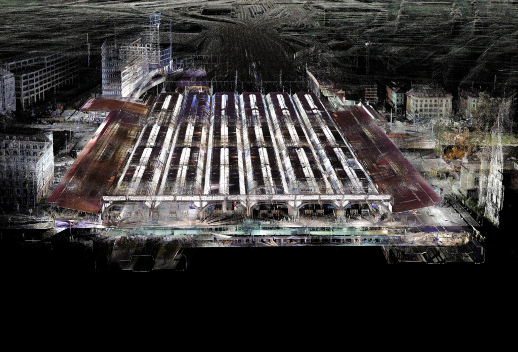
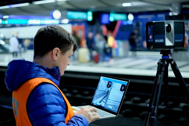
Die Stadt ist unser Lebensraum. Doch die Komplexität dieser grossräumigen Landschaft kann Menschen Probleme bereiten, sich im Stadtraum sicher zu bewegen oder sich die räumliche Organisation vorzustellen. Wie kann gangunsicheren Personen geholfen werden, wieder sicherer über die Strasse zu gehen? Und wie sieht es eigentlich unter der Oberfläche aus? Wie können wir den Stadtraum ganzheitlicher betrachten? Wir nehmen mit 3D-Laserscannern Stadtlandschaften auf und erarbeiten damit präzise und realitätsgetreue digitale 3D-Punktwolkenmodelle.
In Zusammenarbeit mit der Stadt Zürich erstellen wir an der Professur Girot ein interaktives und detailliertes Modell der ober- und unterirdischen Stadt. Neben dem Ziel einer gesamtheitlichen Darstellung, stehen Fragen der Darstellung und Vermittlung unseres Lebensraumes anhand von Geodaten und wie sie unsere Wahrnehmung des städtischen Untergrundes verändern im Vordergrund. Ausgestattet mit einer VR-Brille kann der Betrachter seinen Standpunkt in einer interaktiven Umgebung selbst wählen und sich an einen beliebigen Punkt in der Stadt begeben, um ihn zu erkunden.
Kommen Sie vorbei, probieren Sie es selbst aus!
Beteiligte
Prof. Christophe Girot
Matthias Vollmer
Johannes Rebsamen
Dennis Häusler
Prof. Dr. Adrienne Grêt-Regamey
Dr. Ulrike Wissen Hayek
Laura Schalbetter
Fabian Gutscher
Autorschaft
Institut für Landschaft und Urbane Studien (LUS), Professur Christophe Girot, ETH Zürich
http://girot.arch.ethz.ch
Institut für Raum- und Landschaftsentwicklung (IRL), Planung von Landschaft und Urbanen Systemen (PLUS), ETH Zürich
http://www.plus.ethz.ch
Projektpartner: Stadt Zürich; Spitäler Schaffhausen
Lieferanten weiterer Daten: SCANVISION; SBB
Cities are large-scale landscapes with complex situations and infrastructures above and below ground. Virtual reality (VR) offers the possibility to experience urban landscapes in a different way with their full complexity as a measured space.
The city is our living space. But the complexity of this large-scale landscape can cause problems for people to move safely in urban space or to imagine the spatial organisation. How can people who are unsure of their gait be helped to cross the street more safely again? And what does it actually look like under the surface? How can we look at urban space more holistically? We record urban landscapes with 3D laser scanners and use them to create precise and realistic digital 3D point cloud models.
In collaboration with the city of Zurich, we are creating an interactive and detailed model of the city above and below ground at the Girot Chair. In addition to the goal of a holistic representation, the focus is on questions of how we represent and communicate our living space using geodata and how it changes our perception of the urban underground. Equipped with VR glasses, viewers can choose their own point of view in an interactive environment and go to any point in the city to explore.
Come by, try it out for yourself!

3.-4. September 2021
Öffnungszeiten Hauptgebäude:
Samstag: 11.00 – 19.00 Uhr
Sonntag: 11.00 – 17.00 Uhr

