
STUDIO
This studio was a collaboration between Future Cities Laboratory and included a workshop with SUTD architecture students in Singapore.
GUEST LECTURERS
Prof. Jan Carmeliet, Prof. Kees Christiaanse, Prof. Peter Edwards, Prof. Milica Topalovic
ASSISTANTS
Philipp Urech, Magdalena Kaufmann, Benedikt Kowalewski, Fujan Fahmi
STUDENTS
Sogol Amuzegar, Joana Aphold, Sandrine Badoux, Julian Fischbacher, Niels Galitch, Jonas Haldemann, Kelly Man, Roxane Rambaud-Roch, Nina Rohrer, Louis Strologo, Larissa Strub, Nicolas Wüthrich, Manuel Viecelli
Joint design research studio
Cool topology – Singapore’s railway corridor and new strategies for heat islands | SUTD Singapore
SEMINAR WEEK
Singapore / 17. – 25. March 2018
SEMINAR WEEK REPORT
DISSERTATION
Research on the urban heat island effect currently being done by Philipp Urech at the Future Cities Laboratory in Singapore | Green Trail Singapore
Contact
Designing Thermal Comfort in Singapore
The Landscape Architecture Studio of Prof. Christophe Girot designed and invented new landscape topologies in and around Singapore’s Railway Corridor. The goal of the studio was to improve local climate conditions and to reduce Urban Heat Island effects through ecological design. Emphasis was placed on landscape topology and regeneration aiming at improving thermal comfort and opening up a range of possibilities for future uses and developments on the city island.
The Railway Corridor, left empty since the termination of the KTM service in 2011, remains as a unique infrastructural topography in the urban landscape of Singapore. When re-opened to the public, it will be one of the longest continuous pedestrian lines connecting various new towns and natural areas of the island. Although a master-planning commission was awarded by competition in 2015, the Urban Redevelopment Authority has since rescinded the contract, and the future of this greenspace remains unclear.
This urban landscape design studio explored the use of new technologies in the exploration of possible futures for the Railway Corridor. The goal was to improve climatic conditions in neighbourhoods adjacent to the Corridor, by studying the interface of a linear park with existing urban fabric. With workshops throughout the semester, students acquired skills in point cloud and 3D modelling, visualisation techniques and CNC prototyping. The studio was conducted jointly with the Design Research Studio of Prof. Joshua Comaroff and Philipp Urech at the SUTD in Singapore and in collaboration with the Future Cities Laboratory in Singapore.
Methodological approach to the design tasks
The design evolved from the basis of a geolocated dataset, which has been provided from a number of sources (figure 1). One part was collected at various scales on the study site using Terrestrial Laser Scanning to produce an extensive point-cloud model that represents the existing environment to a high degree of precision. The data was combined with Aerial Laser Scanned data to provide dense and continous information on the site. The point-cloud formed the basis on which the students developed design proposals for urban landscapes (figure 2).
The studio explored the dataset and the actual site, which has been divided into 3 study areas. Sub-set portions of these areas were explored by pairs of students, to examine the existing conditions—and in particular, the interfacing of the Green Corridor with surrounding neighborhoods. Because of their particle structure, pointclouds are well adapted to segmentation in the form of sections, classifications or cut-out objects. This property allows to place sections in real time throughout the model and examine them separately, exposing the inner structure of the landscape where ground, plants, buildings can be recognized as distinct features (figure 3).
Students used a workflow in which specific portions of the data was exported to Rhino for modeling and CNC output, as well as Cinema 4D for point-cloud modeling and back to Cloud Compare for assemblage and visualization. In succeeding steps, the landscape is shaped with topological information retrieved from point-cloud datasets. The initial condition of the site is manipulated by locally extracting, filtering and meshing the point-cloud model where the design transformation takes place. This allows to decompose the point cloud model in entities that will edited in the design process (figure 4). From there, designers add or remove elements relevant to their project, shape topography and vegetation to compose new urban spaces. The workflow bridges spatial information of the point cloud model with meshed geometries for editing (figure 5). At the end, the tailored designs are assembled with the unchanged 3D context (figure 6).
Virtual flight through the pointcloud of Singapore along the Green Corridor. From Bukit Timah to Tanjong Pagar Station – Philipp Urech / FCL Singapore – 2018
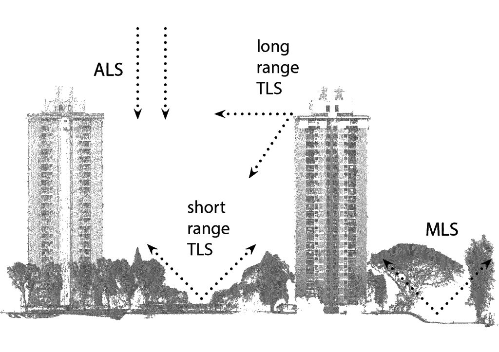
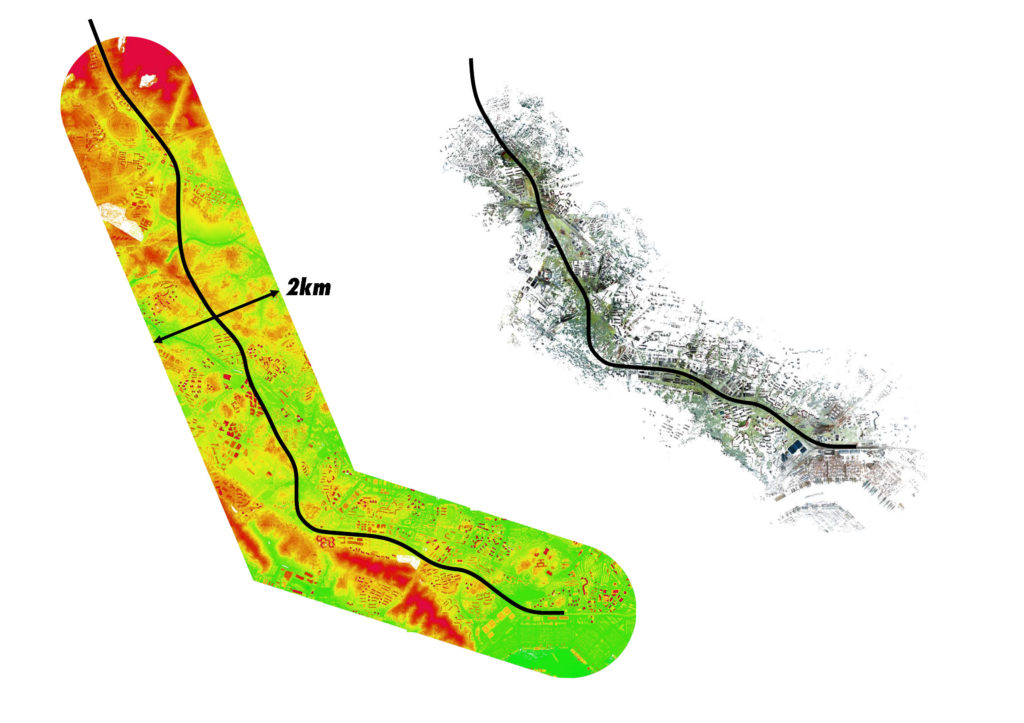
Figure 1: Different sources were combined to form a base from which to develop new design proposals for the Rail Corridor
Figure 2: Extent of the aerial and terrestrial laser scanning datasets providing the spatial context of the former railway line
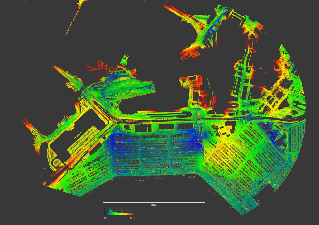
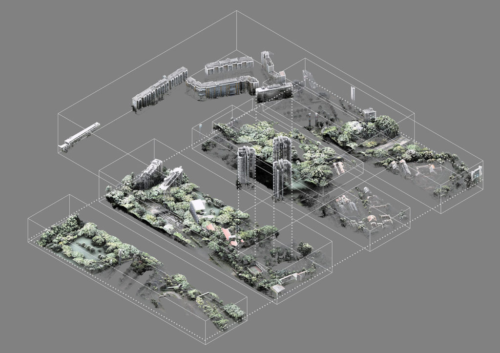
Figure 3: The topography filtered out from the areal Laser-scanned dataset is colored on the Z-axis to reveal detailed terrain information such as drainage, depressions and topographical irregularities
Figure 4: Manual cutting is combined with automated filtering to disassemble the existing situation in components used separately in the design process
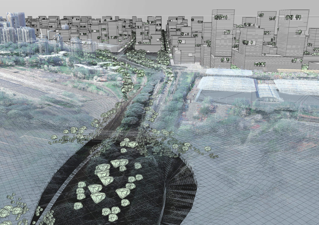
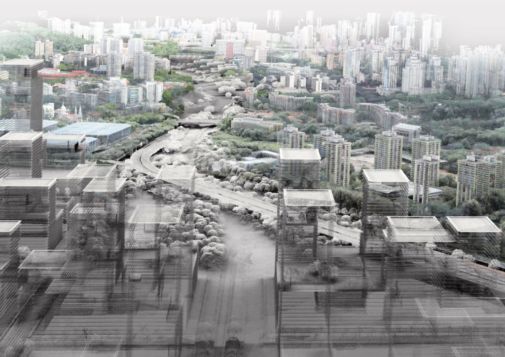
Figure 5: Geo-referenced data in the form of points and polygons is combined to enable specific editing steps
Figure 6: Southern end of the Rail Corridor in Tanjong Pagar, combination of ETH and SUTD student proposals
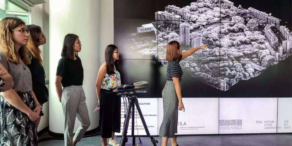
Workshop presentation during the Seminar Week in Singapore, 2018
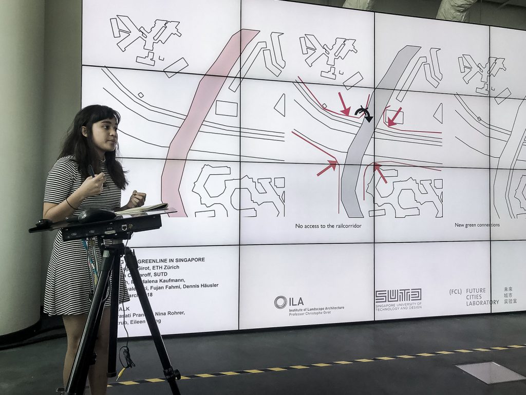
The conceptual approach proposed by a group of ETH and SUTD students during the seminar week in Singapore
Prof. Christophe Girot interviewing during the Design Charrette in Singapore
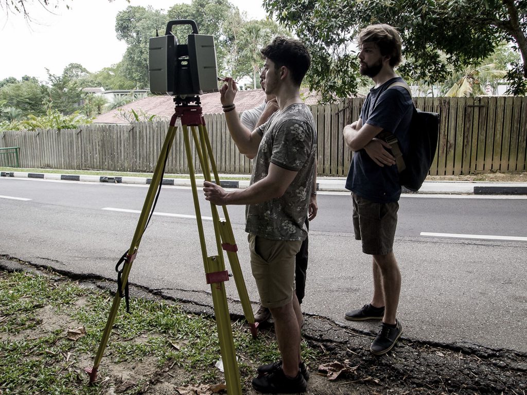
Louis Strologol and Manuel Viecelli while scanning the site in Singapore
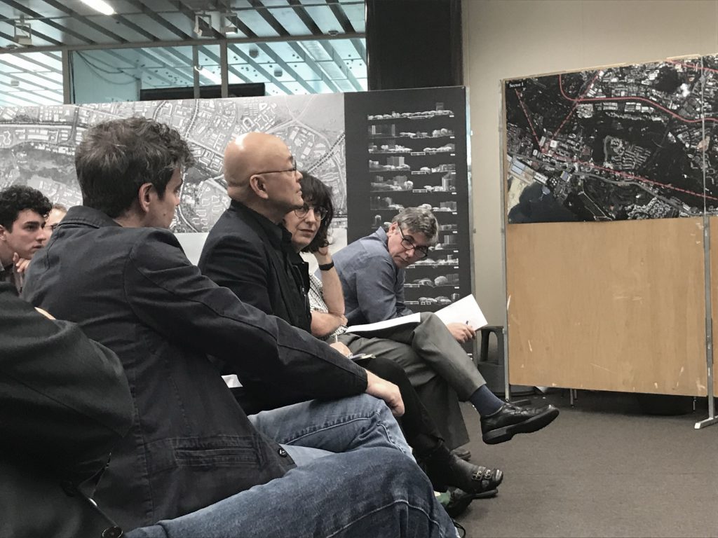
Final review with our guests: Prof. Erwin Viray (SUTD) Prof. Jan Karmeliet (ETHZ) & Ass. Prof. Joshua Comaroff (SUTD)
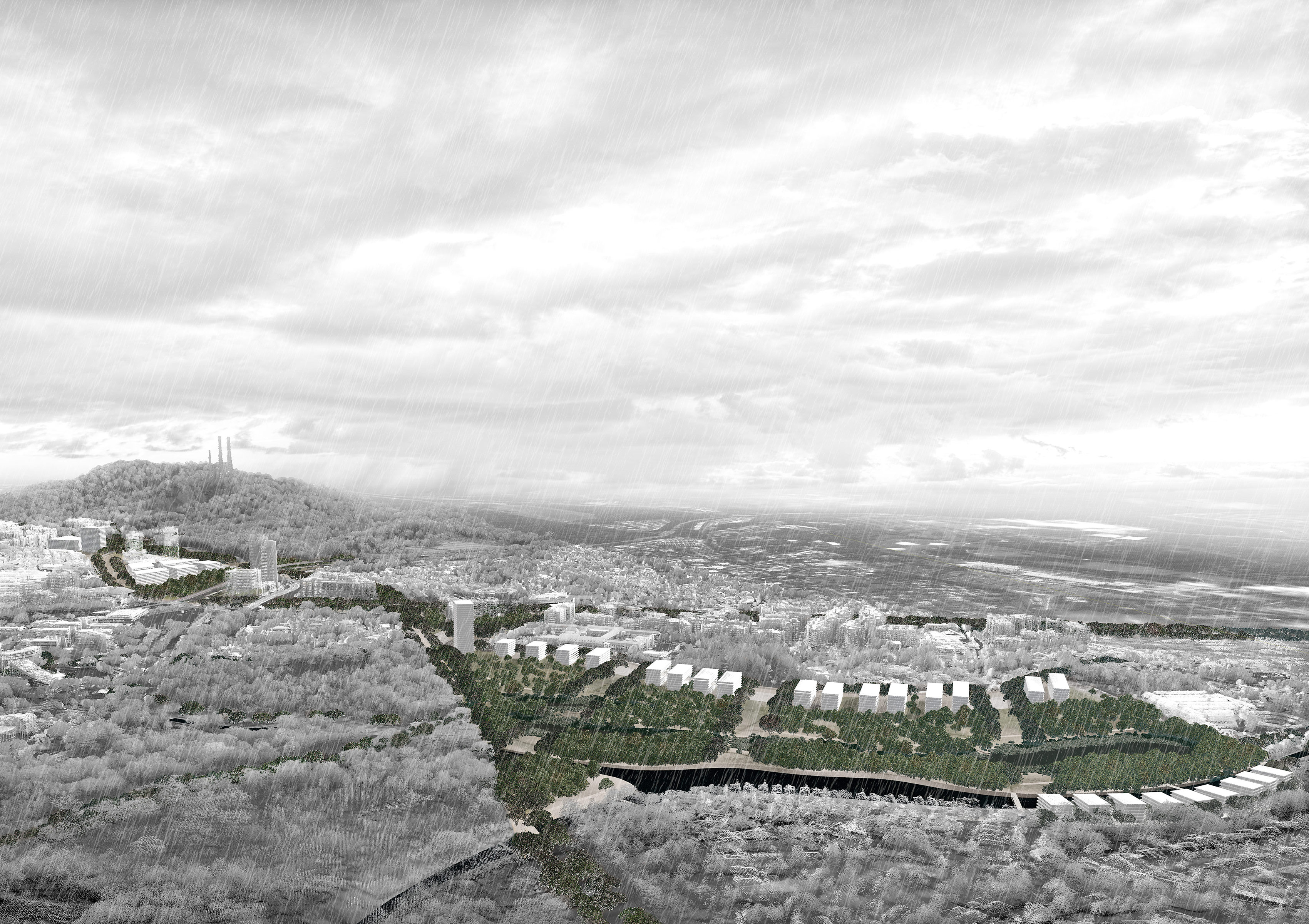
Bird-view perspective of a landscape designed to catch rain at the foot of Bukit Timah hill | Jonas Haldemann & Manuel Viecelli
Plan proposing partial covering of the highway | Julian Fischbacher & Nicolas Wuethrich
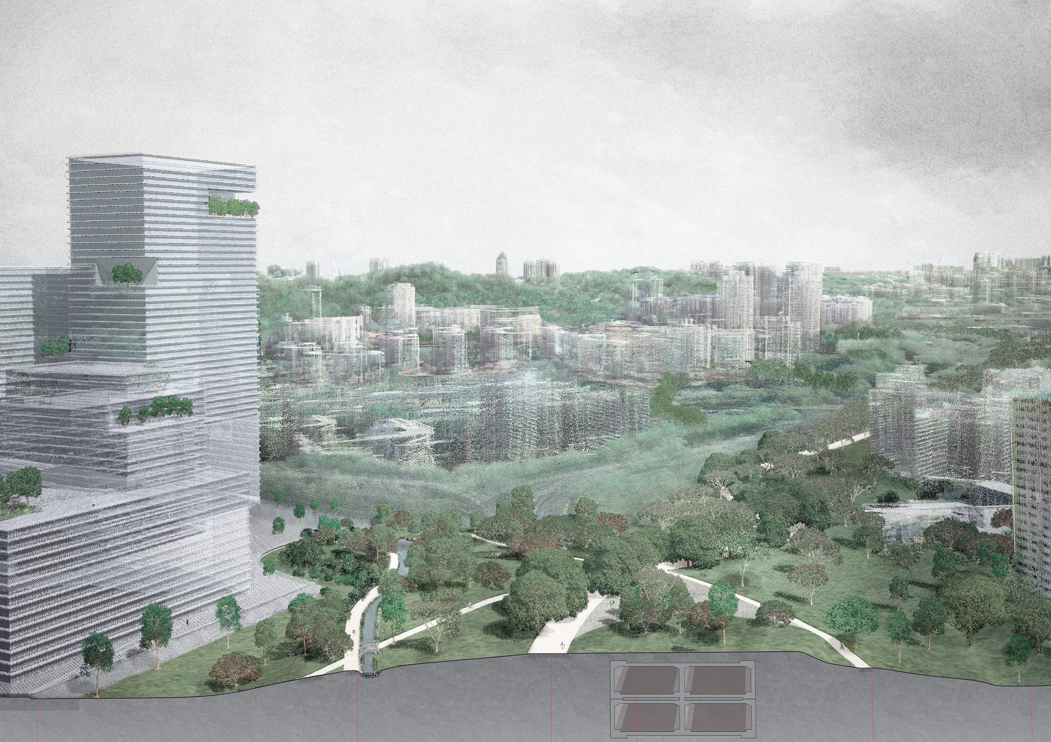
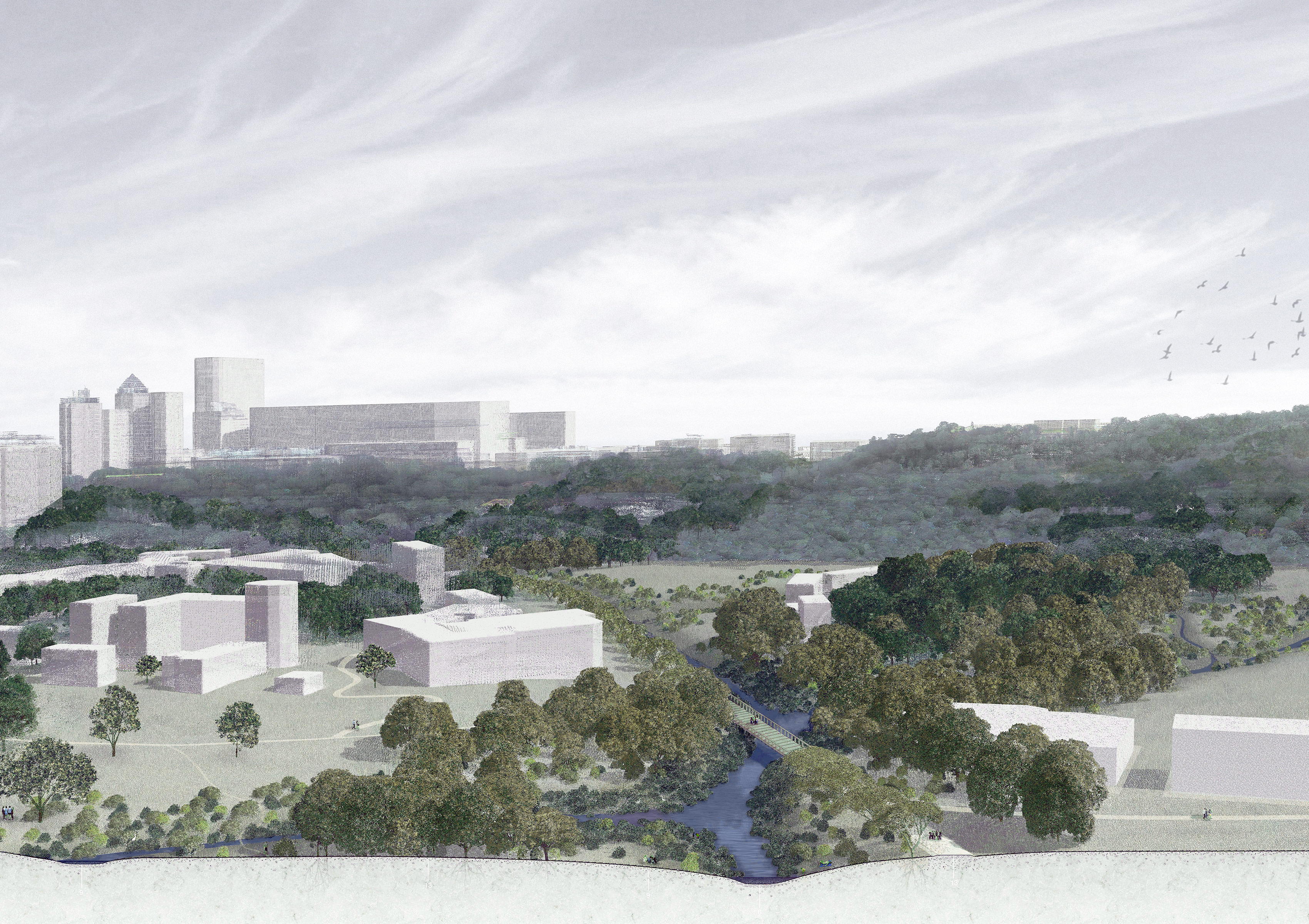
Section perspective of a park bridge over the highway | Sandrine Badoux, Niels Galitch & Kelly Man
Section on a renaturated canal | Sogol Amuzegar & Larissa Strub
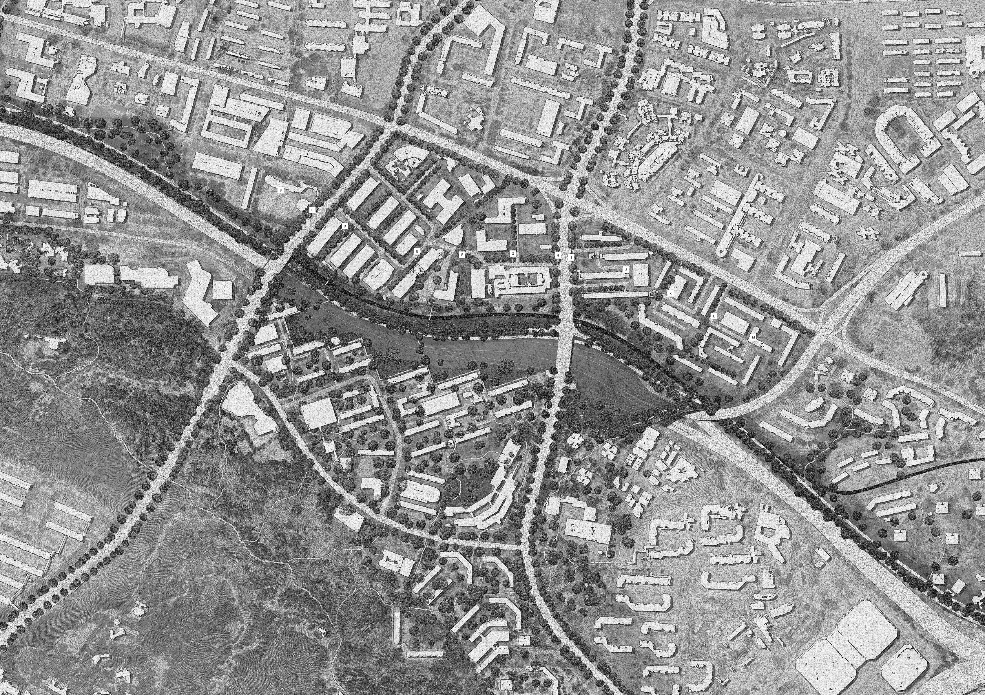
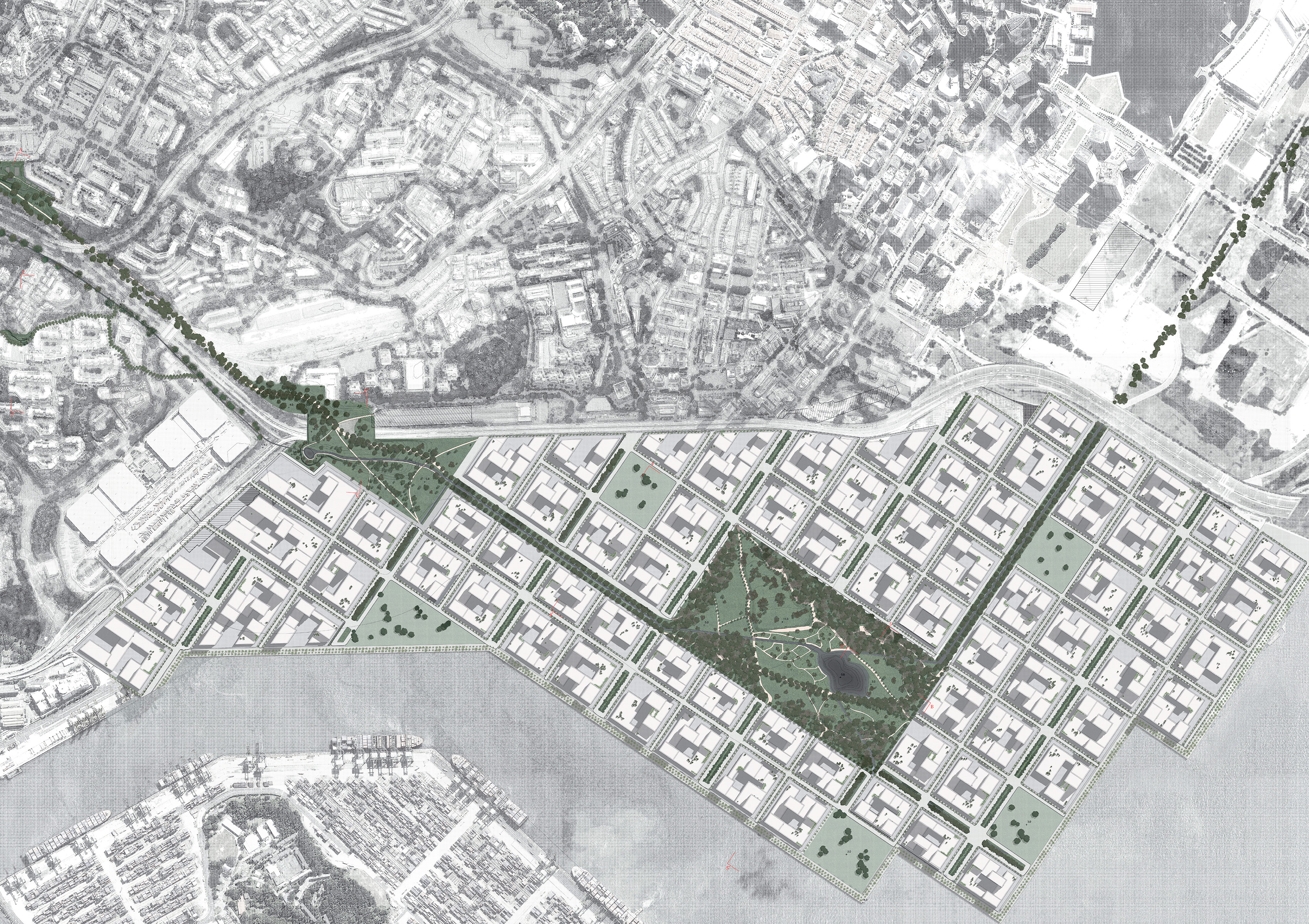
Proposed park connection at Tanjong Pagar | Sandrine Badoux , Niels Galitch & Kelly Man