
STUDIO
The FS 2019 Studio “The Dark Side of the Sihl”, asked the students to design and develop a new landscape project along a stretch of the Sihl river in Zürich Kreis 5.
EXPERTS
Stefan Rotzler | Landscape Architect; Jacqueline Parrish| Tiefbauamt Stadt Zürich; Dr. Matthias Oplatka | AWEL Zürich
ASSISTANTS
Ilmar Hurkxkens, Fujan Fahmi, Benedikt Kowalewski
STUDENTS
Lidia Bischoff, Utku Coskun, Nadja Furler, Rico Furter, Patrick Greber, Magdalena Hermann, Pauline Jaquenod, Shota Kobayashi, Andreas Lanz, Lara Motschi, Iris Redinger, Silvio Romano, Mino Sommer, Sandra Wegmann
Contact
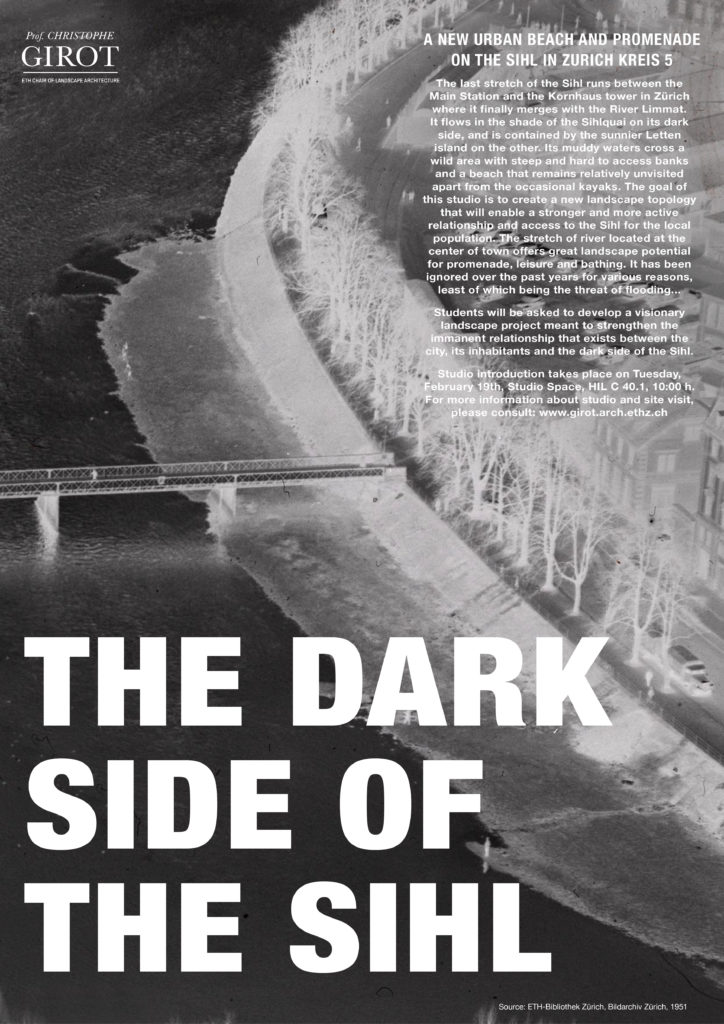
A New Urban Beach and Promenade on the Sihl in Zurich Kreis 5
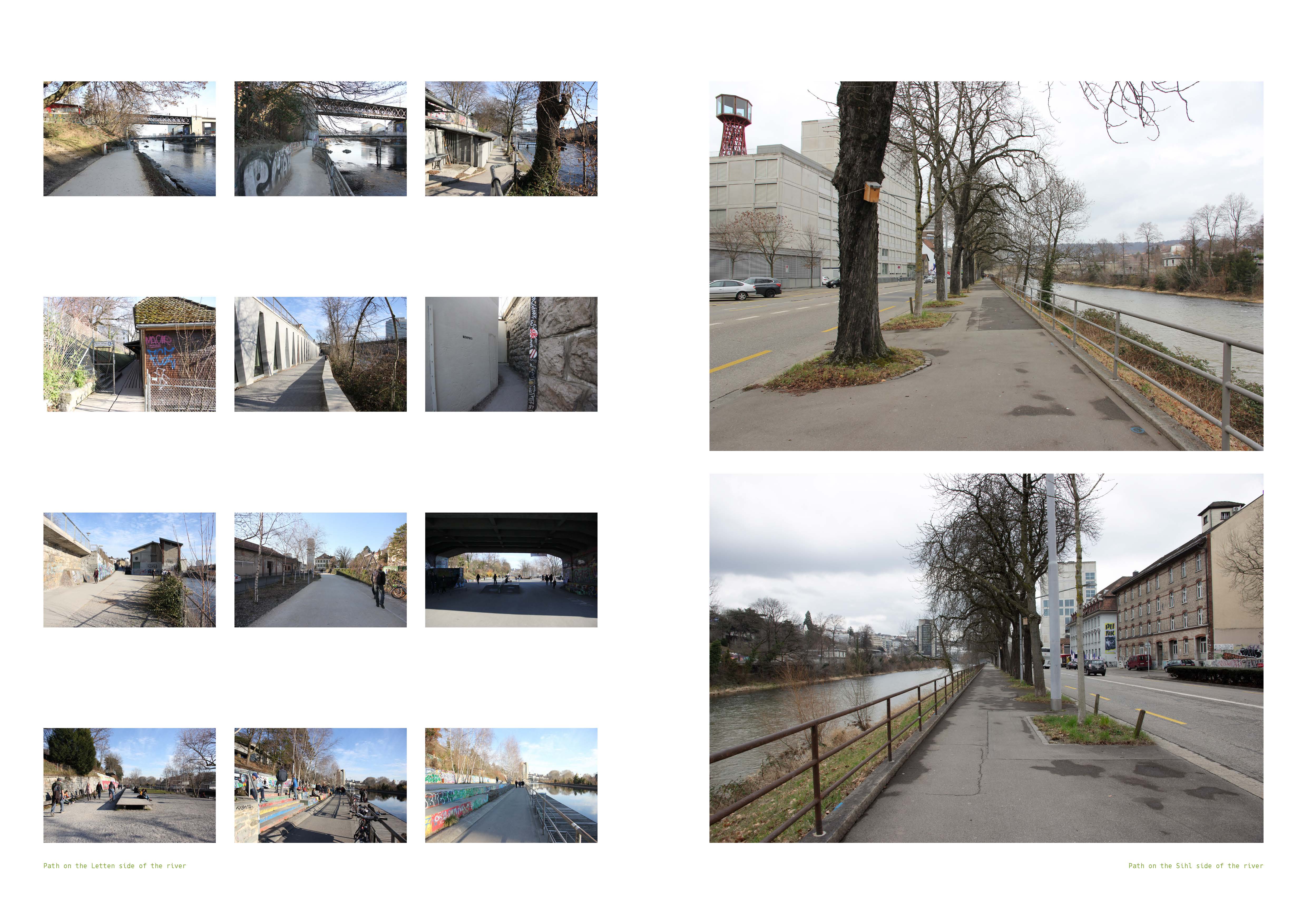
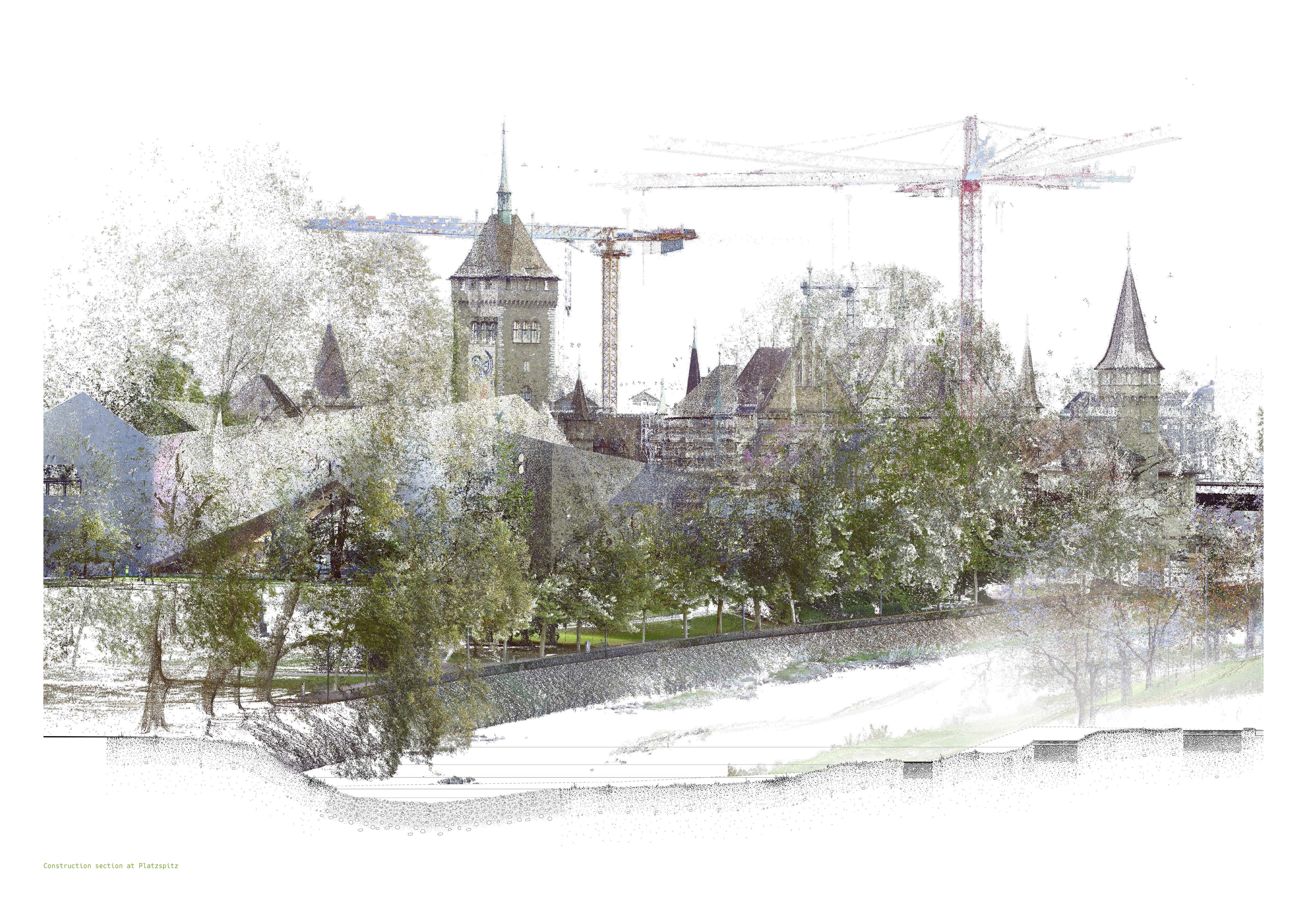
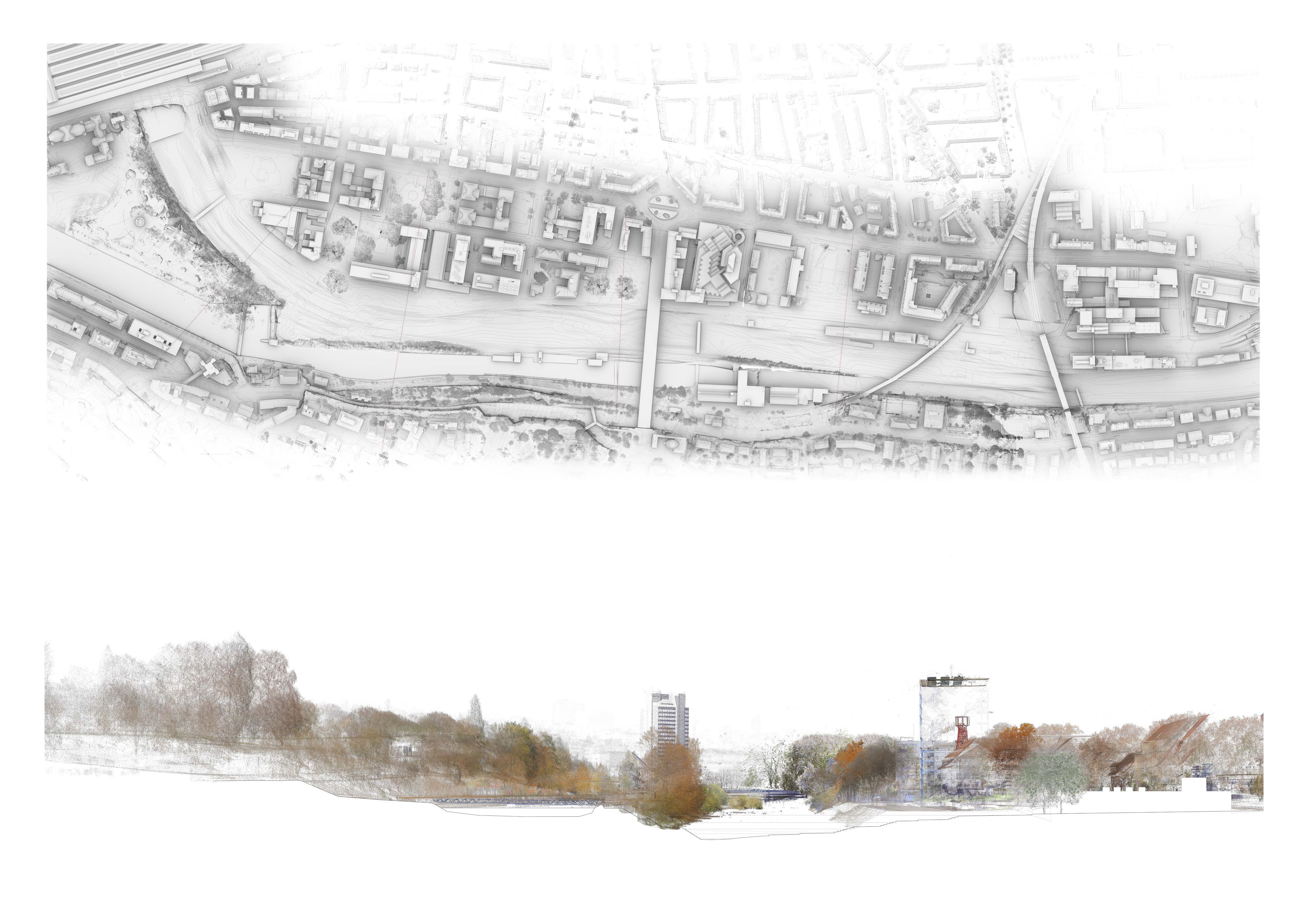
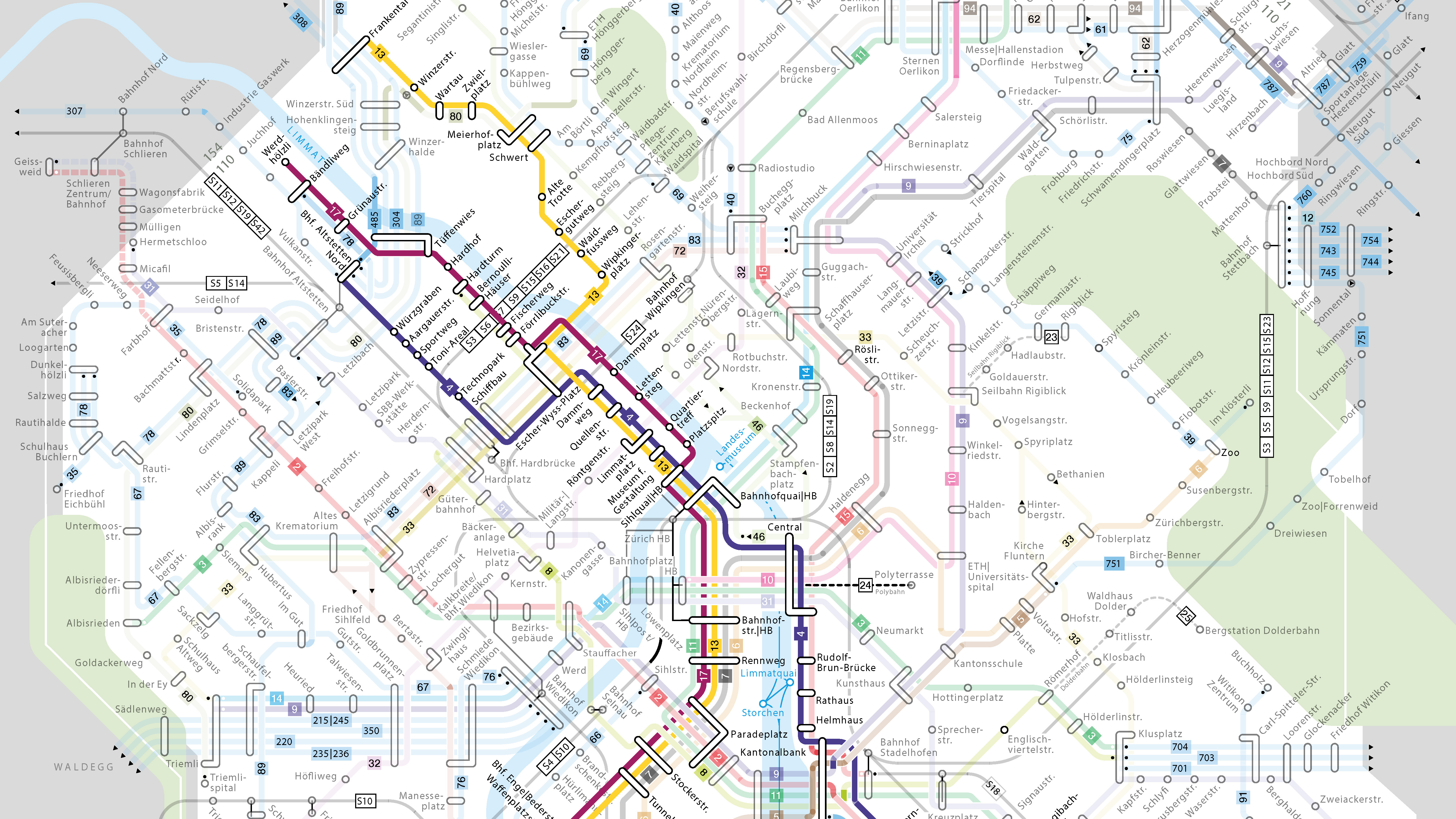
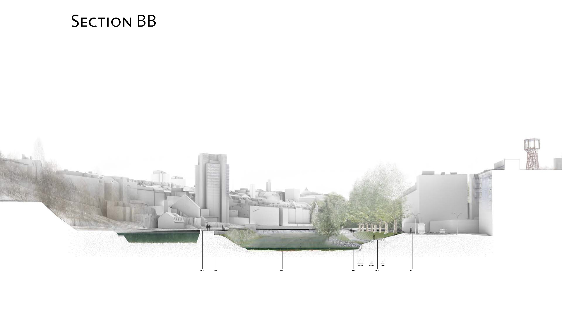
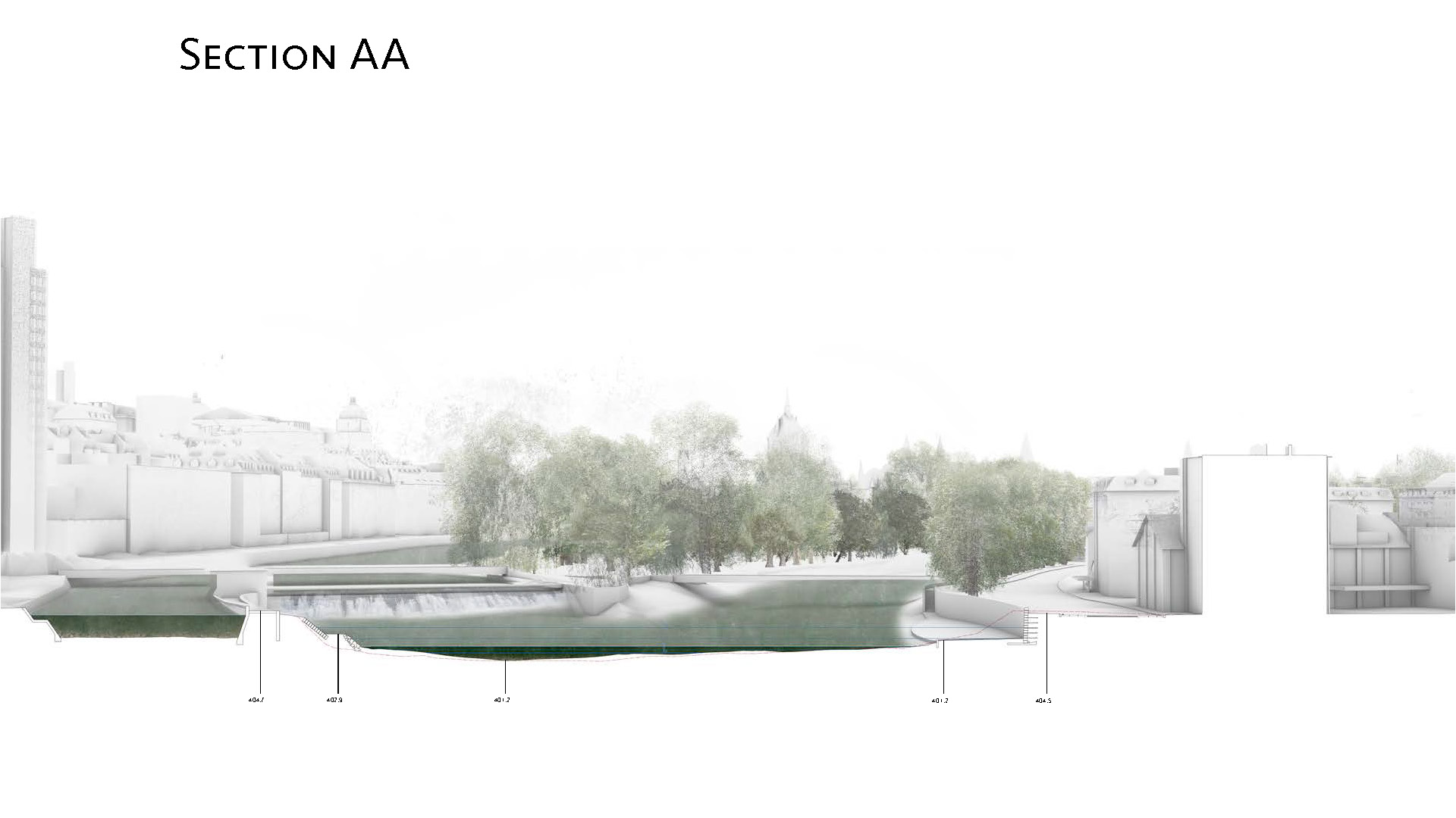
From its source in Canton Schwyz, down 73 kilometers to the last stretch where it runs between the Zurich Main Station and the Kornhaus Tower in Zürich, the muddy Sihl River finally merges with the blue waters of the Limmat. On this last stretch, it flows in the shade of a quai located on the dark side of the Sihl, hence the title of this studio. The Sihl has a different colour than the Limmat due to the geography of its origins. The stretch of river that we are interested in, is contained on one side by the sunnier Letten island, which is nothing more than a canal structure perched above its bed. The area located at the foot of the canal wall has become relatively wild over time with steep embankments that are hard to access. This wilderness is a great plus for the Sihl and the beach located in the bend next to the Main Station and remains relatively untouched apart from the occasional kayakers that gather there. The riverscape located at the center of Zurich could offer great leisure potential for promenade, bathing and meditation.
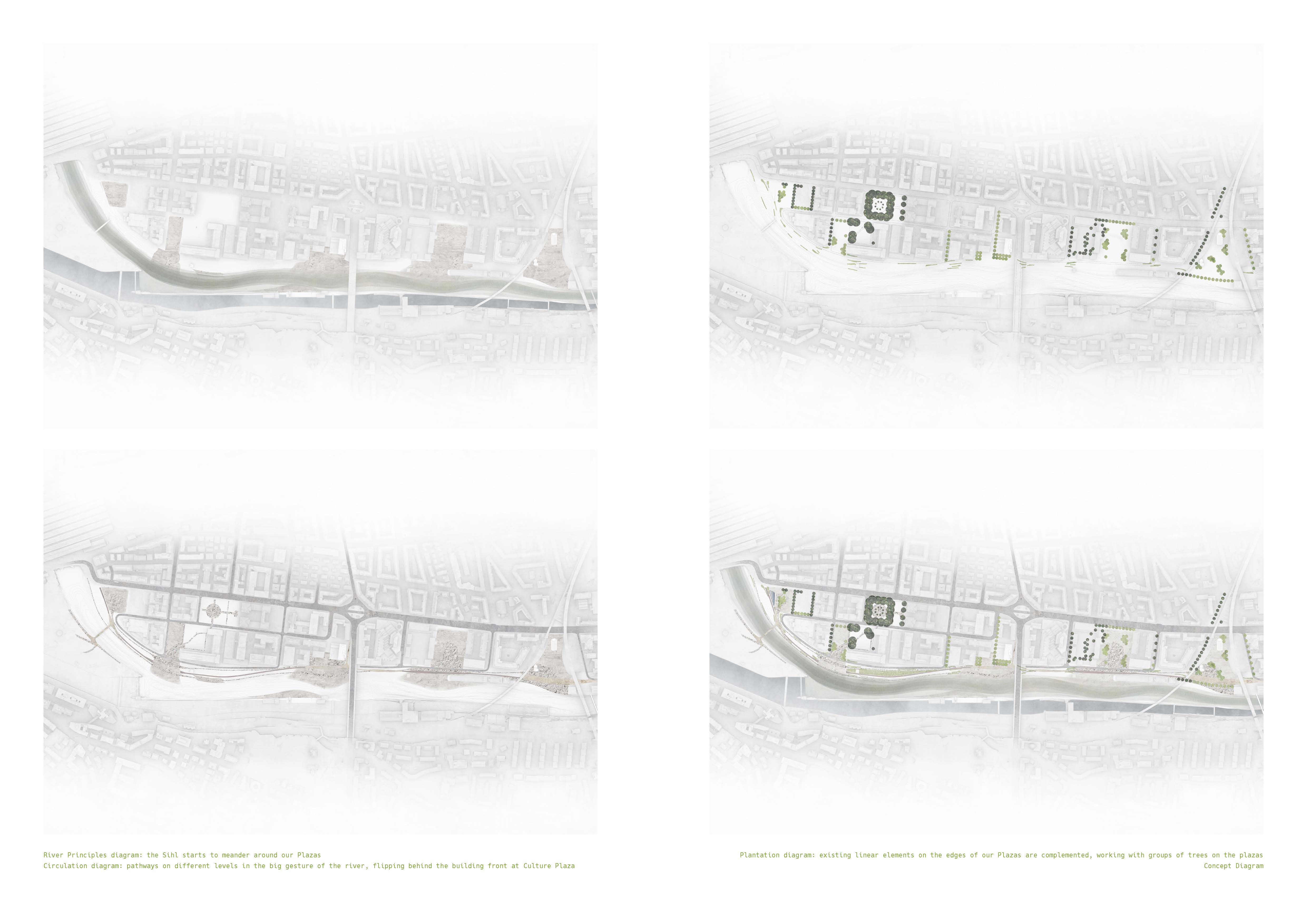
The FS 2019 Studio “The Dark Side of the Sihl”, asked students to design and develop a new landscape project along a stretch of the Sihl river in Zürich Kreis 5. The perimeter under study roughly 1 kilometer long will extend from Platzspitz to the Kornhaus Tower. The site has strong potential for recreational and social use, but has been ignored over the past years for various reasons linked to infrastructure planning, a heavy drug scene and last but not least the constant threat of flooding. The Letten bank located on the other side was transformed into a very successful leisure spot twenty years ago despite its reputation as the crucible of the Needle Park heroin drug scene of the 1970’s and 1980’s. There is now good reason to believe that Zurich is ready to transform the other bank located in Kreis 5 vis a vis of Letten that we have called the Dark Side of the Sihl, into an entirely new experimental urban river environment. The studio tried to formulate an innovative approach to riverscape design by modifying the existing terrain and creating a set of new topographies, compatible with the river, but also capable of generating a variety of activities.
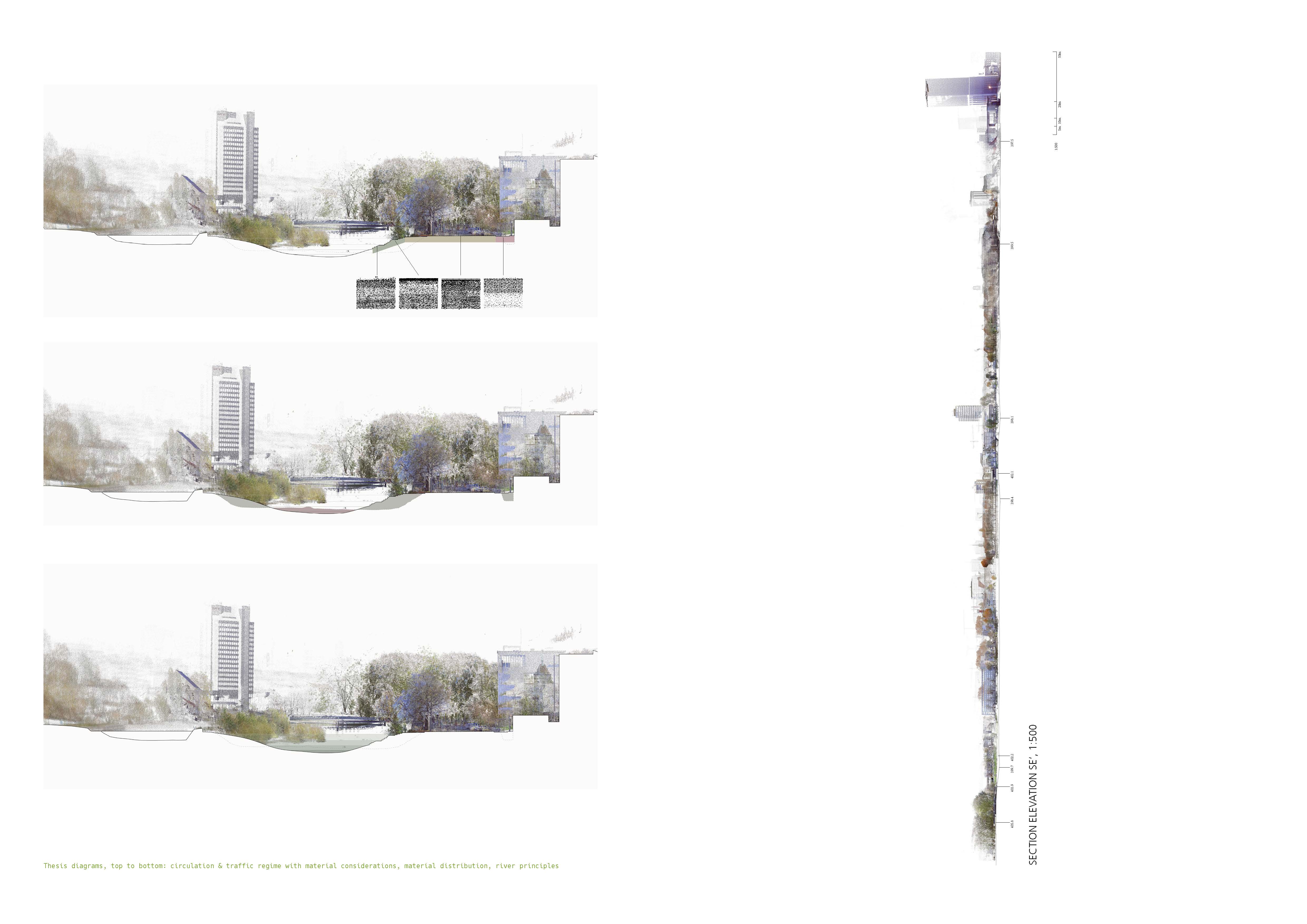
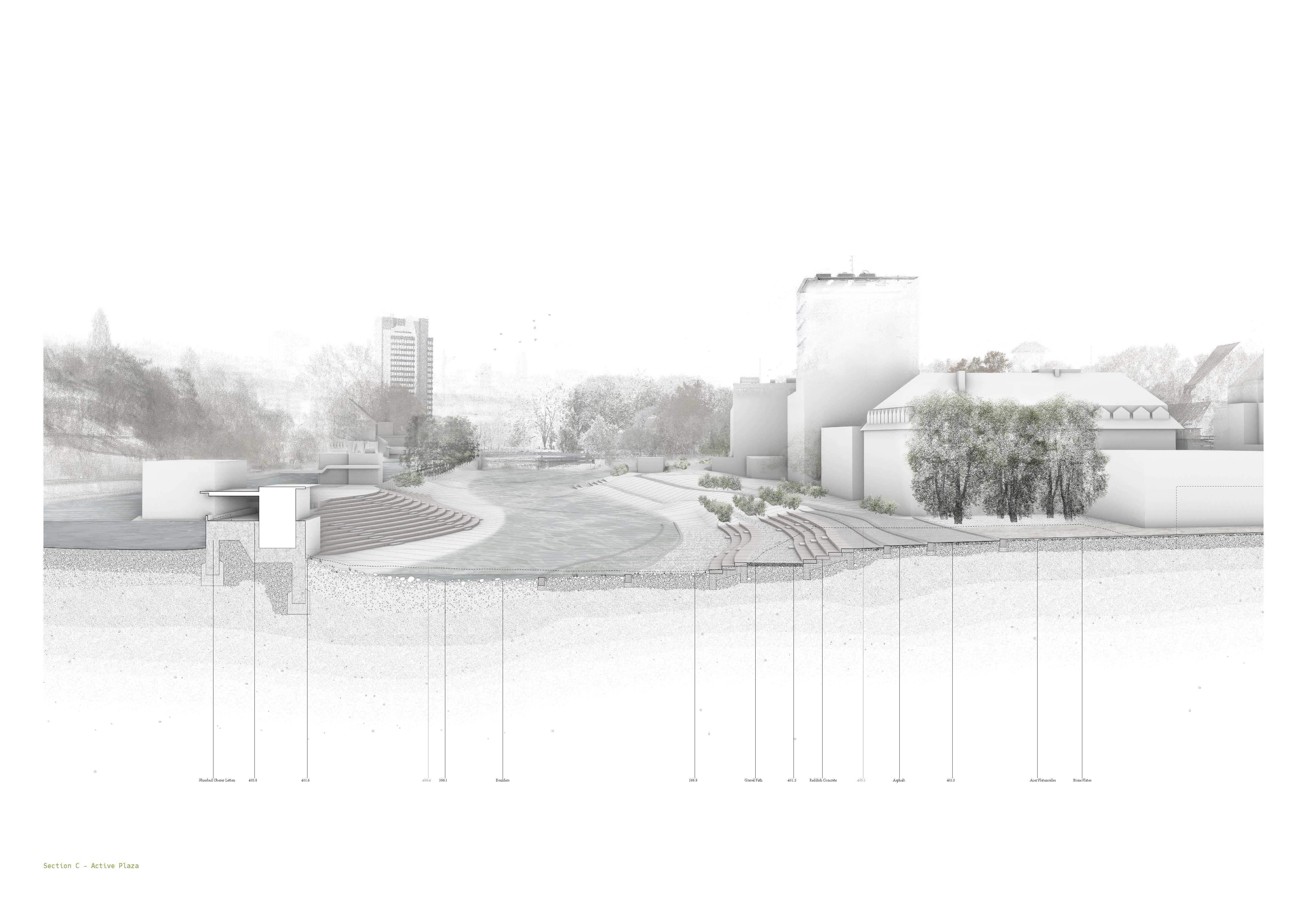
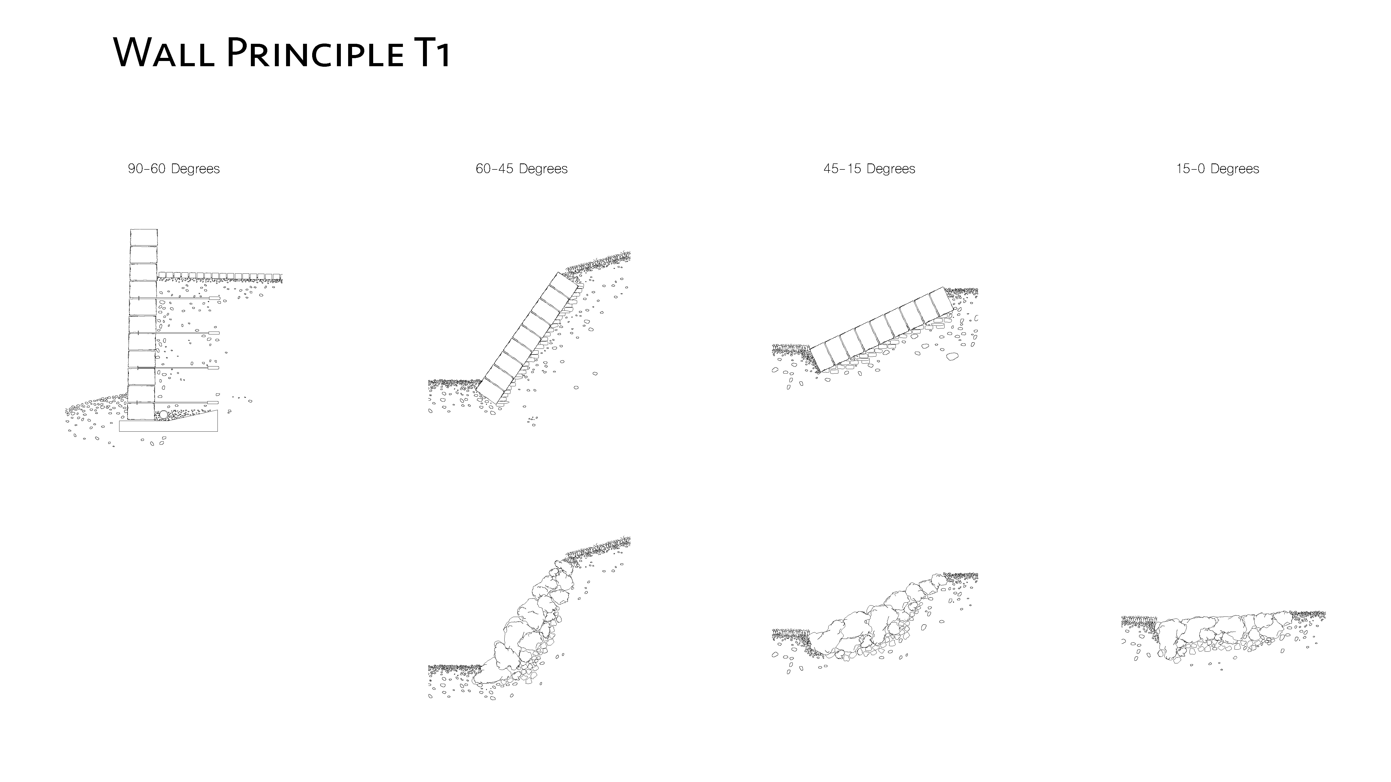
The goal was to create a kind of landscape that will enable a stronger, more active relationship with the Sihl for the local population and visitors alike. Emphasis was placed on access, new places and amenities, as well as possibilities of going into, along and across the river particularly during the dry season. The landscape design method used was that of topology that has been developed and refined at the chair over the past decade. Work began by identifying local conditions in the neighborhood and along the river edge, to then develop a set of site-specific landscape interventions that are agreeable both to the river, its wildlife and its inhabitants. In order to be successful, the designs needed to intertwine the Sihl river, its new activities and natural potential with the life of the surrounding urban fabric.
Methodology
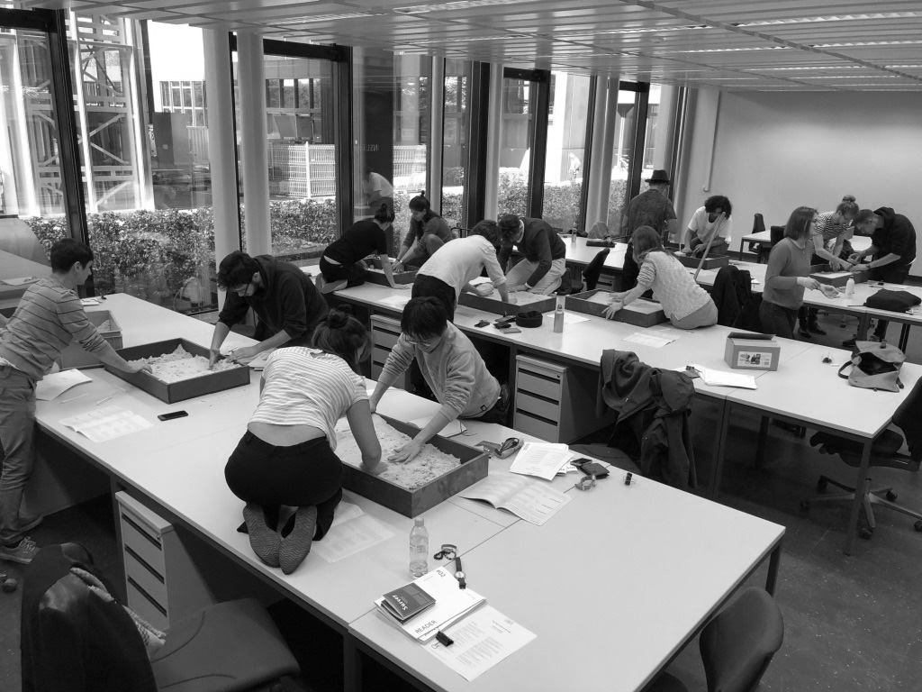
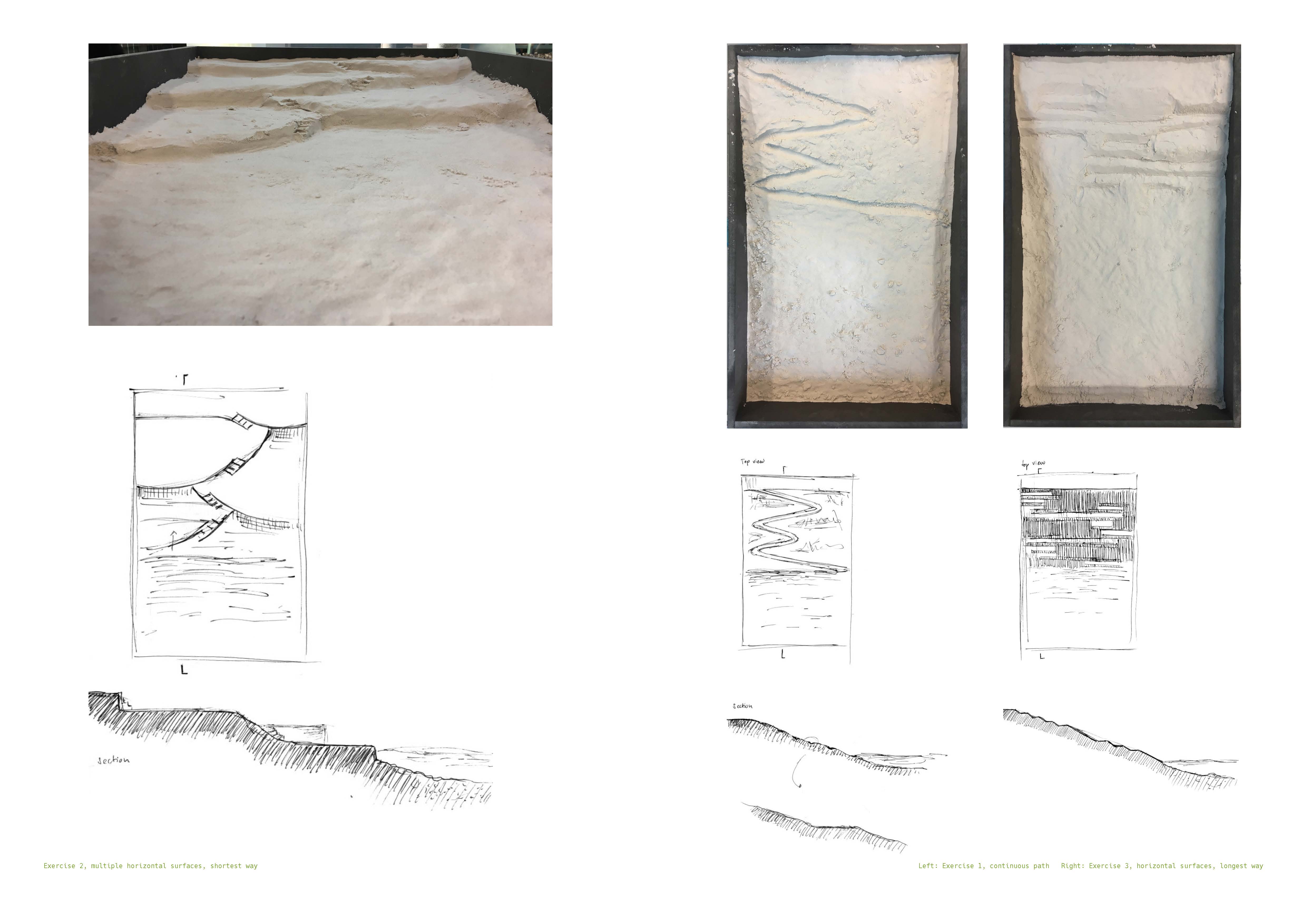
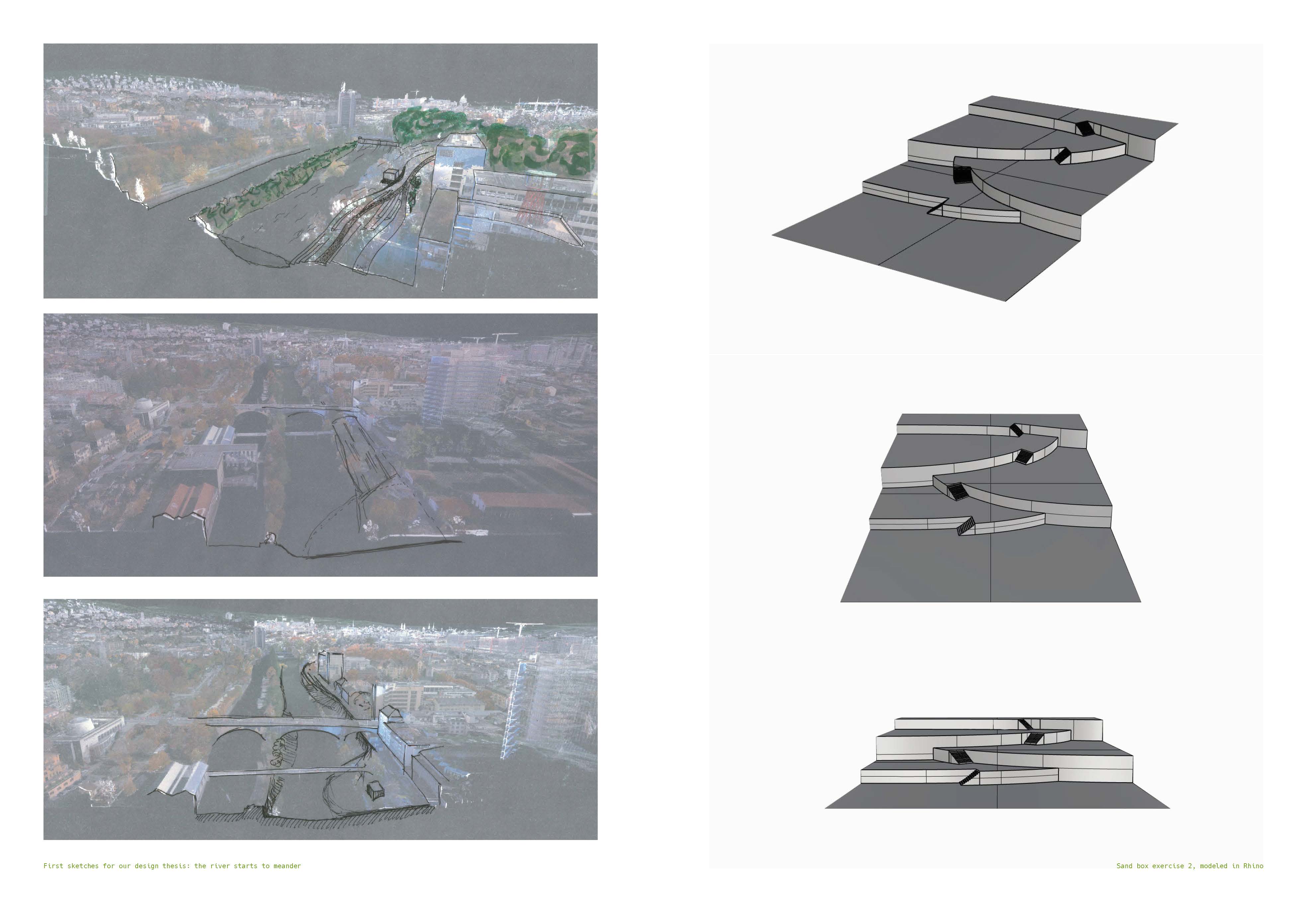
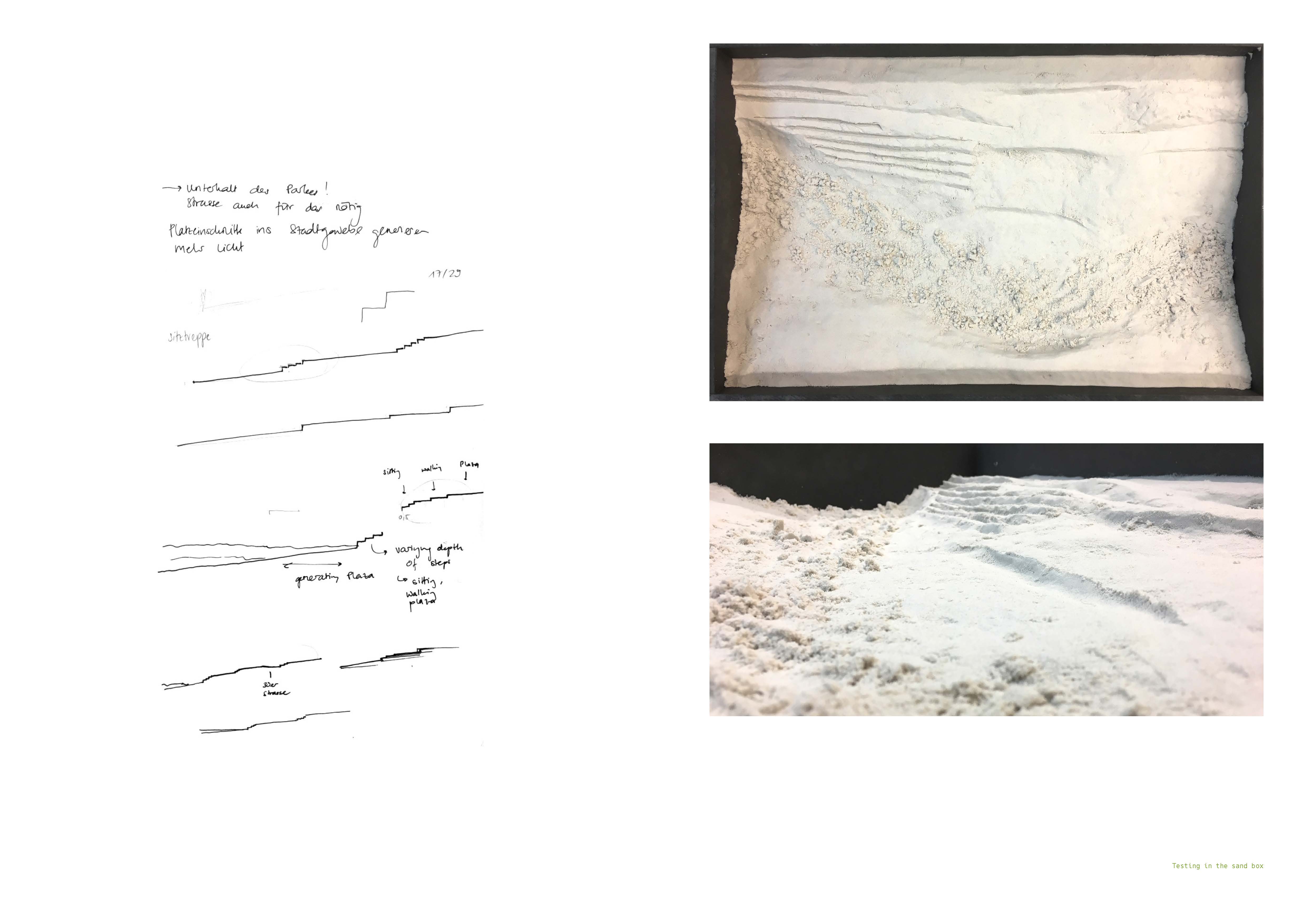
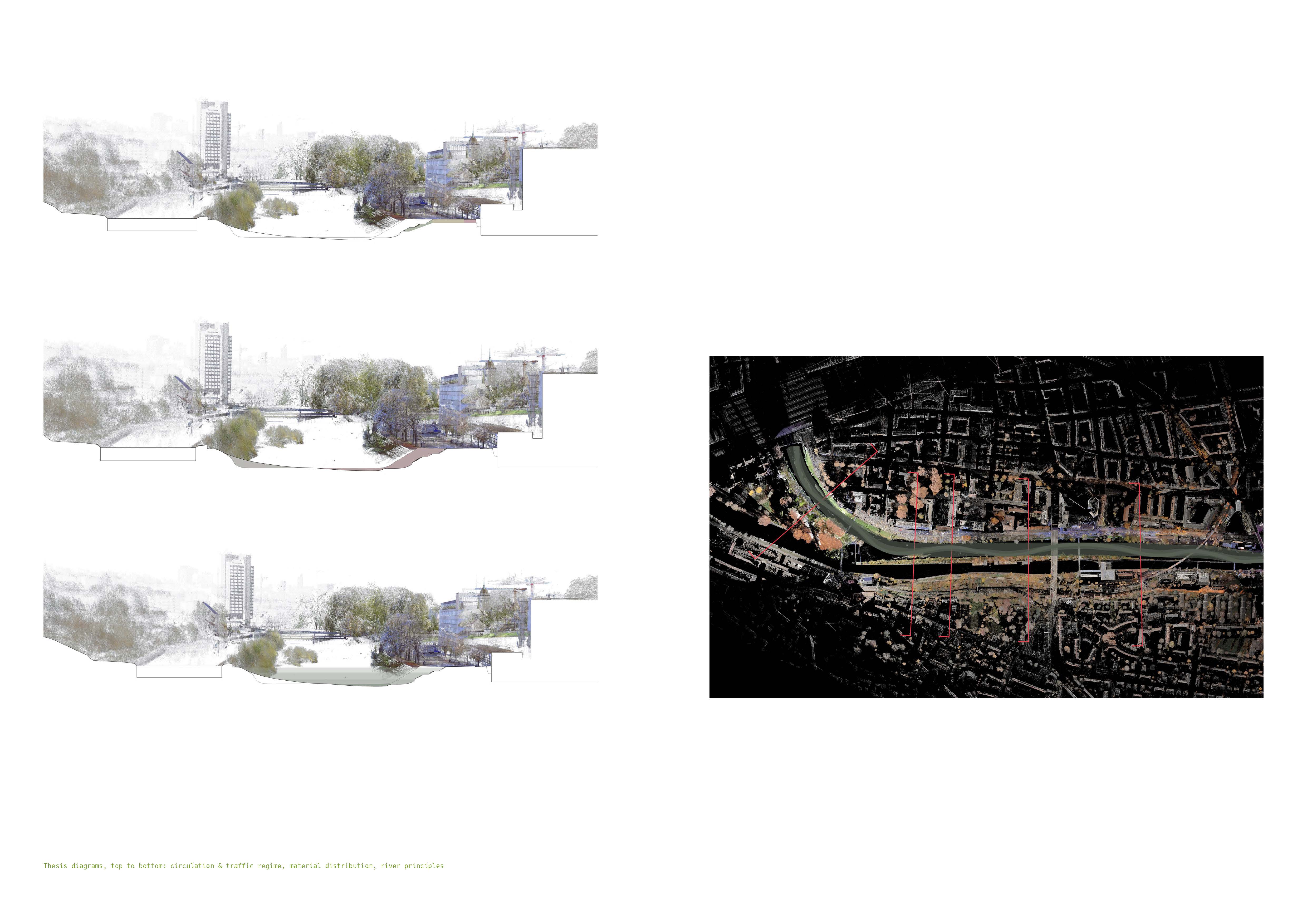
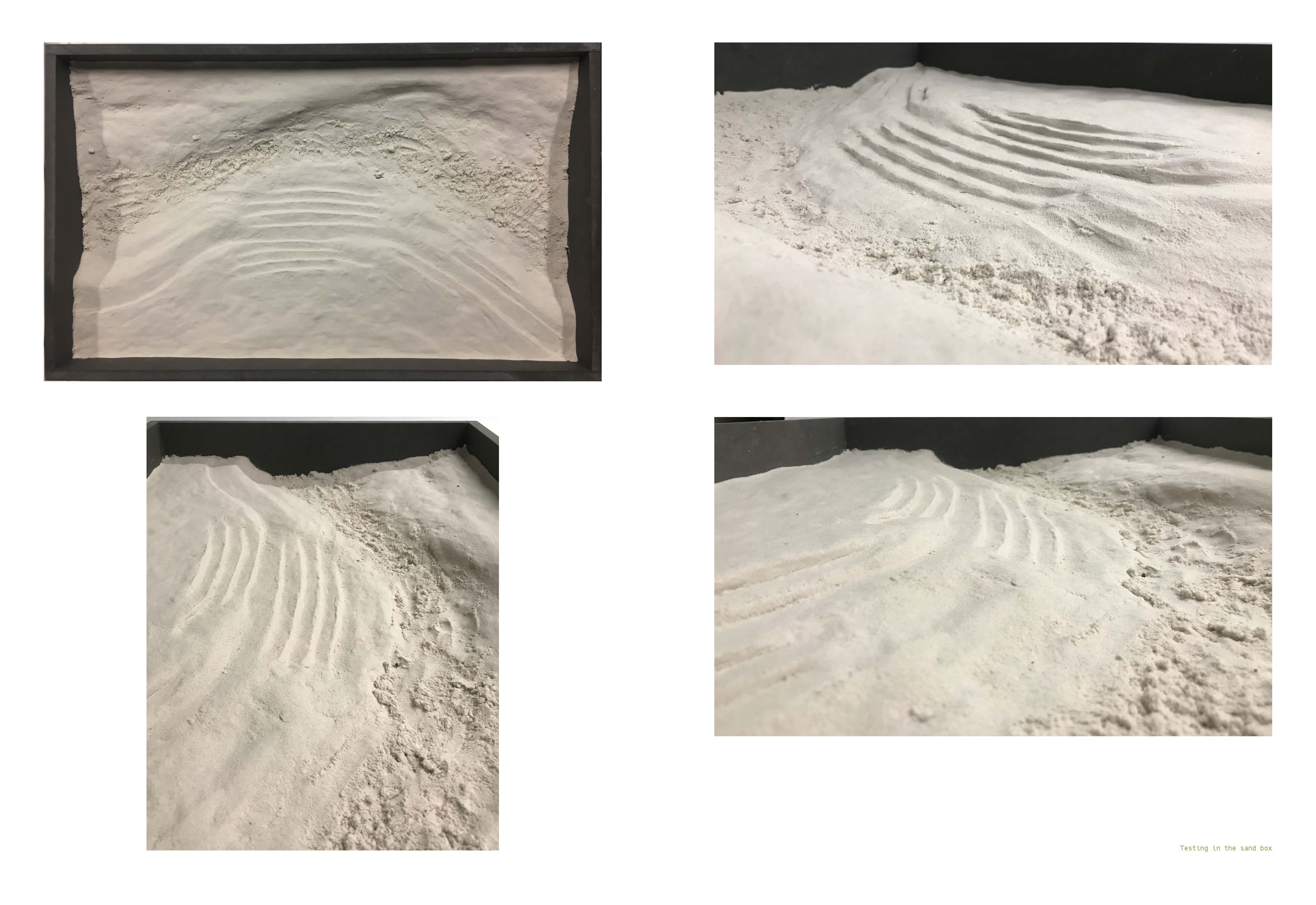
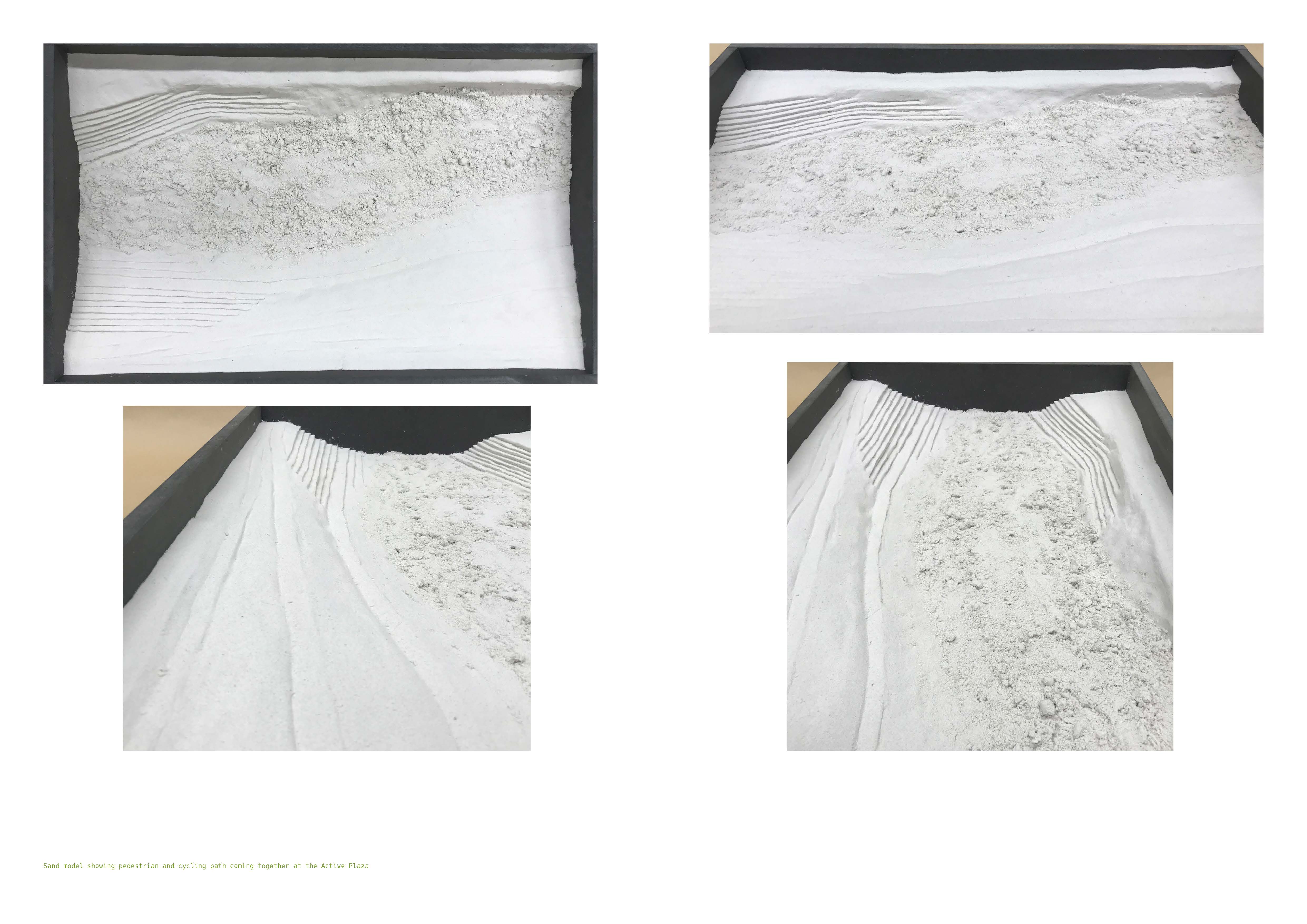
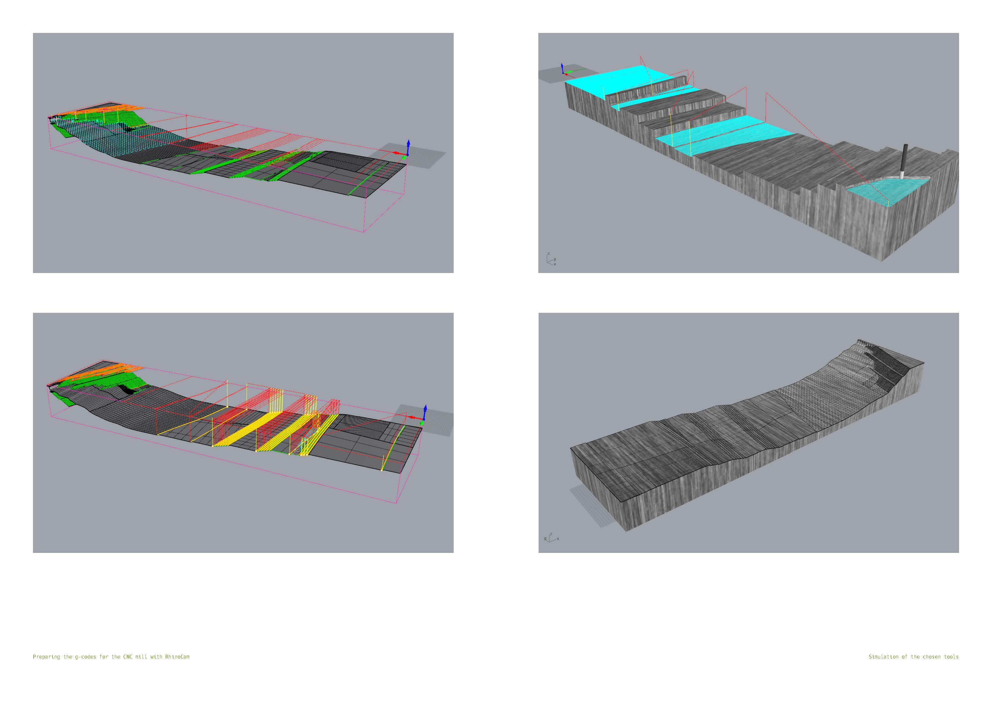
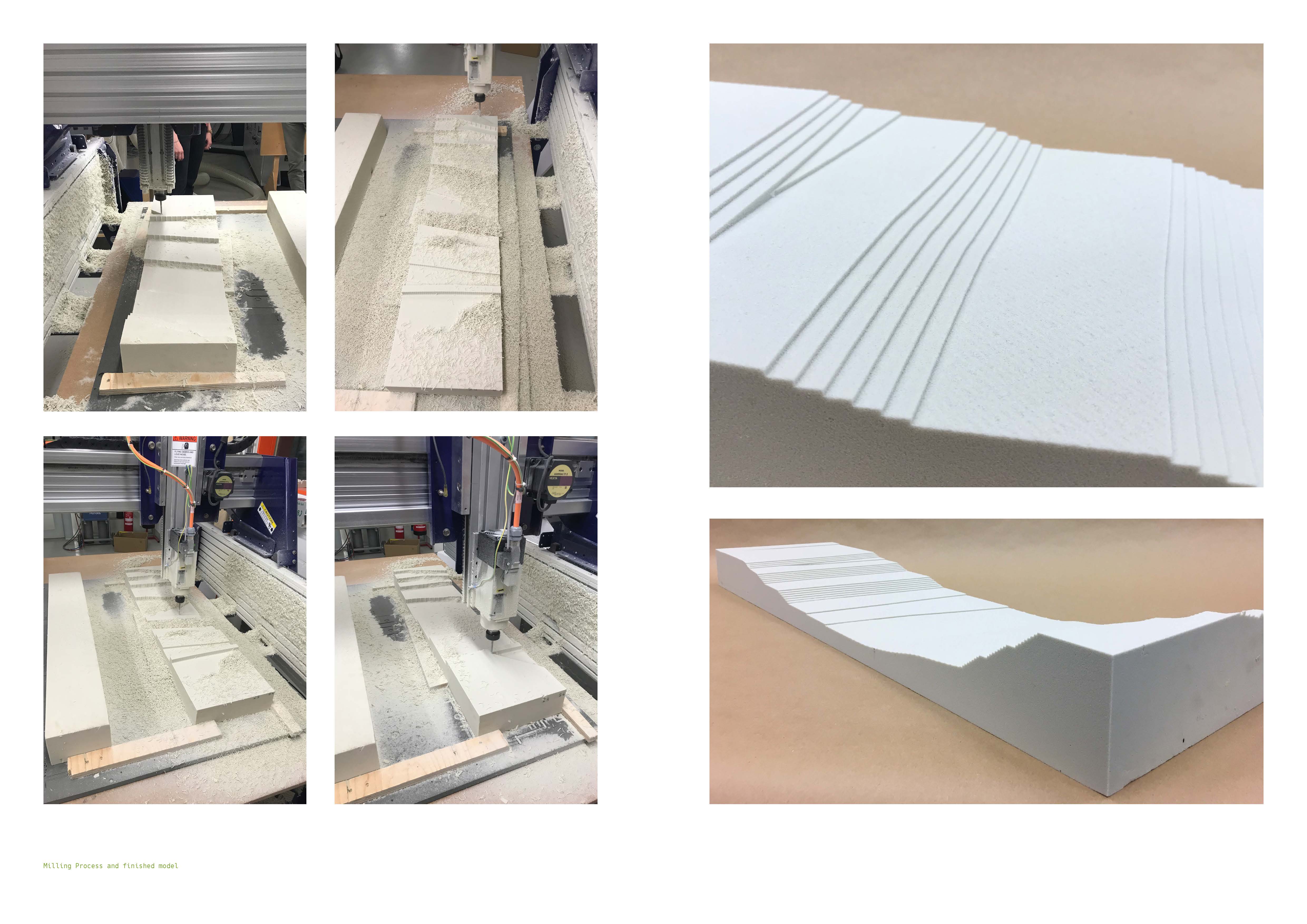
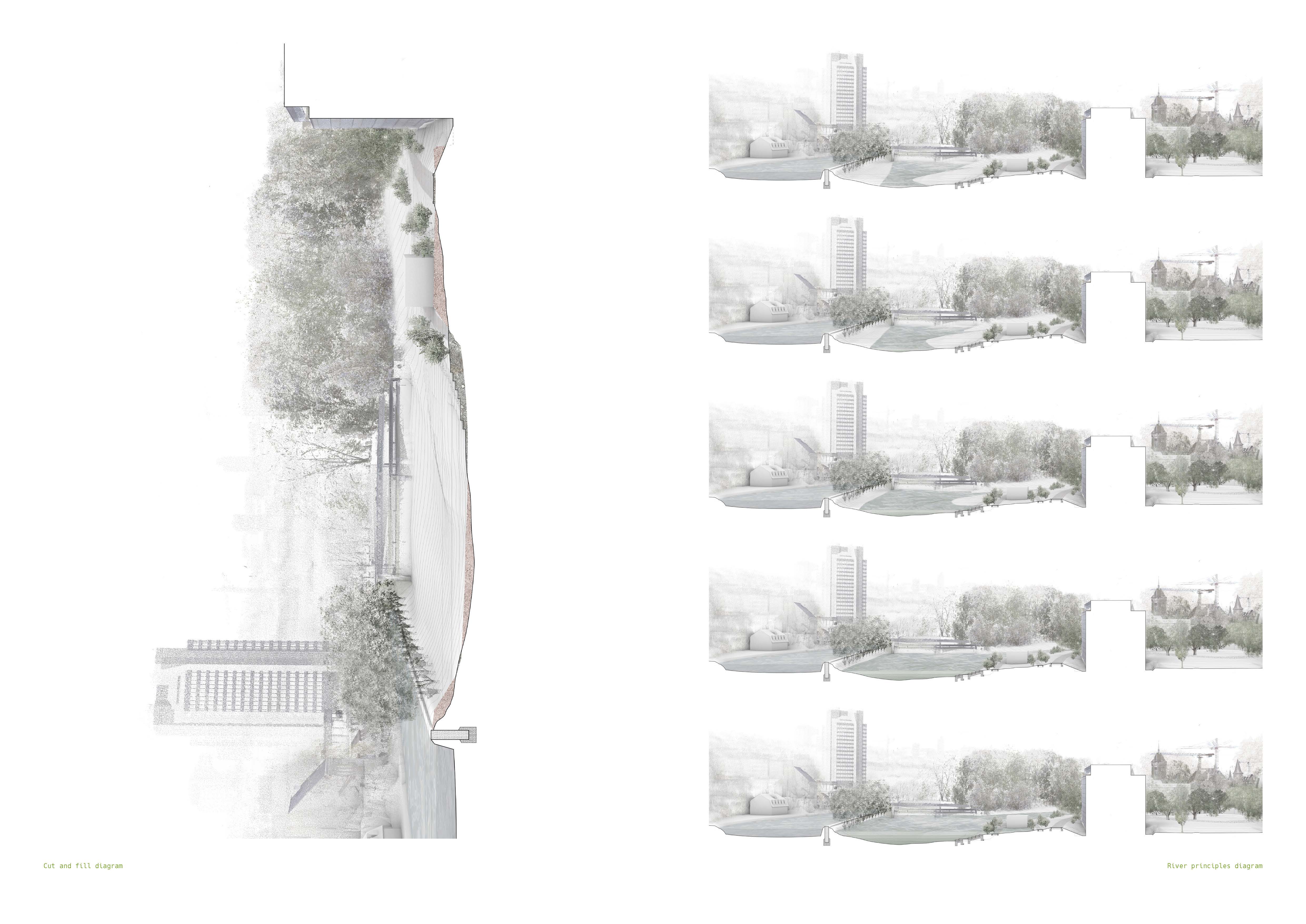
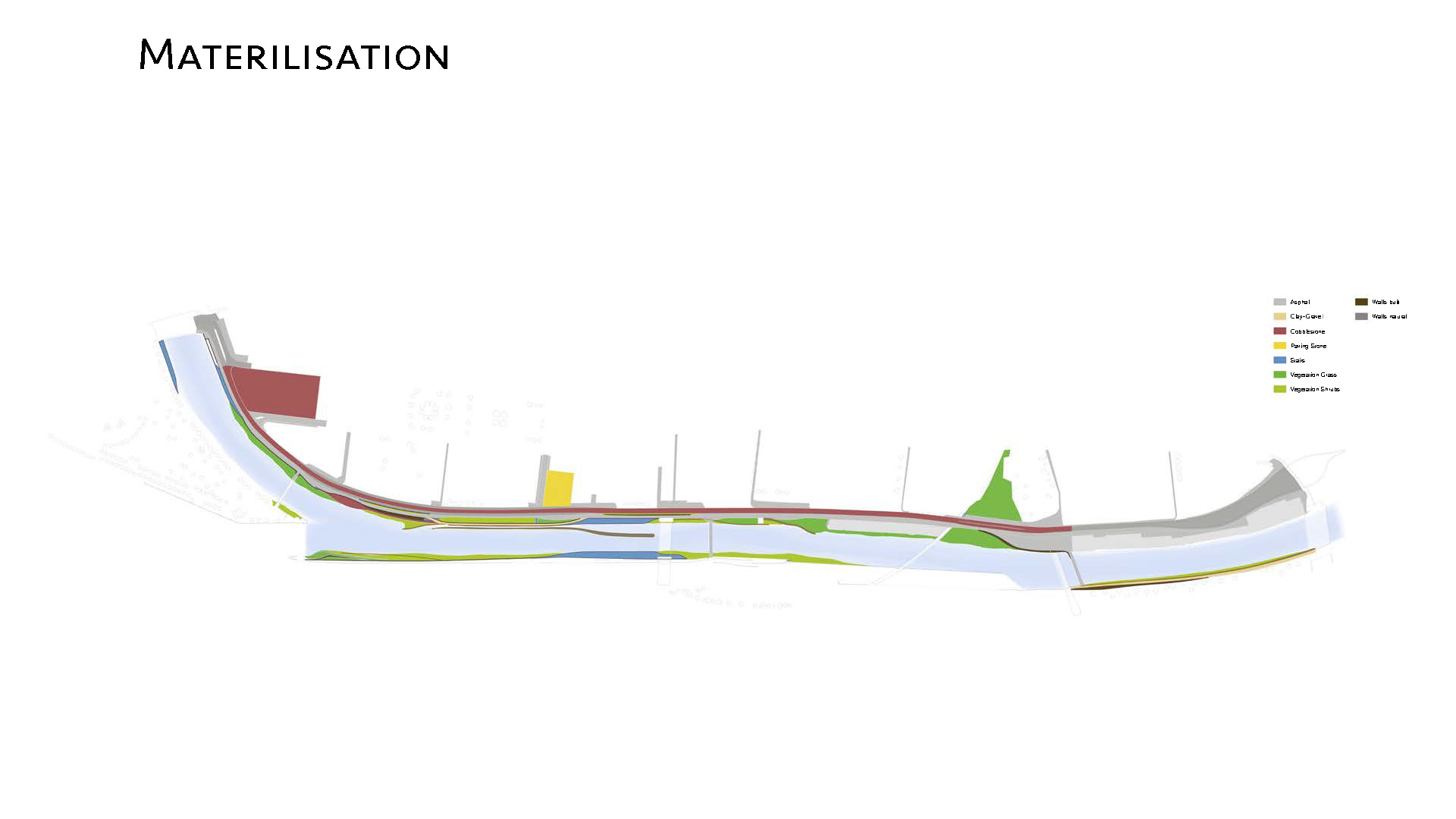
Topology is focused on the art and science of landscape surface manipulations using different materiality and textures. The approach of the studio was based on the use of 3D point cloud models as a design tool. The method has been developed at the Landscape Modelling and Visualizing Laboratory (LVML) over the past decade. Students learned how to develop a large-scale landscape project by using advanced 3D modeling and visualizing techniques. From the site visit up to the final presentation, a series of workshops accompanied the regular desk critiques and design reviews, enabling each students to develop their landscape design skill using digital and physical modeling. Analogue design tools were combined with digital design tools in the early design development phase. For that purpose, a series of seminars were toughed that include sandbox sketching, sand modeling and CNC prototyping, iterative 3D point cloud modeling and visualization techniques. Students were encouraged to develop their own design strategies and adapt the topological method to their projects.
- Drone Video by Ilmar Hurkxkens & Fujan Fahmi
- Point Cloud Model by Dennis Häusler & Benedikt Kowalewski (LVML)
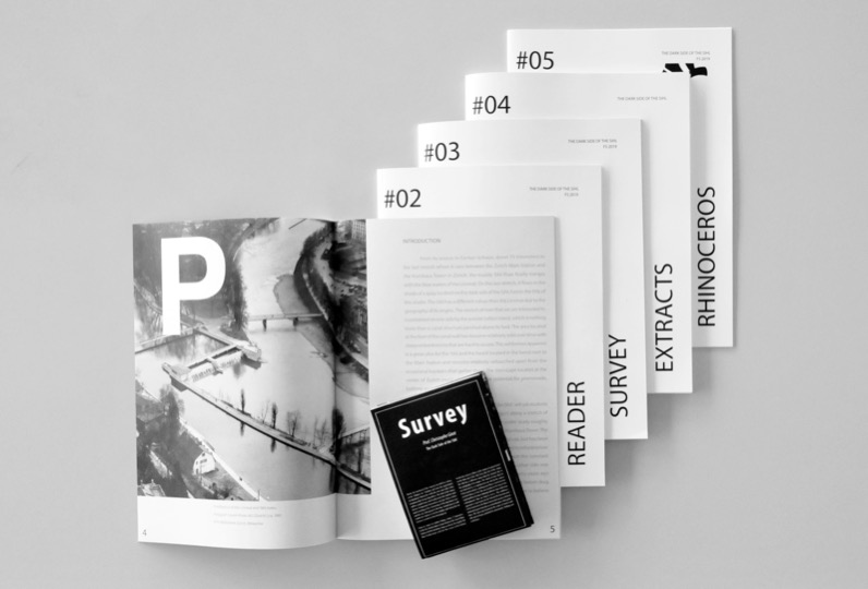
- Semester Booklets 01-05 & Survey Map
- Semester Impressions
- Final Review Exhibition
DESIGN DEVELOPMENT
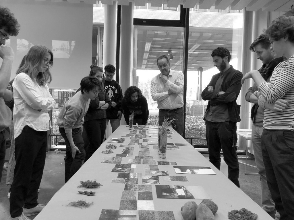
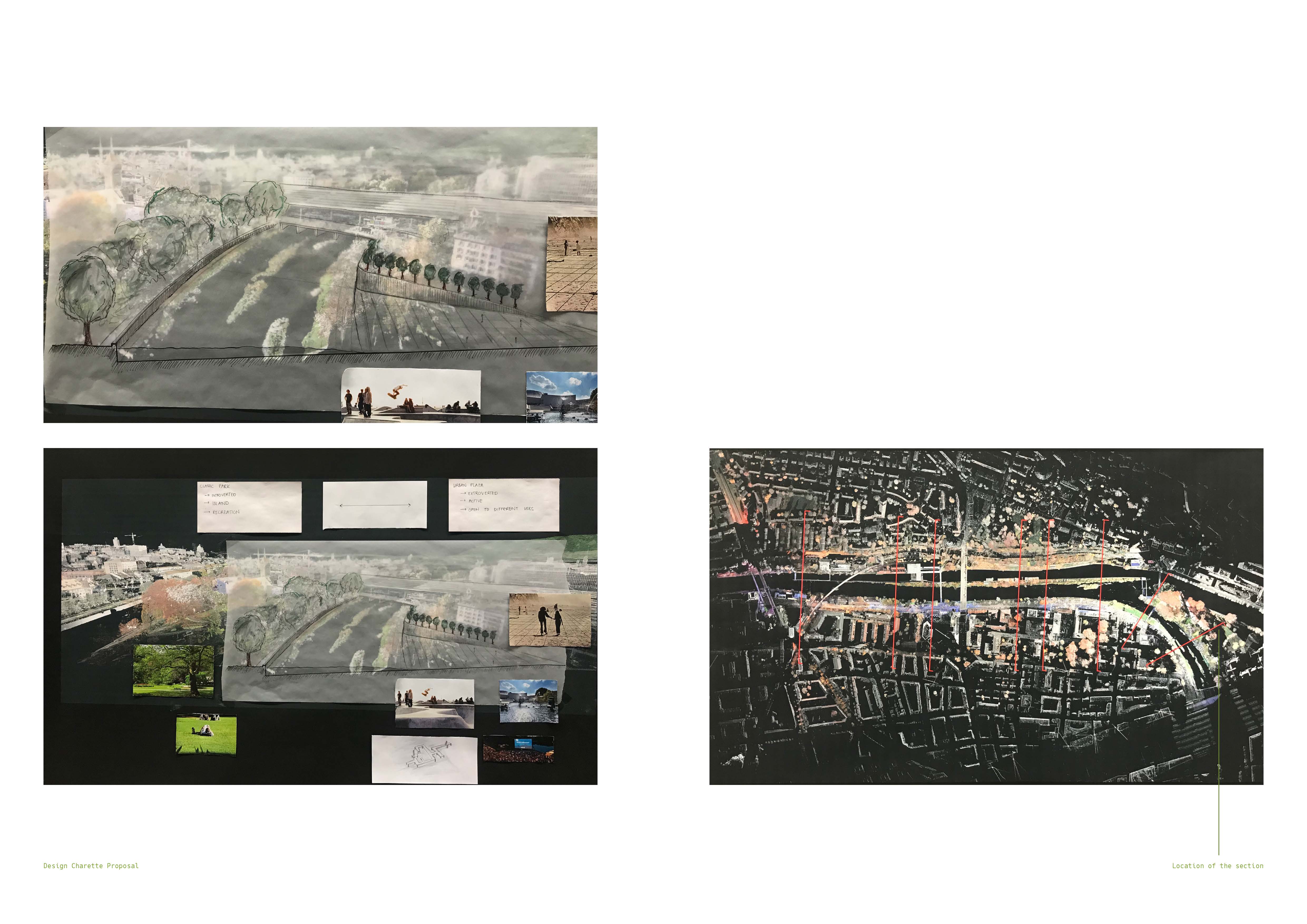
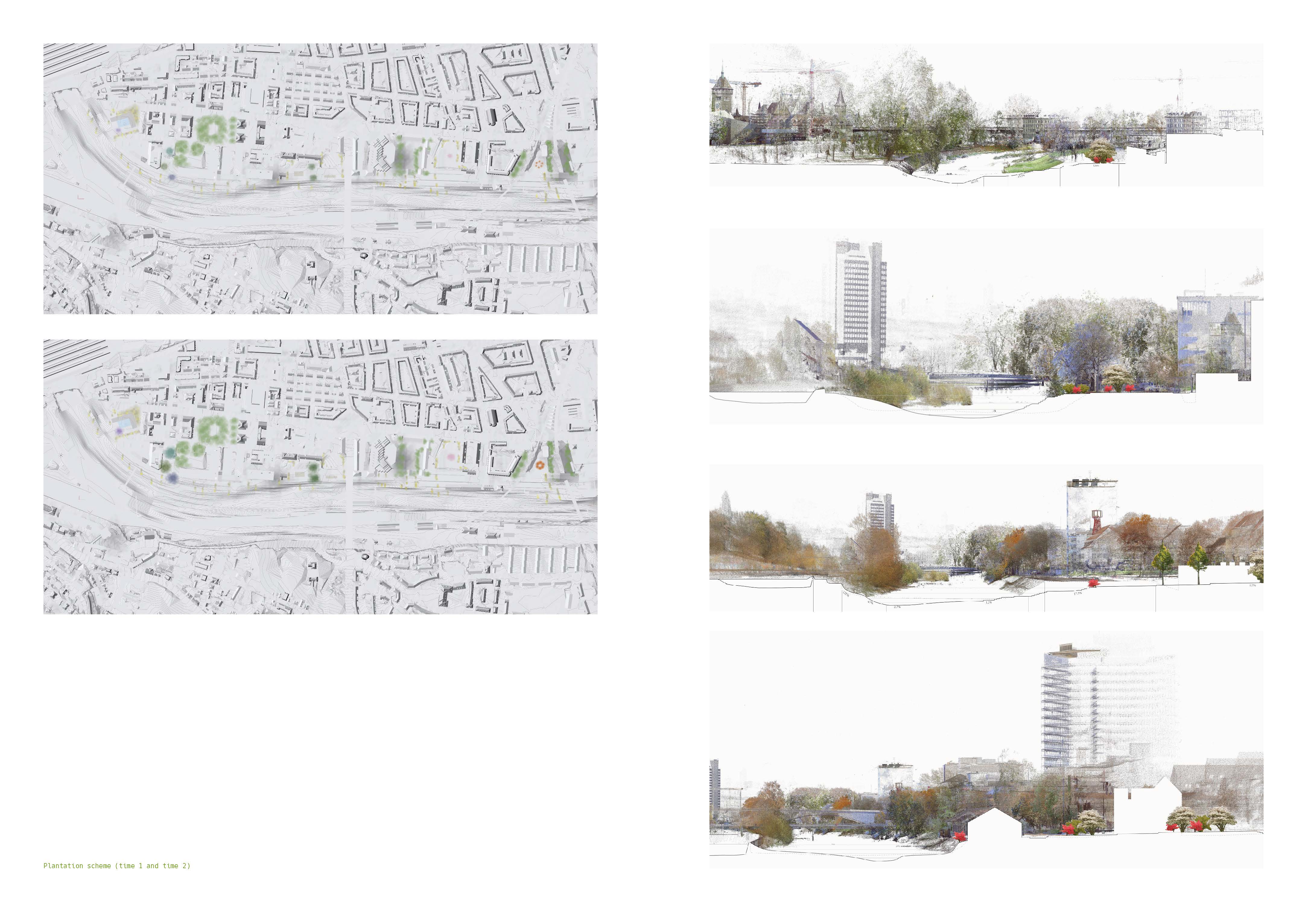
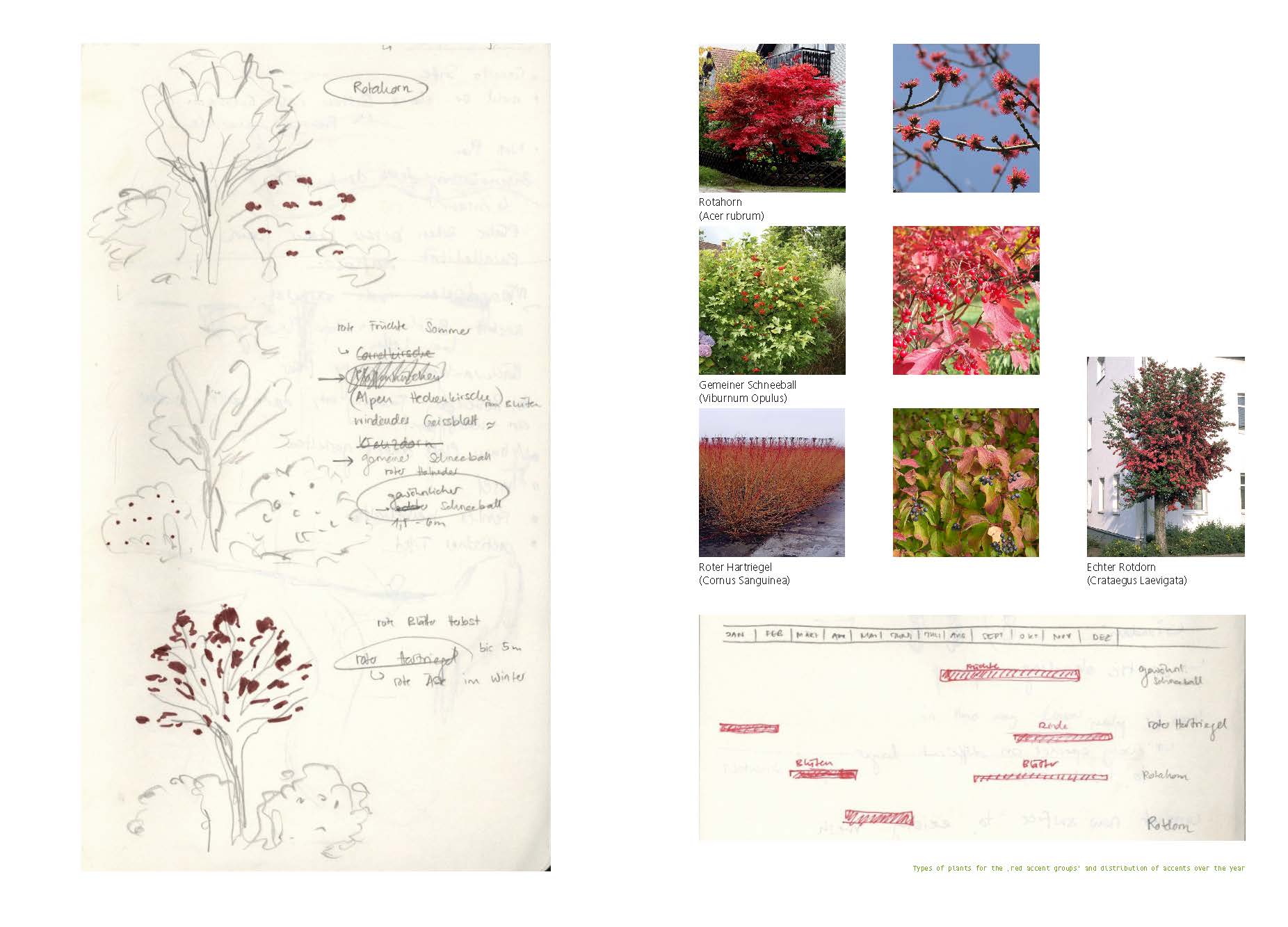
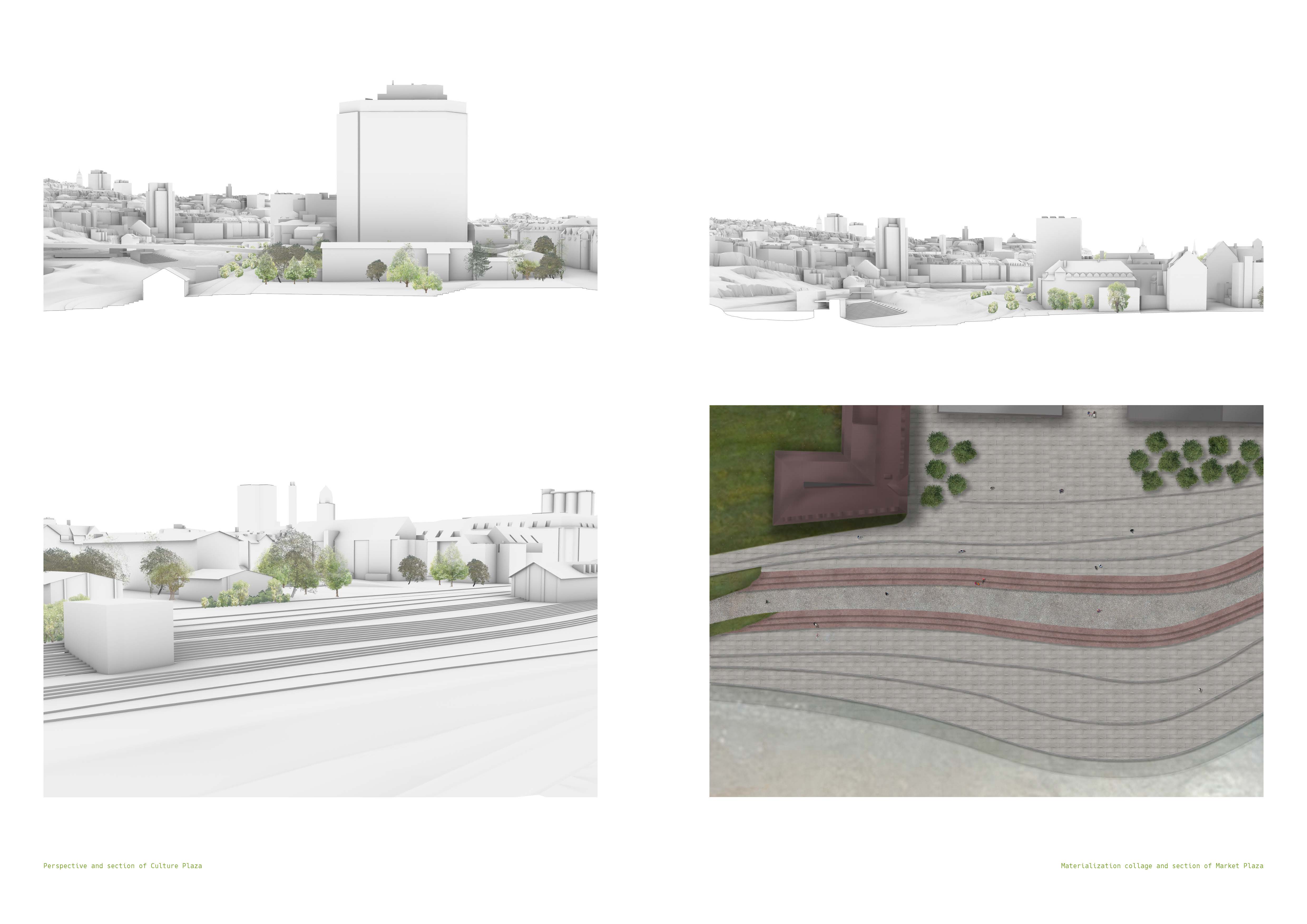
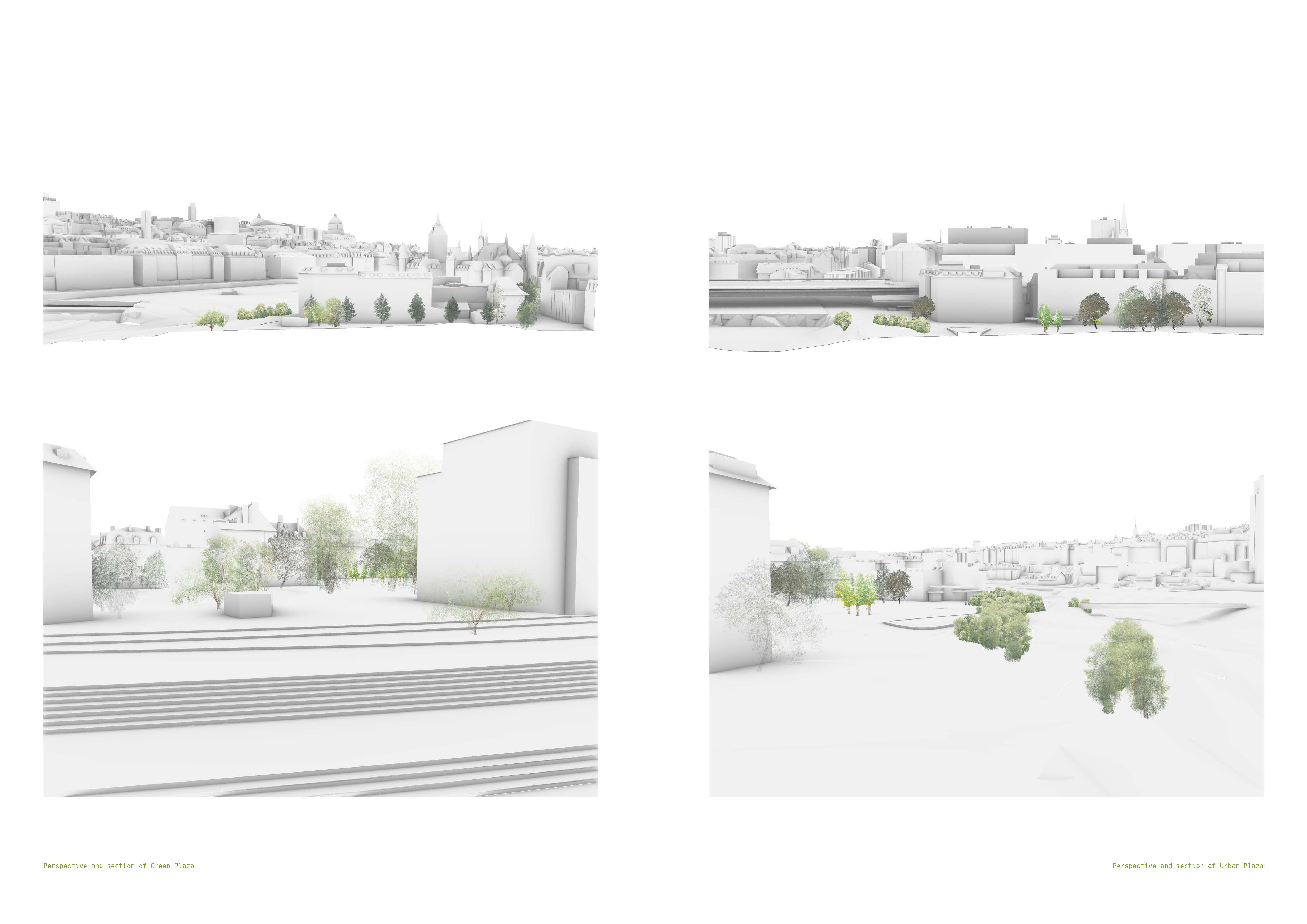
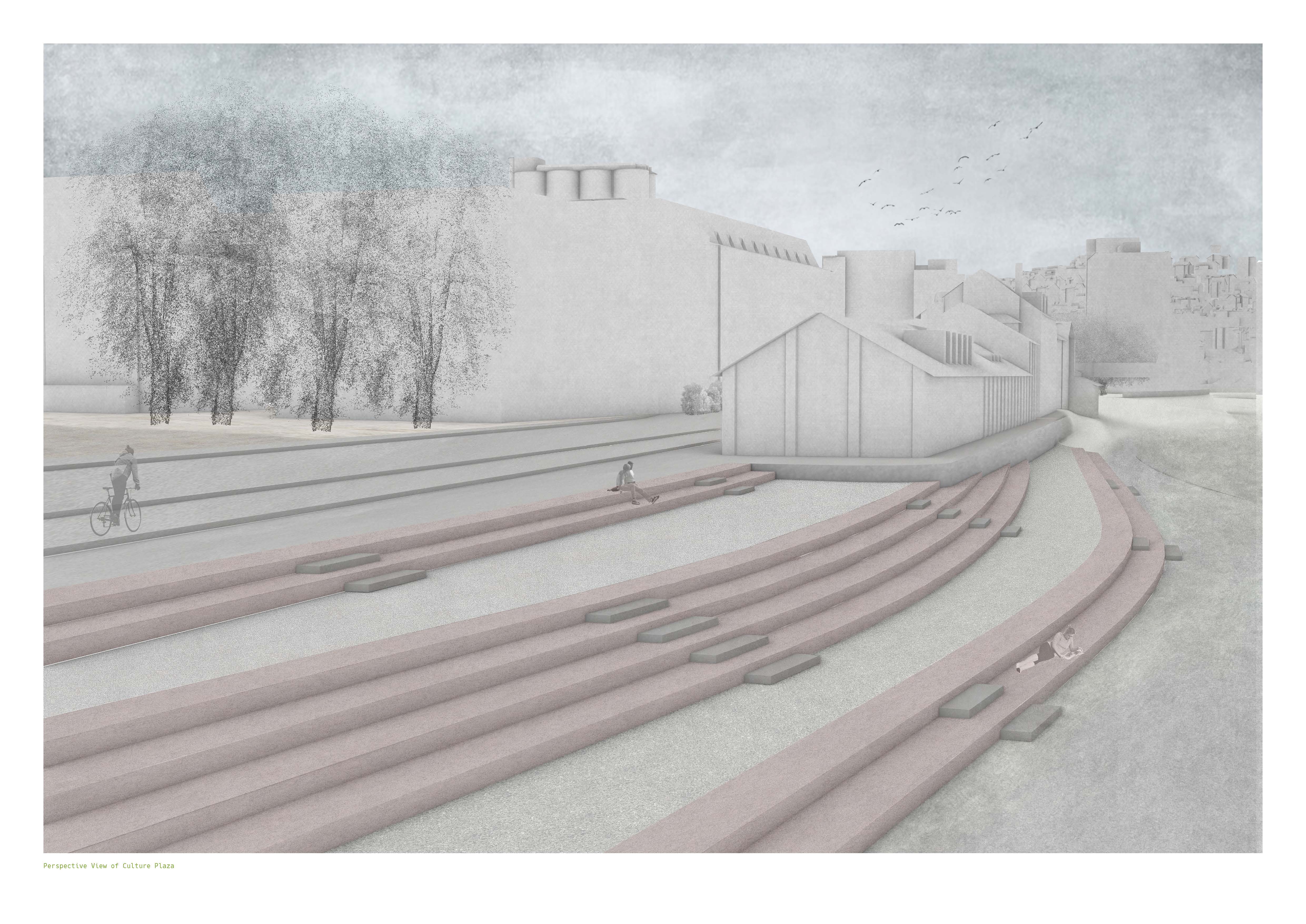
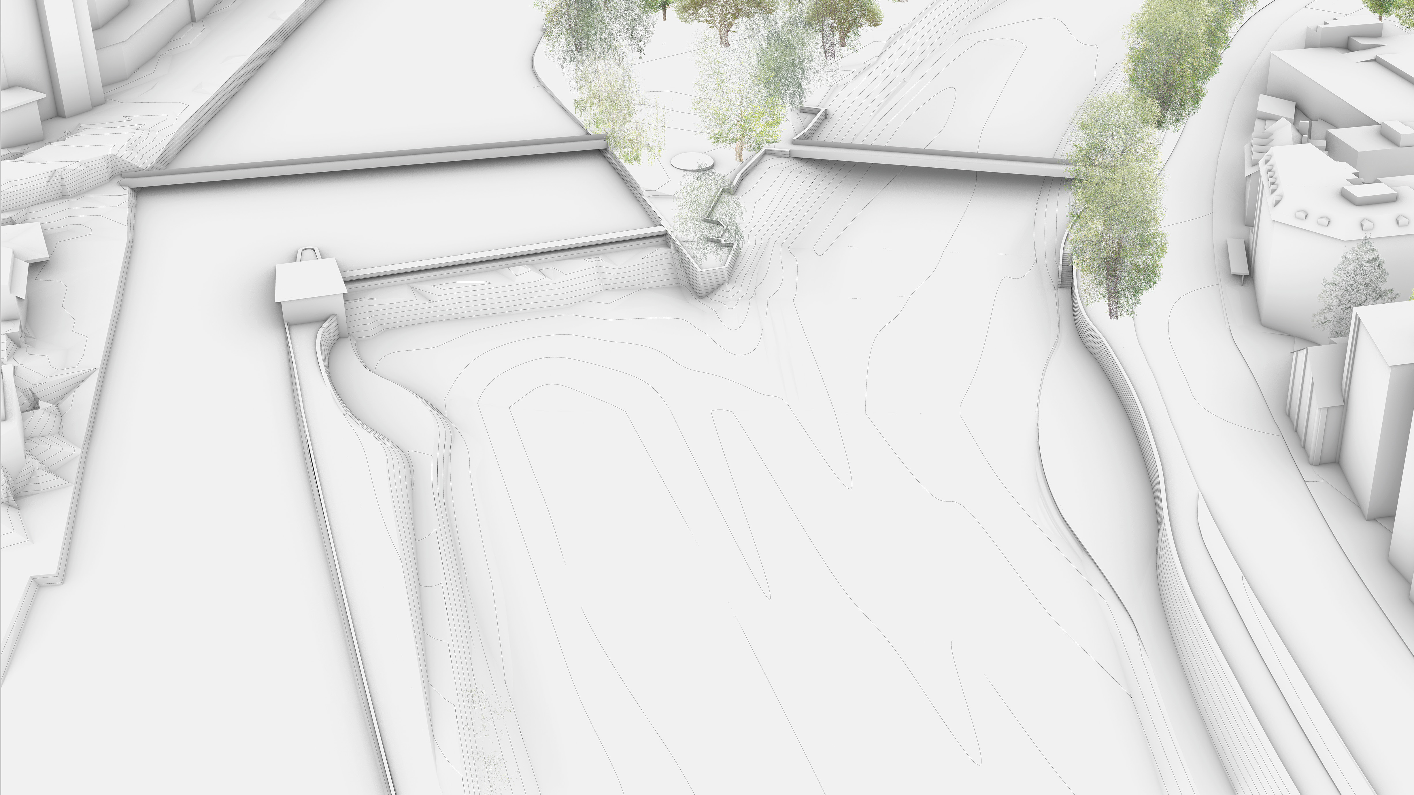
Based on the urban and landscape survey done during the site visit, an initial design hypothesis has been formulated by each student team. This has be done by using the analysis of the site and looking at case studies to build-up a strong hypothesis. The urban landscape seen as the road and river infrastructure, has taken civic amenities into account. Sites of interest such as parks, plazas, cafes, bars, baths and beaches were integrated in the concept. Salient features already existing on and around the site was identified during the survey and become the incubators for improvements. The intention was to develop the Sihlquai into a large and inviting public space with extensions into the neighborhood whenever possible. This was followed by a workshop in sand box modeling with simple topographic exercises to help develop a more intuitive and physical approach to terrain modelling. A workshop in digital 3D modeling with Rhinoceros has accompany this first design phase and helped students become more proficient with topology. Based on the design hypothesis that they have formulated, students choose a site-specific topographic approach to the given terrain in order to propose a new urban landscape along the Sihl. Emphasis was placed on projects that enable better access to the water, while maintaining a strong relationship to the surroundings. At the end of phase I students were asked to write a short brief pertaining to their design hypothesis, where precise landscape architectural measures through various design interventions were proposed and validated.
FULL DESIGN DEVELOPMENT THROUGH MODELLING AND ITERATIONS
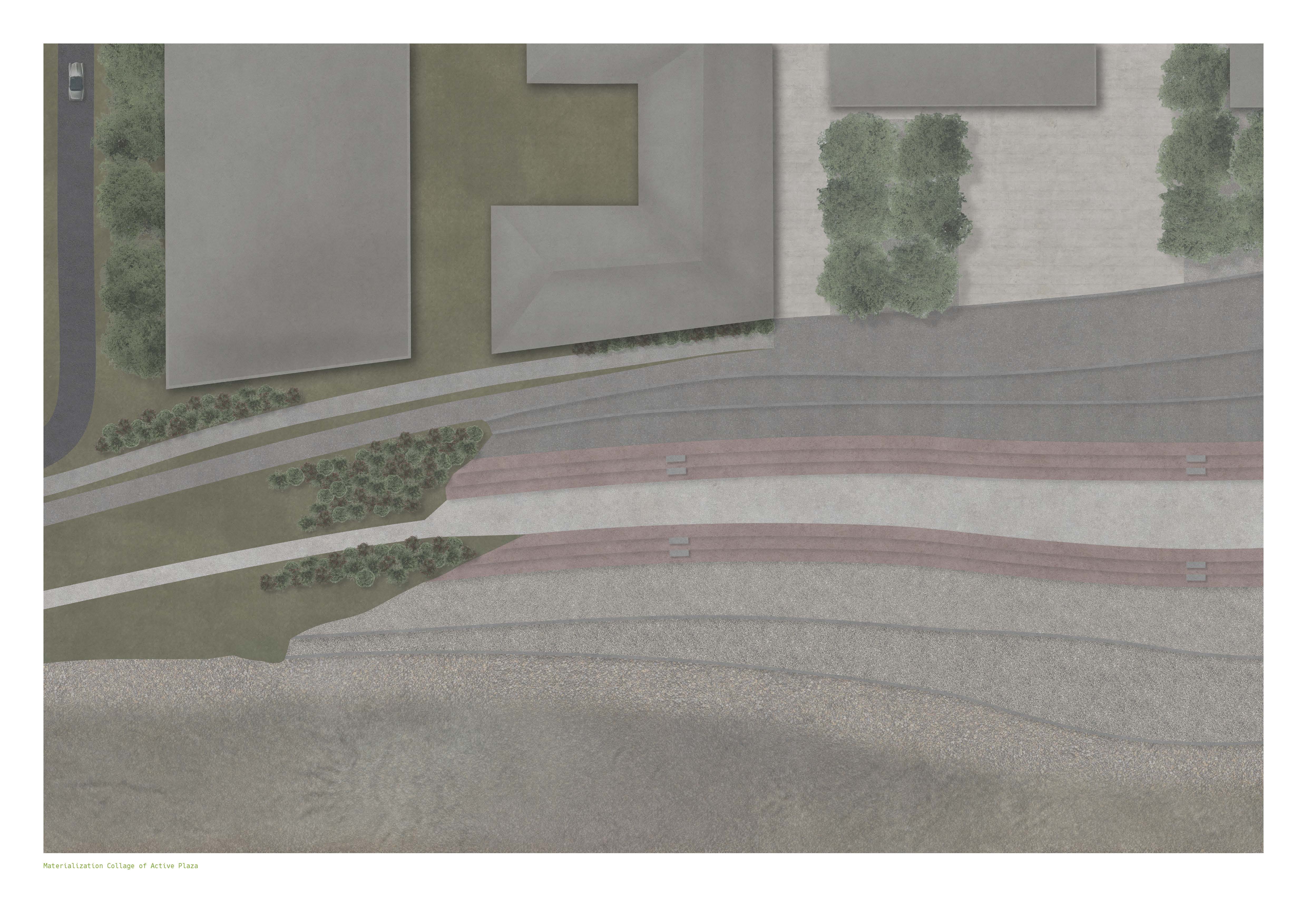
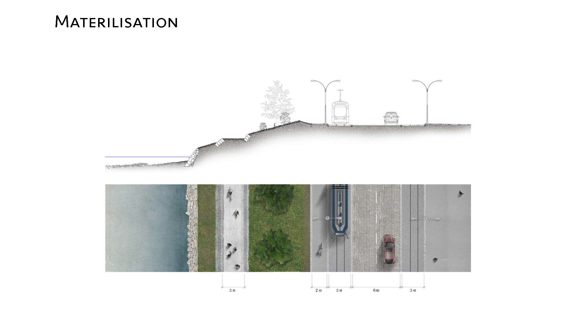
In the second part of the semester, the students have further develop their landscape design strategy to help increase the use and accessibility of the river for people. Access to the river included creating new entrances at several locations along the Sihlquai with the possibility to go down to the Sihl, wade in the water and even cross over to the Letten island on footbridges or stepping stones. At least one beach area had to be developed to allow for swimming, relaxing and sports like rafting, kayaking and fishing.
In order to modify the Sihlquai riverfront consequently, the existing road width will be reduced and alternative pedestrian and biking trails will be proposed. This has to be coupled with a strategy to reduce local rainwater runoff and encourage percolation.
The designs went through several iterations by means of Rhino and Point Cloud modeling. The focus has been on simulating various river levels from the dry summer river bed to major flooding events.
PROJECT SYNTHESIS
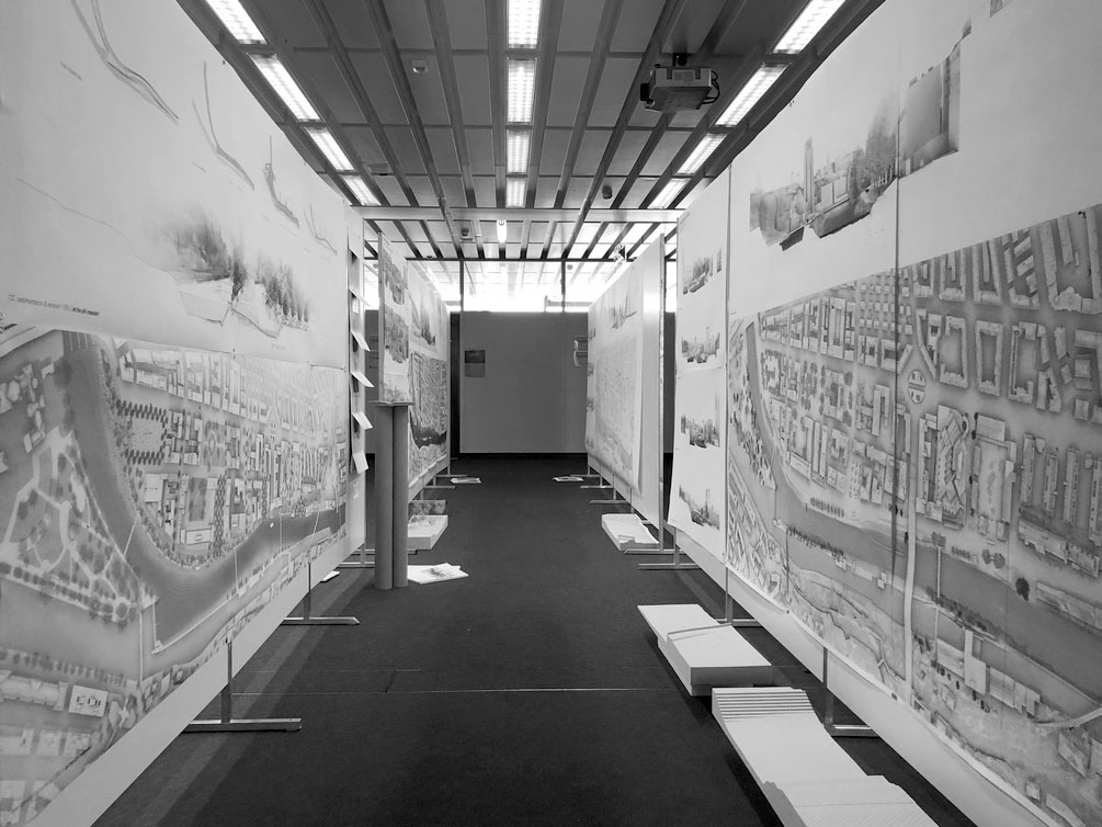
The central challenge of this Landscape architecture studio was to develop appropriate topographies that are compatible with ecology, diversity, human activity and river water management at different scales. In the last phase of the studio students were asked to formulate a clear synthesis of their initial design hypothesis, by revisiting a range of techniques acquired during the semester and learning how to produce precise topographic models using a CNC milling machine. During the final production phase students applied all the topological knowledge they have learned by using plans, sections and models to improve their landscape architectural design. The goal of this studio was for students to gain confidence in their ability to work landscape architecture on complex situations at the interface of ecology and urban design, and to deepen their design skills in this field.
Design Process: Student Project by Nadja Furler & Sandra Wegmann

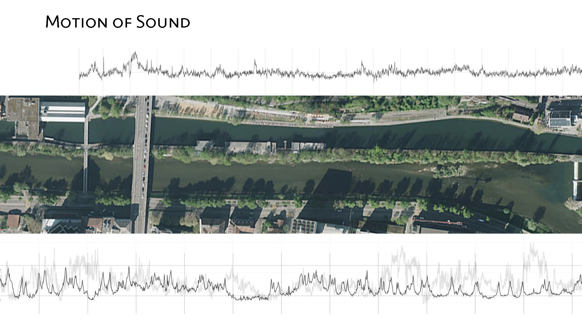
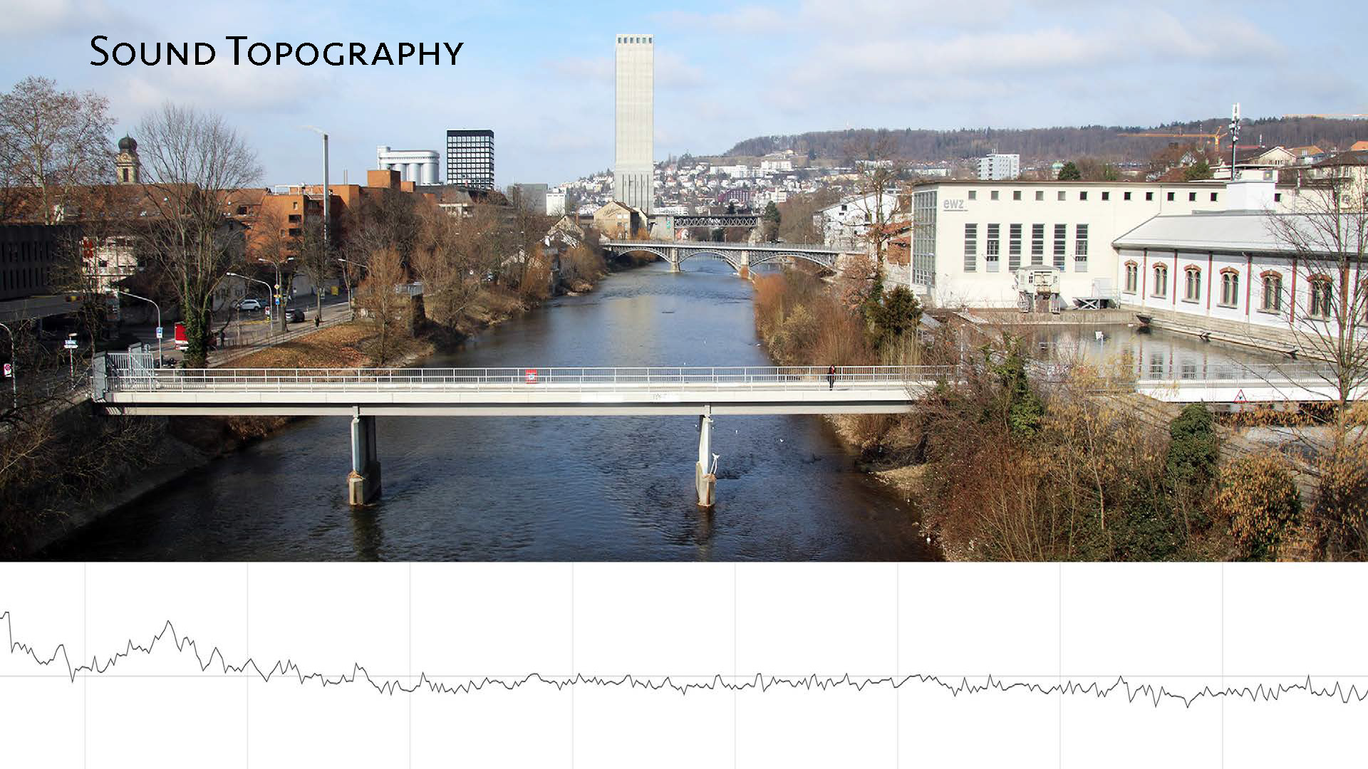
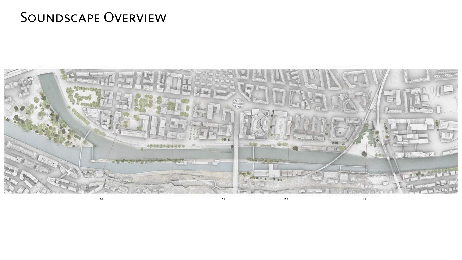
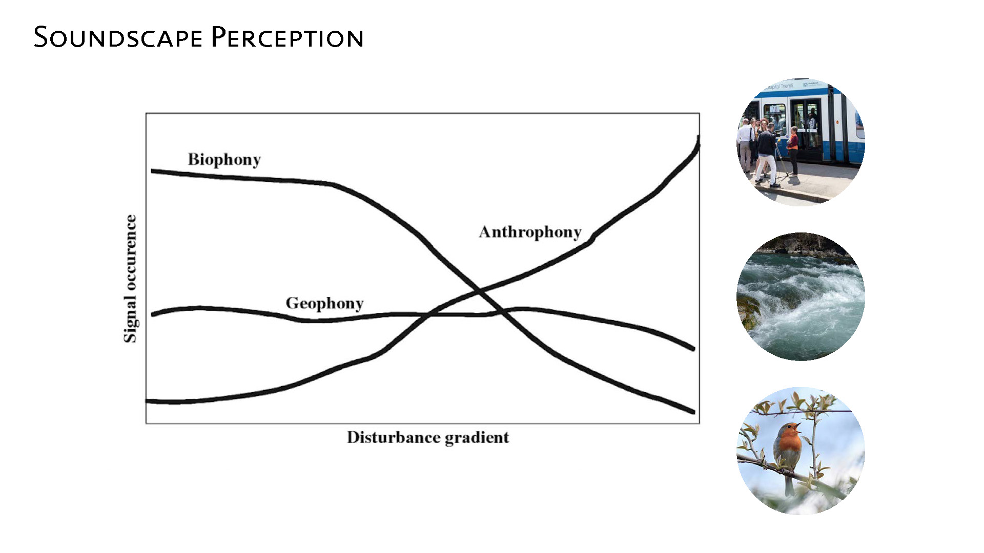
Topography of Sound: Student Project by Silvio Romano & Patrick Greber