
STUDIO
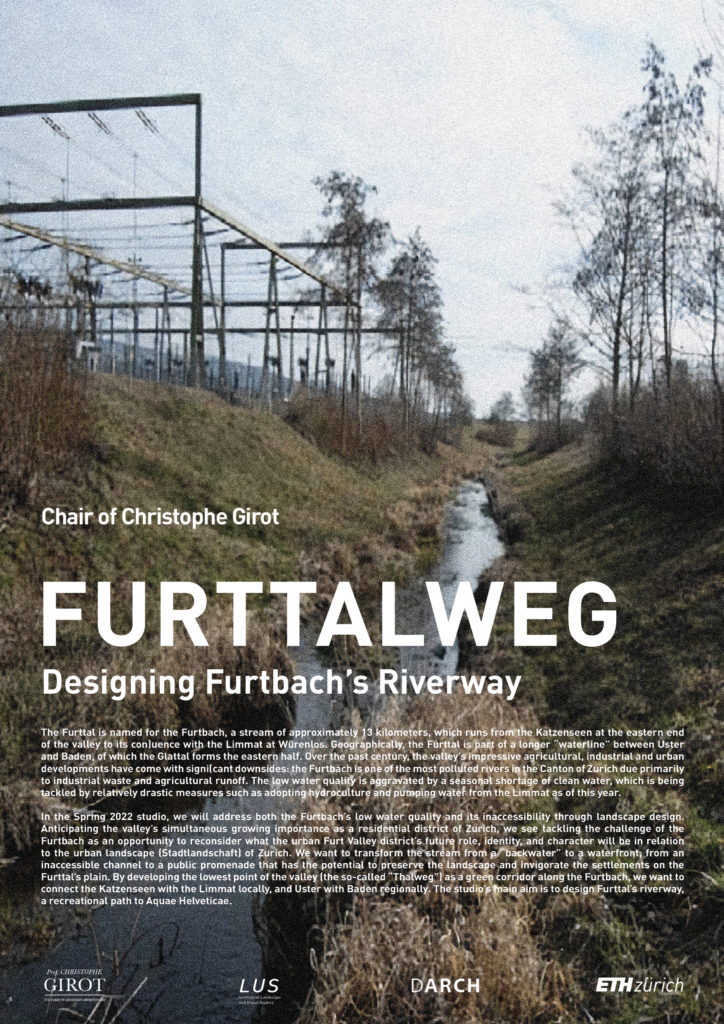
The FS2022 Studio “Furttalweg” asked the students to transform the stream from a “backwater” to a waterfront, from an inaccessible channel to a public promenade that has the potential to preserve the landscape and invigorate the settlements on the Furttal’s plain. By developing the lowest point of the valley (the so-called “Thalweg”) as a green corridor along the Furtbach, we want to connect the Katzenseen with the Limmat locally, and Uster with Baden regionally. The studio’s main aim is to design Furttal’s riverway, a recreational path to Aquae Helveticae.
GUEST LECTURERS
Prof. Milica Topalovic, Prof. Angelus Eisinger
TEACHING TEAM
Prof. Christophe Girot, Magdalena Kaufmann, Lara Mehling, Julian Fischbacher
STUDENTS
Beatrice Kiser, Flore Schärrer, Angela Stadelmann, Simon Orga, Annabell Daverhuth, Fanny Christinaz, Sophia Garner
Designing Furttals Riverway
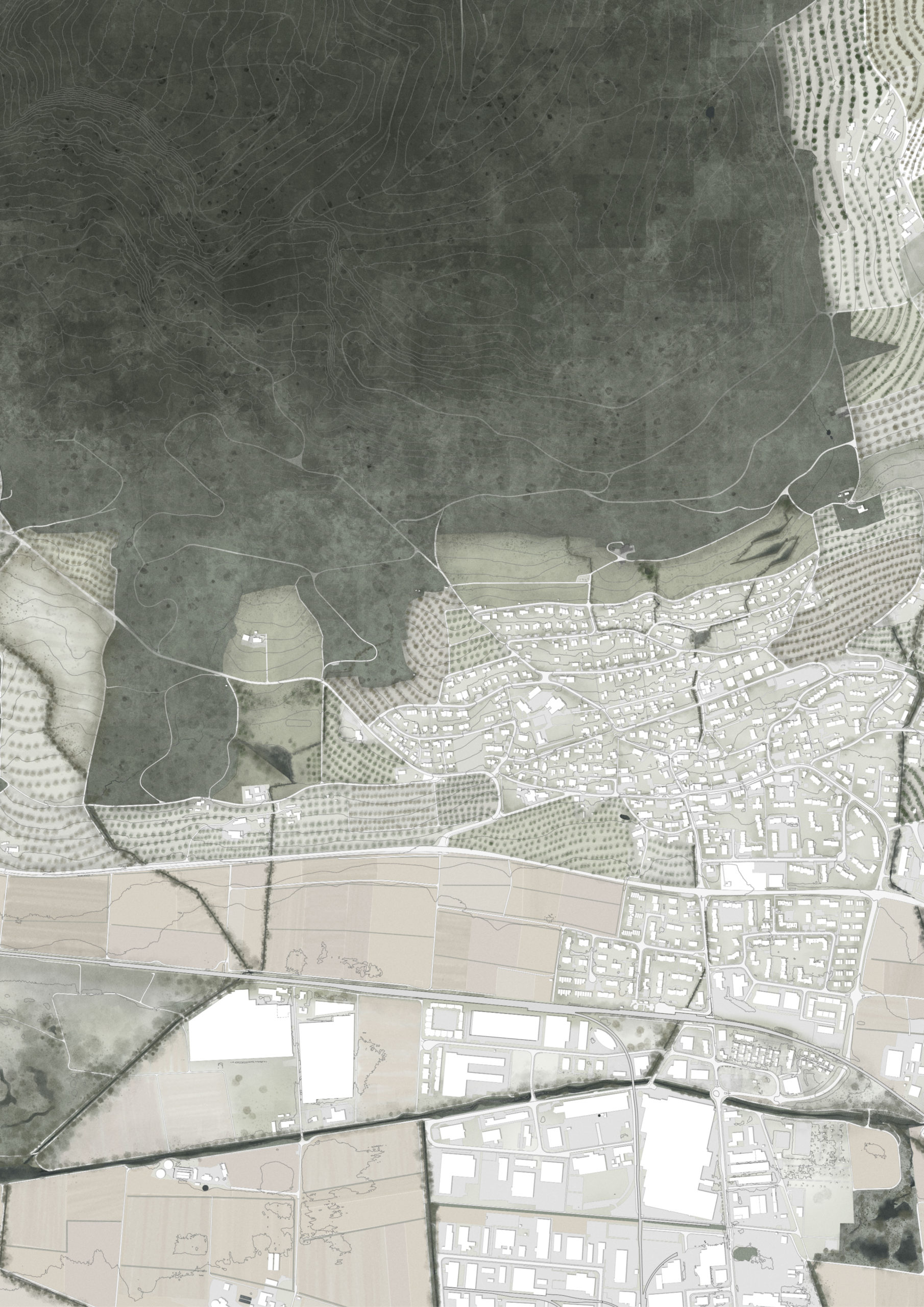
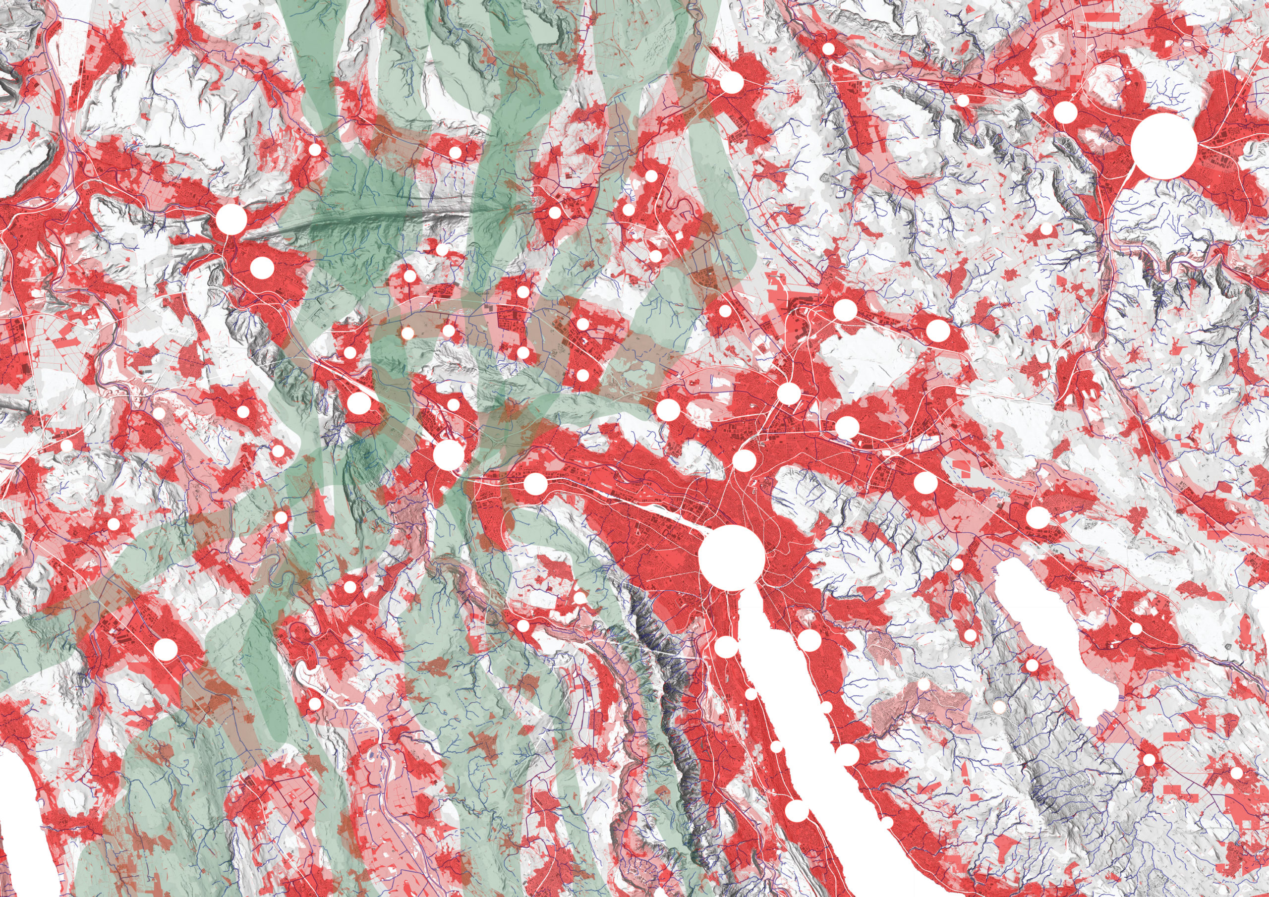
The Furttal, located in the northwest corner of the Canton of Zurich, forms a relatively self-contained settlement area between the steep slopes of the Lägern mountain (the eastern ridge of the folded Jura mountains) and the molasse deposit of the Altberg. During Roman times, an arterial road flanked both sides of this valley, leading from the legionary camp in Windisch (Vindonissa) to the spa settlement at the vicus of Baden (Aquae Helveticae, “Helvetische Bäder”), and on to Oberwinterthur (Vitudurum).
The Furttal is named for the Furtbach, a stream of approximately 13 kilometers, which runs from the Katzenseen at the eastern end of the valley to its confluence with the Limmat at Würenlos. Geographically, the Furttal is part of a longer “waterline” between Uster and Baden, of which the Glattal forms the Eastern half. The two valley plains are separated only by a saddle at the location of the Katzenseen, which divides the two watersheds. From the lakes, two streams flow in opposite directions: The Katzenbach to the east and the Furtbach to the west.
Due to the relatively flat topography of the valley floor, the Furtbach was prone to flooding. To increase the agricultural yield and enable settlement on the otherwise swampy plain, the association Entsumpfungsgesellschaft des Regensdorfer Thales (Furttal) was formed in 1871 to drain the natural wetland area. Until 1980, multiple corrections significantly reduced the risk of flooding and “reclaimed” the land, resulting in one of the largest areas of vegetable production in the canton. Just as the Romans built their roads beyond the wetland perimeter, later settlements formed towards the slopes on either side of the valley, beyond the belt of fertile soil along the valley floor.
In addition to agriculture, industry formed an important pillar of the valley’s economy starting from the 1960s. While the City of Zurich began transitioning to a service economy around the same time, the Furttal still remains one of the largest industrial areas in the canton. By the 1950s, figures such as Max Frisch and Lucius Burckhardt called for an end to Switzerland’s incessant sprawl by proposing a Neue Stadt, a utopian garden city for 10,000-20,000 inhabitant. For their studies on the Neue Stadt, a group around architect and urban planner Ernst Egli used the Furttal as their location of choice
Today, the Furttal has become an increasingly attractive residential area within the greater Zurich metropolitan area with a projected 30% growth in the coming decades (10,000 new inhabitants by 2040). However, while the Furttal still advertises its natural landscapes as attractive recreational areas for the residents of Zurich, these picturesque destinations are mostly confined to the surrounding forested hills of Lägern and Altberg – while the valley plain remains dominated by farming and industrial sprawl and the Furtbach resembles more of a drainage ditch than a living water system.
The valley’s agricultural, industrial and urban developments have come with significant downsides: the Furtbach is one of the most polluted rivers in the Canton of Zurich due primarily to industrial waste and agricultural runoff. The pollution has raised concerns about potential health risks to humans through the agricultural produce. The low water quality is aggravated by a seasonal shortage of clean water, which is being tackled by relatively drastic measures such as adopting hydroculture and pumping water from the Limmat as of this year.
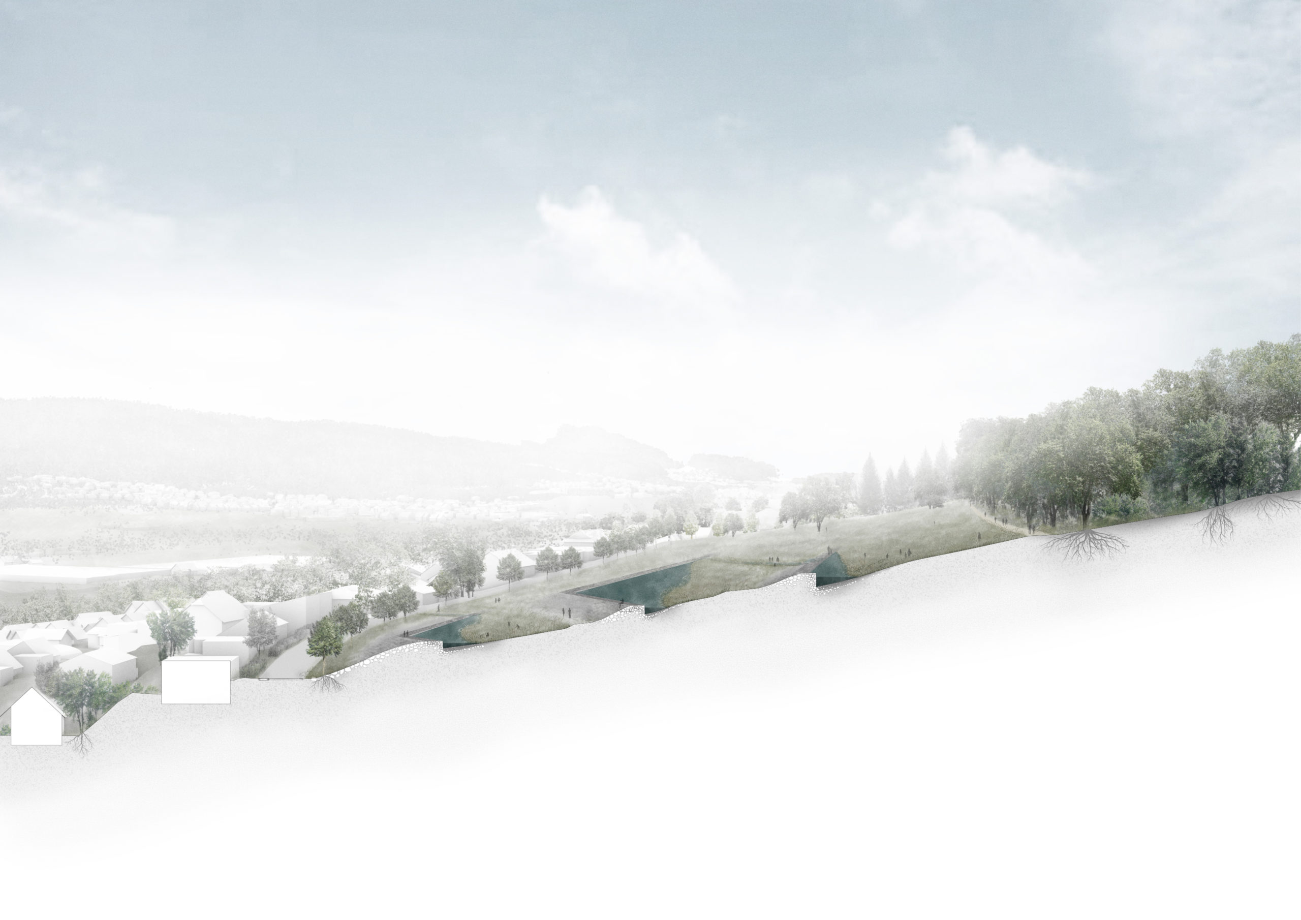
The valley’s pressing water issues can no longer be ignored. In this studio, we will address both the Furtbach’s low water quality and its inaccessibility through landscape design. Anticipating the valley’s simultaneous growing importance as a residential district of Zurich, we see tackling the challenge of the Furtbach as an opportunity to reconsider what the urban Furt Valley district’s (Furttal) future role, identity, and character will be in relation to the urban landscape (Stadtlandschaft) of Zurich.
We want to transform the stream from a “backwater” to a waterfront, from an inaccessible channel to a public promenade that has the potential to preserve the landscape and invigorate the settlements on the Furttal’s plain. By developing the lowest point of the valley (the so-called “Thalweg”) as a green corridor along the Furtbach, we want to connect the Katzenseen with the Limmat locally, and Uster with Baden regionally. The studio’s main aim is to design Furttal’s riverway, a recreational path to Aquae Helveticae.
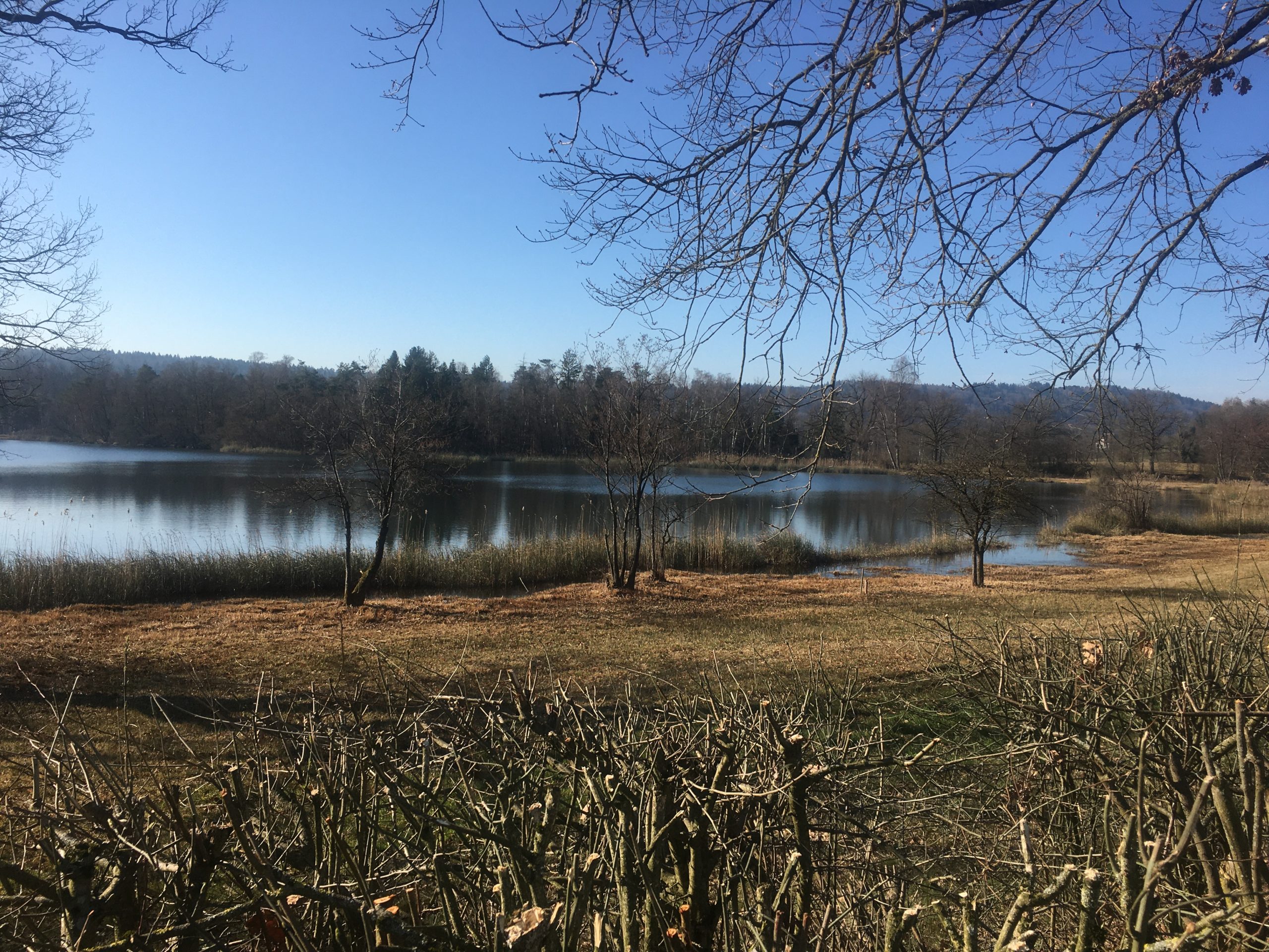
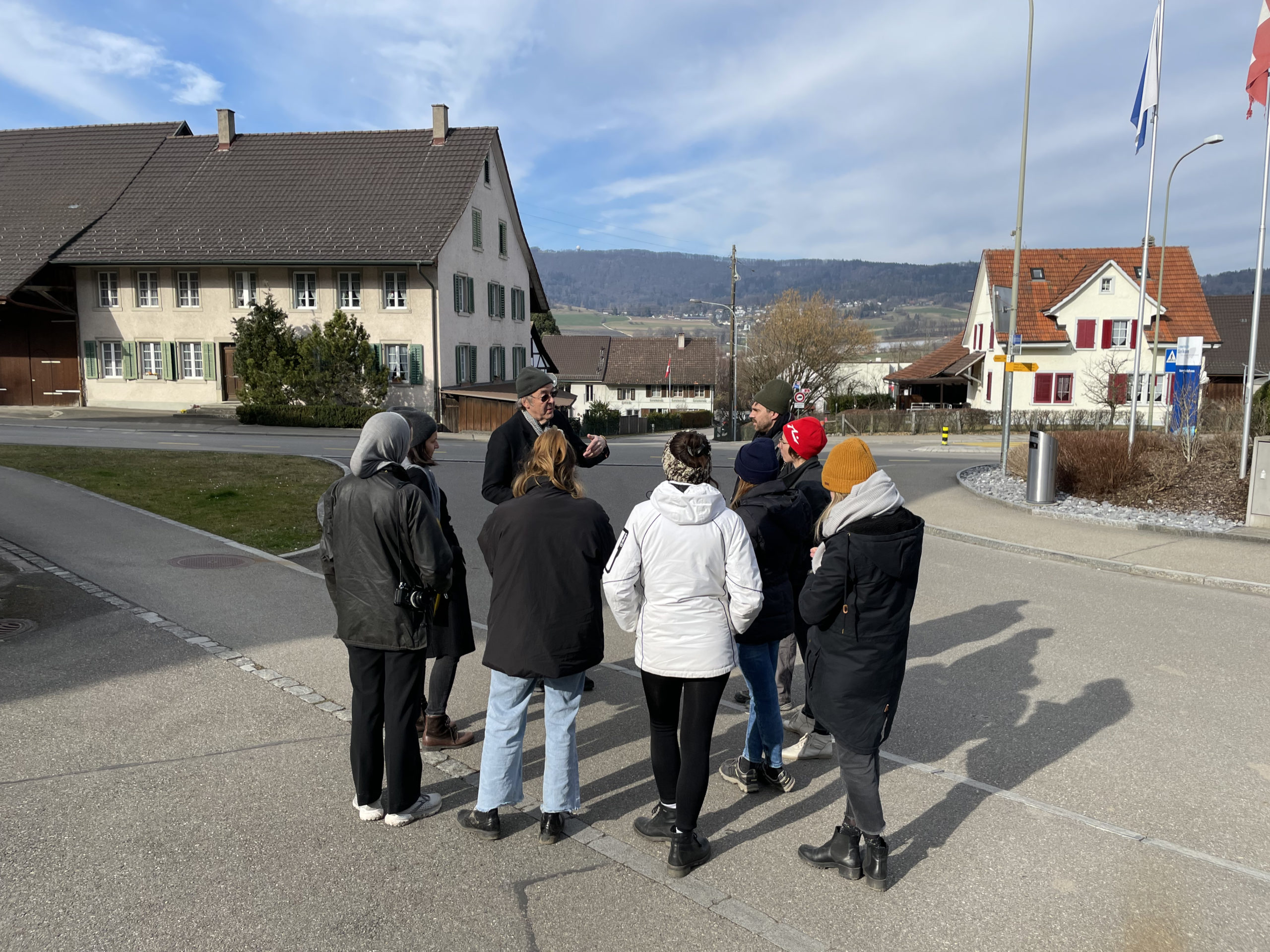
Site Visit, Katzenseen, 2022
Site Visit, At the Roman Road in Dänikon, 2022
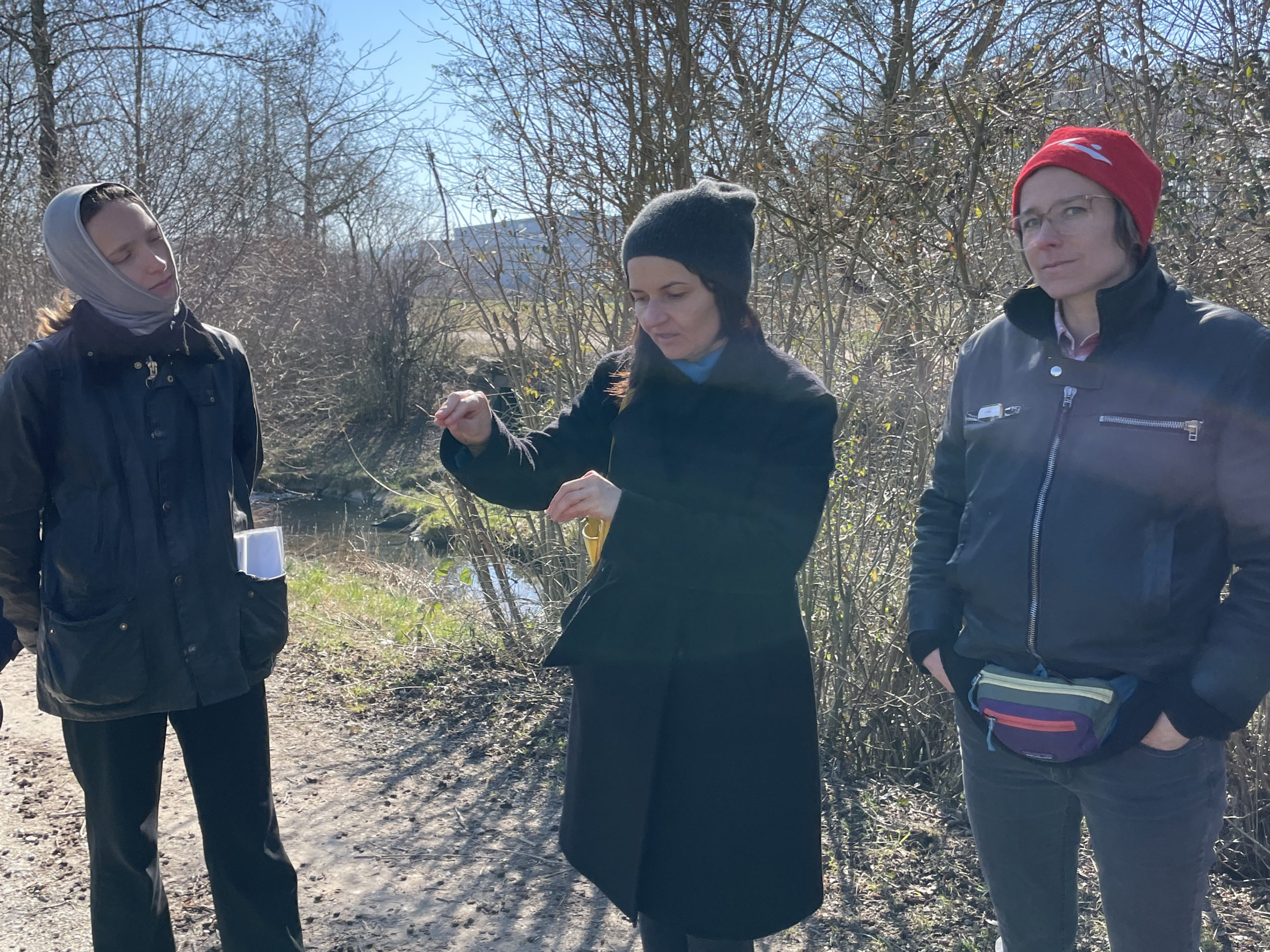
Site Visit, Furtbachs Riveredge, 2022
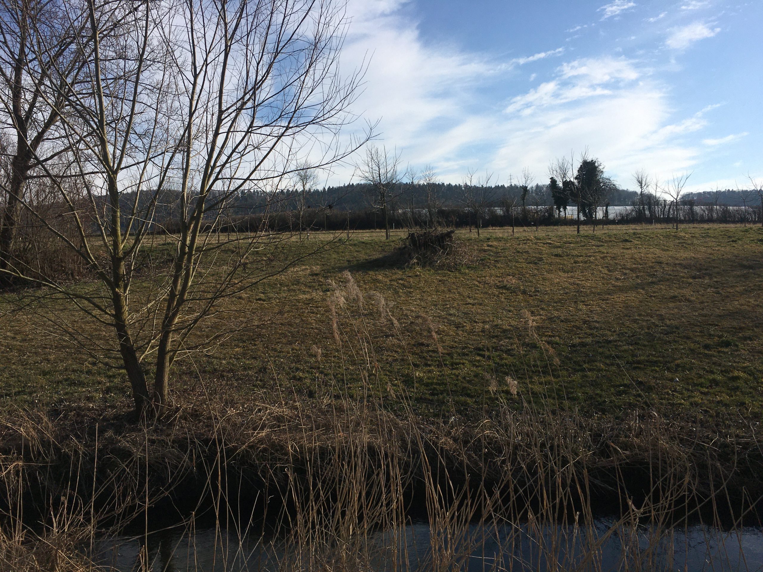
Site Visit, Furtbach Otelfingen, 2022
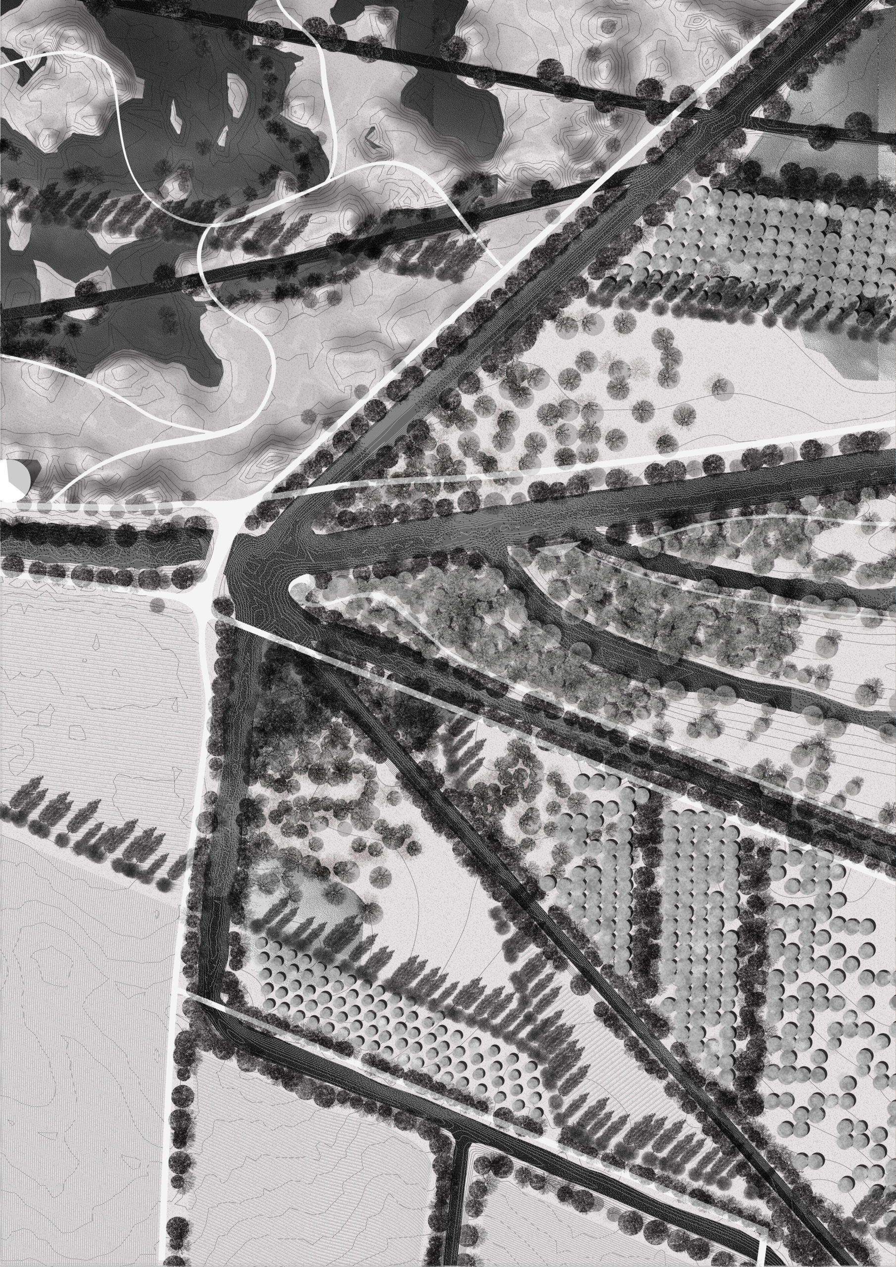
Student Work
“Broad Waters“ – Section Perspective | Annabell Daveruth
“Broad Waters“ – Sector Plan | Annabell Daveruth & Simon Orga
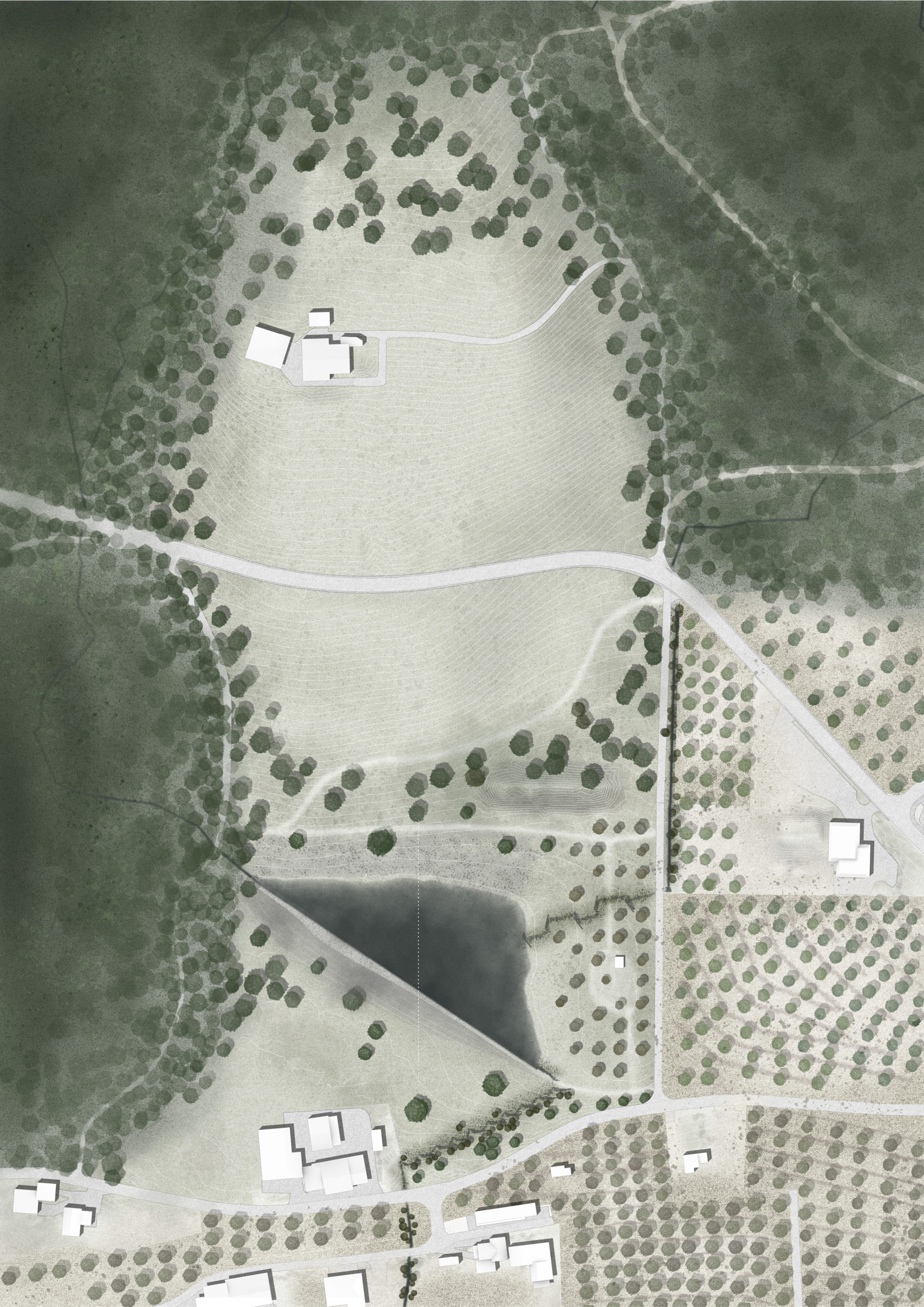
“Broad Waters“ – Focus Plan | Simon Orga
“Broad Waters“ – Focus Plan | Annabell Daveruth
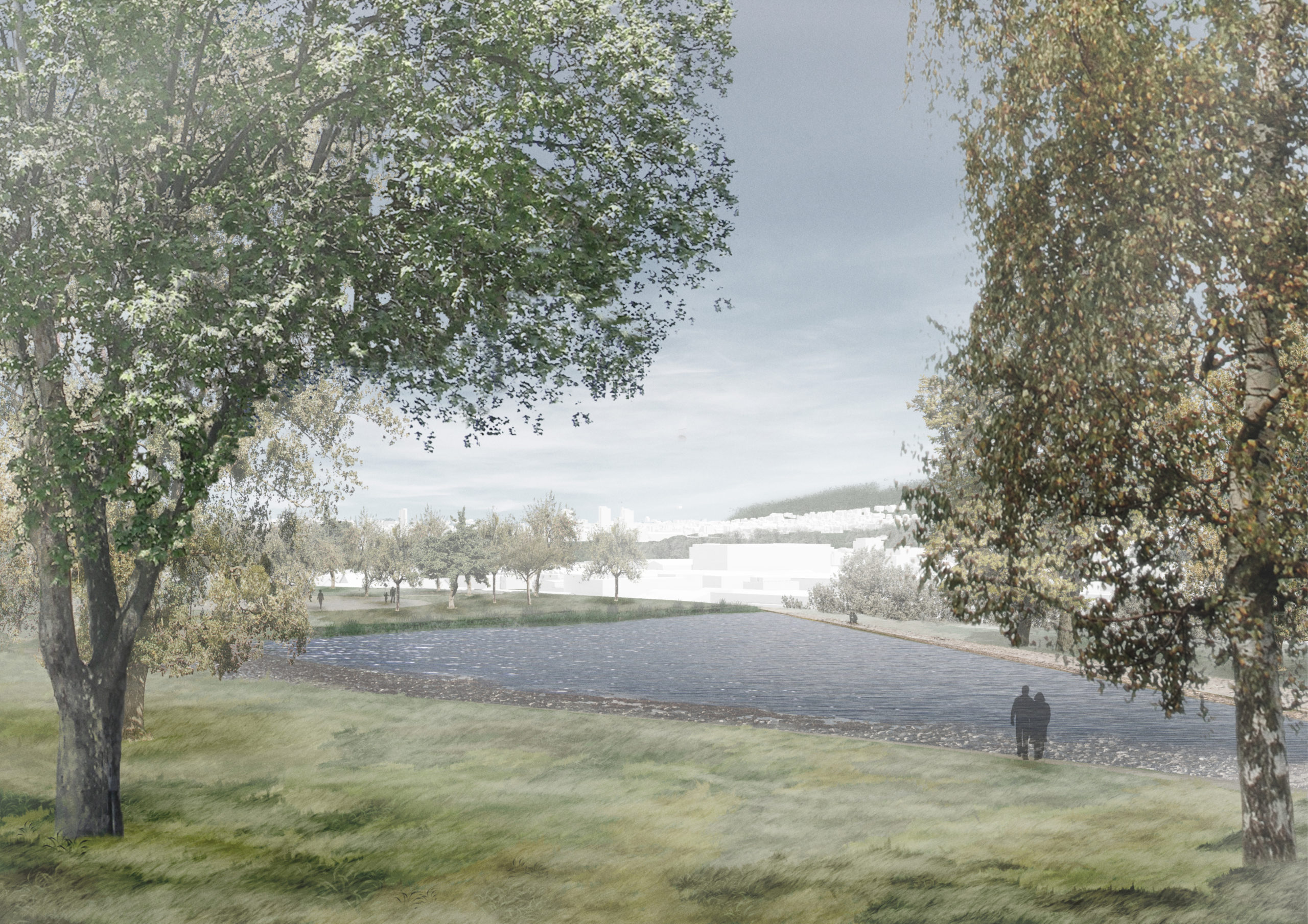
“Broad Waters“ – Human Eye Perspective | Simon Orga
“We are Water“ – Sector Plan | Beatrice Kiser, Angela Stadelmann & Flore Schärrer
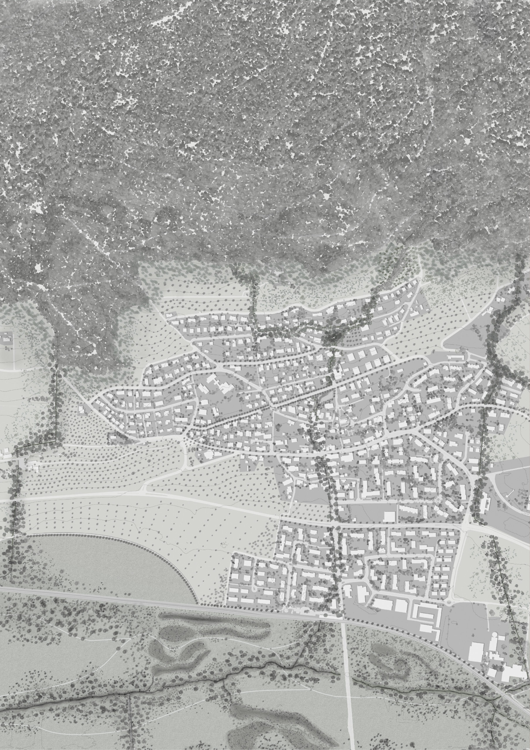
“We are Water“ – Sector Plan | Beatrice Kiser, Angela Stadelmann & Flore Schärrer
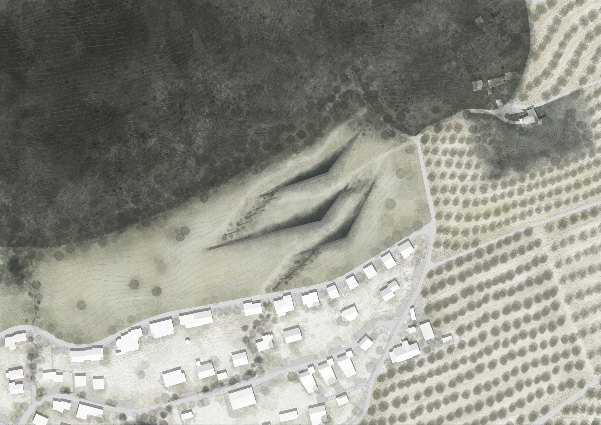
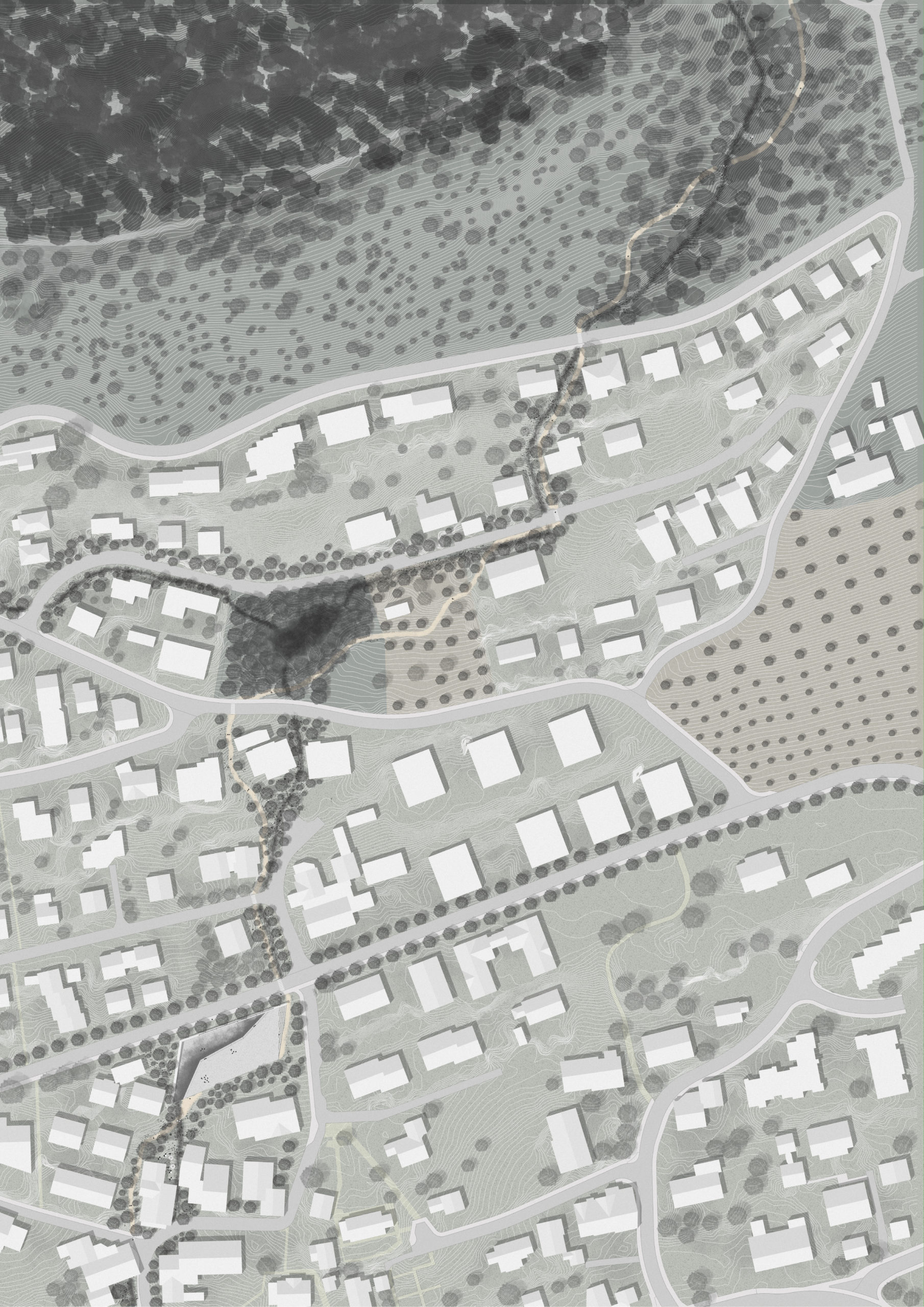
“We are Water“ – Focus Plan | Beatrice Kiser
“We are Water“ – Focus Plan | Flore Schärrer
“We are Water“ – Human Eye Perspective | Angela Stadelmann
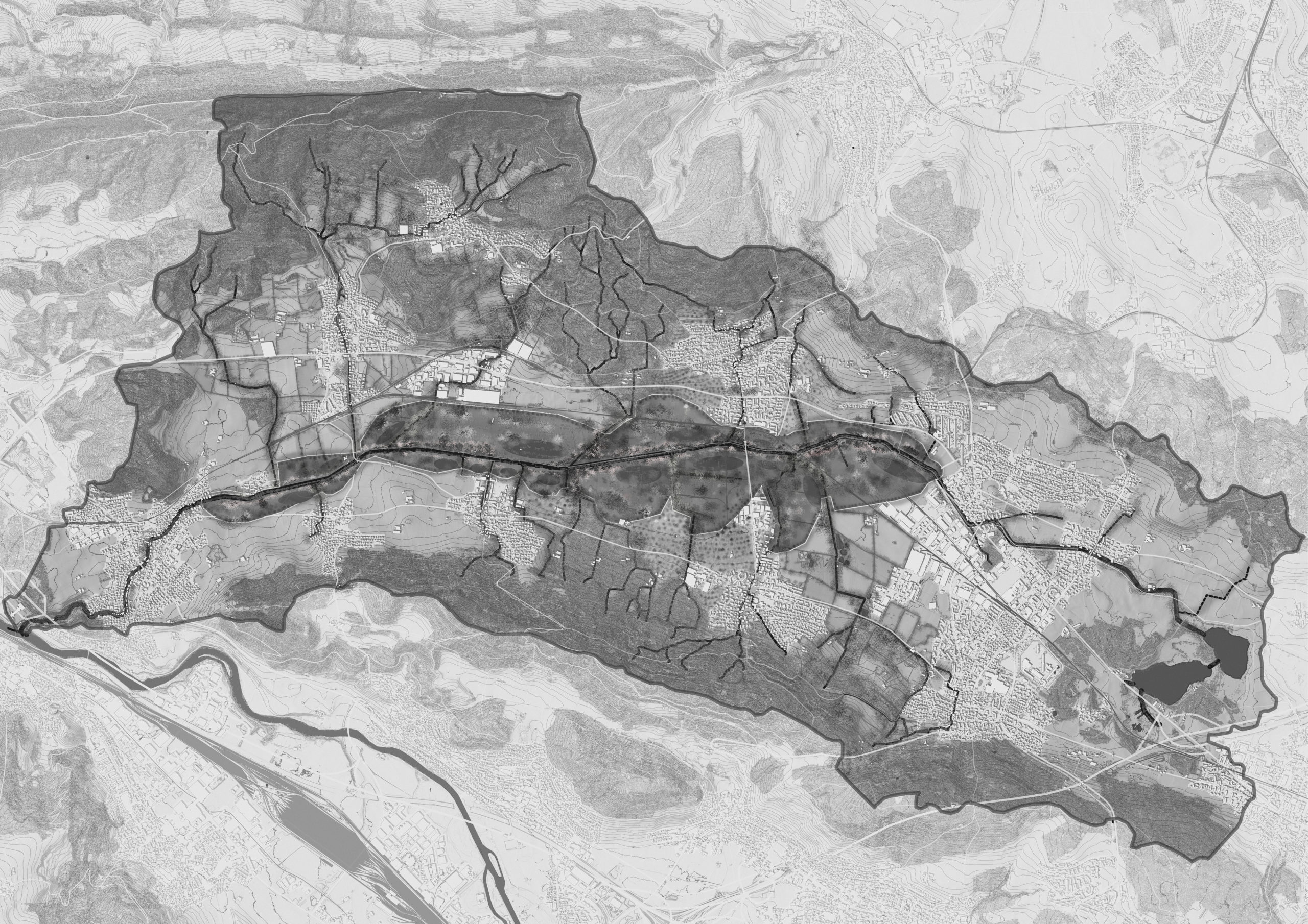
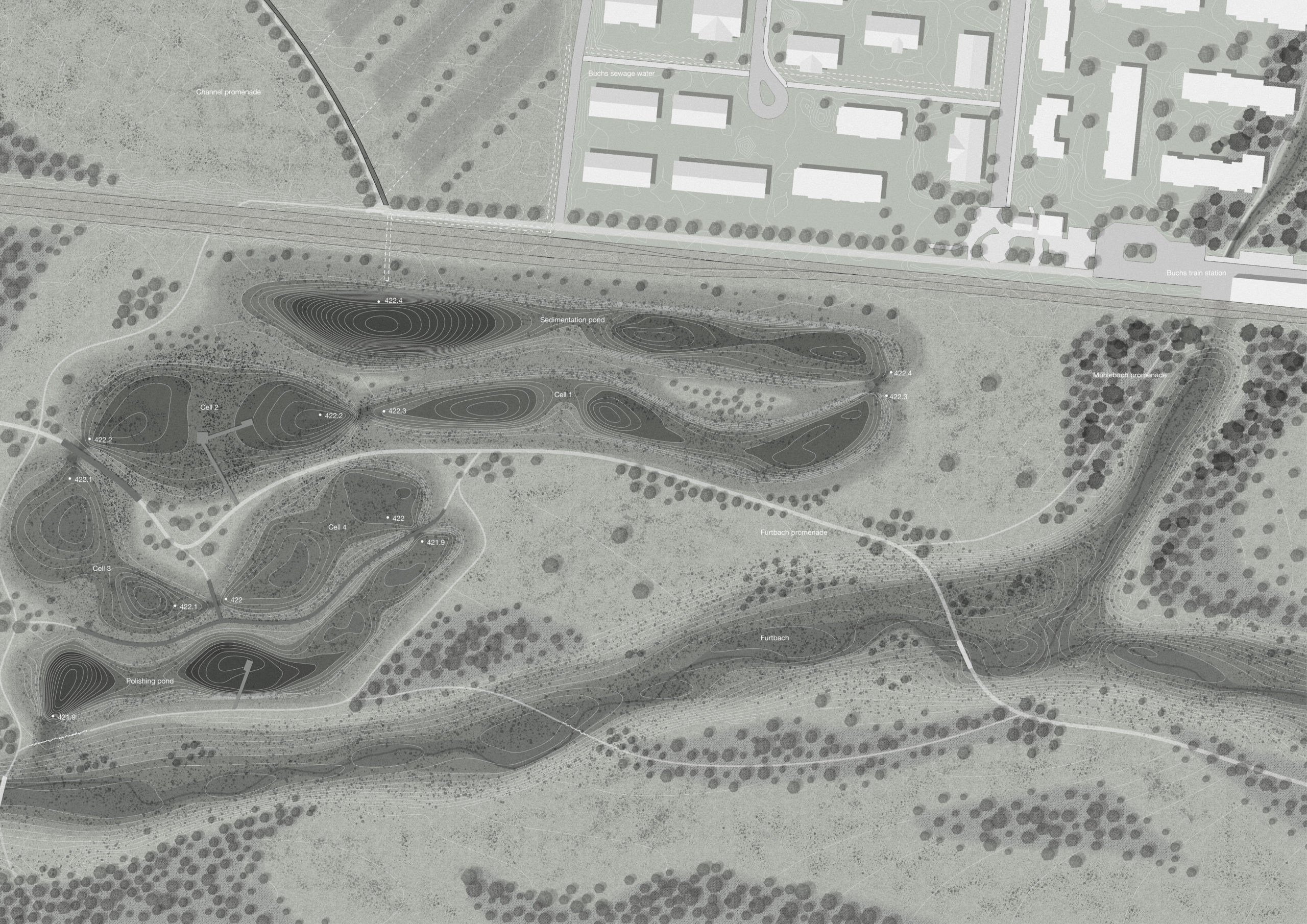
“Amelioration 4.0“ – Territory Plan | Fanny Christinaz & Sophia Garner
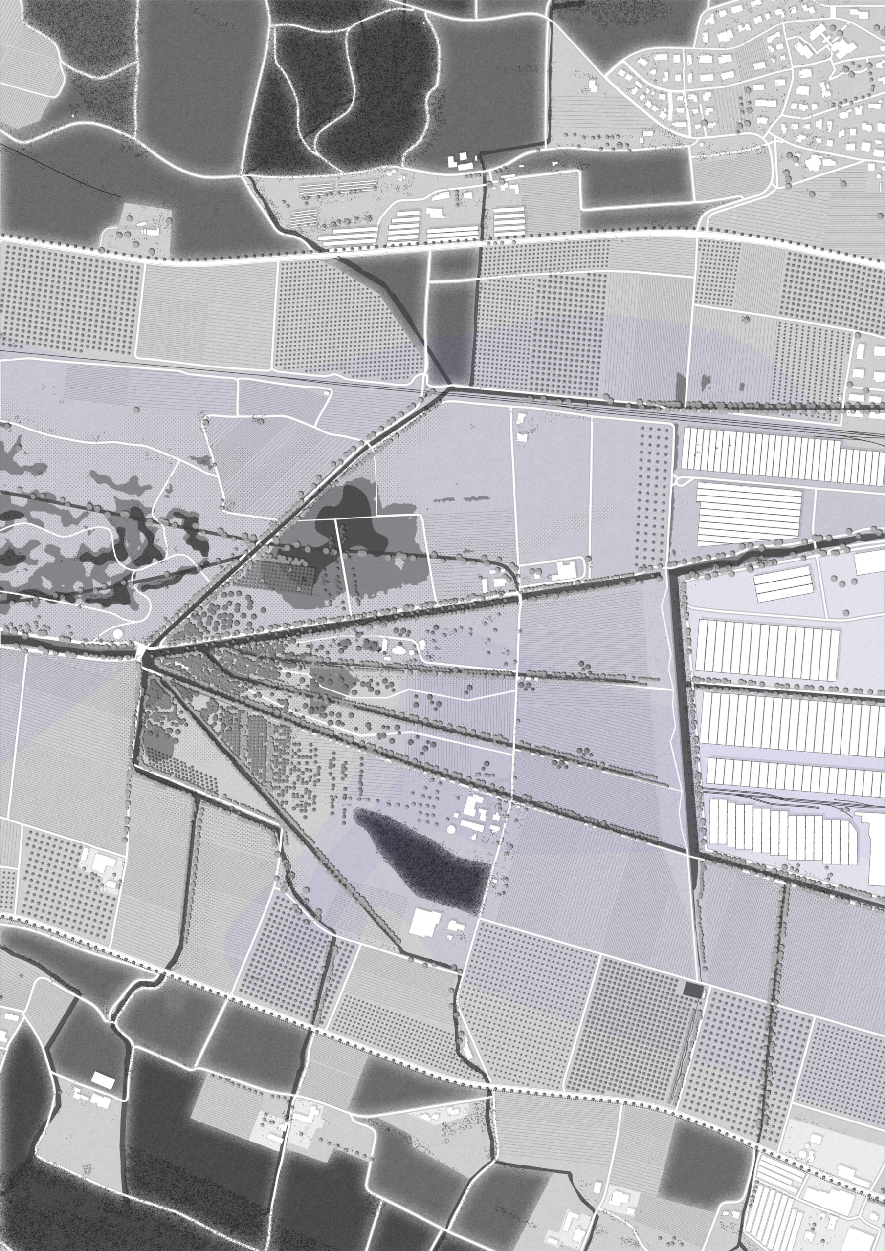
“Amelioration 4.0“ – Secto Plan | Fanny Christinaz & Sophia Garner
“Amelioration 4.0“ – Focus Plan | Fanny Christinaz
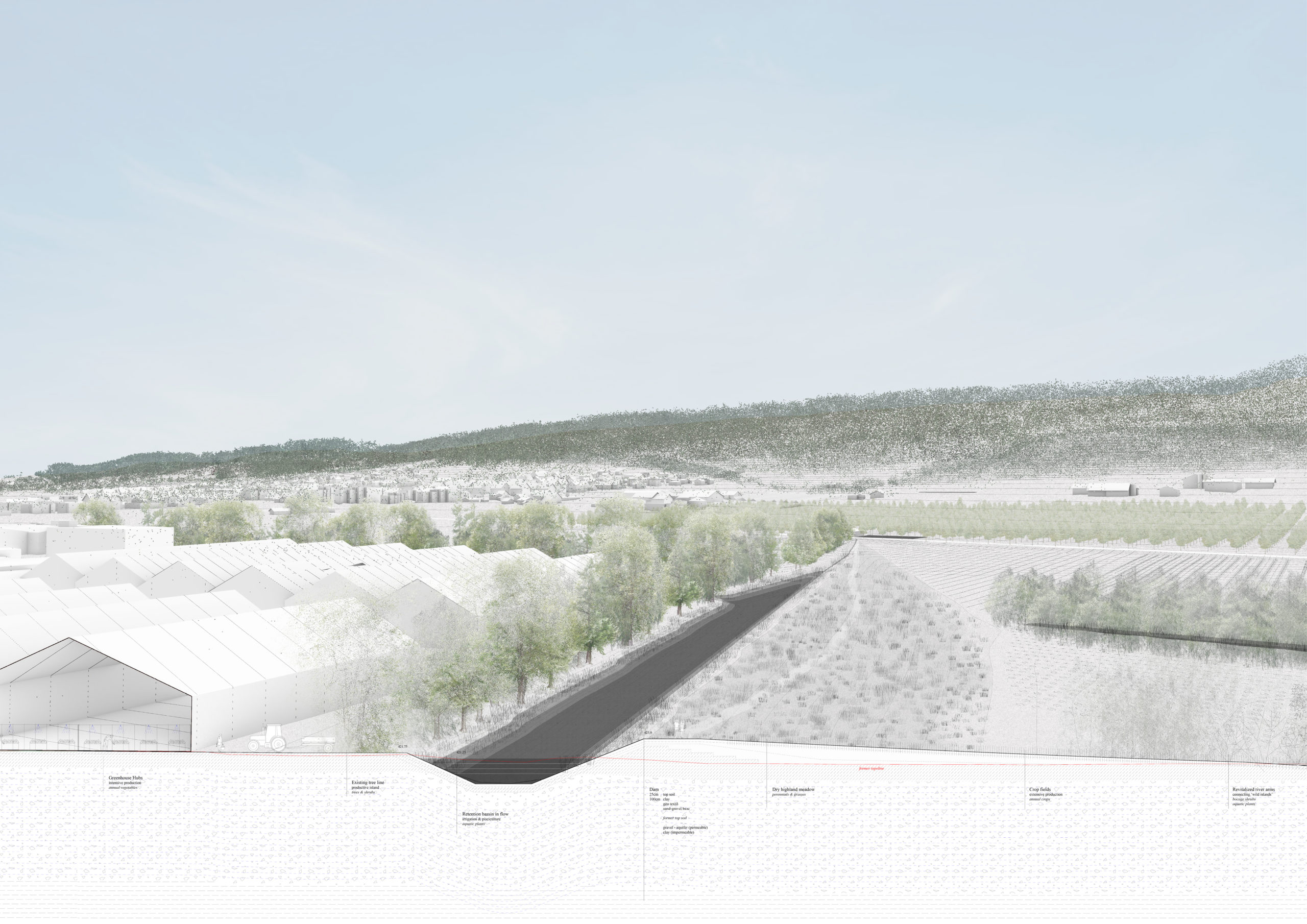
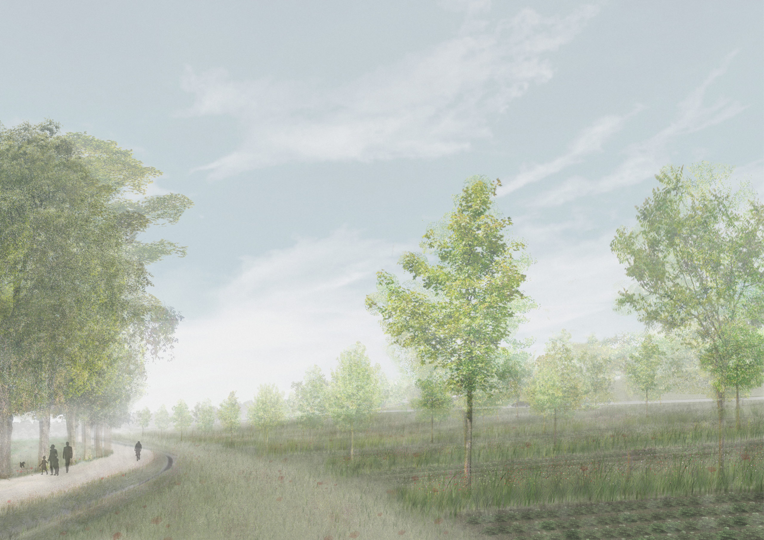
“Amelioration 4.0“ – Section Perspective | Sophia Garner
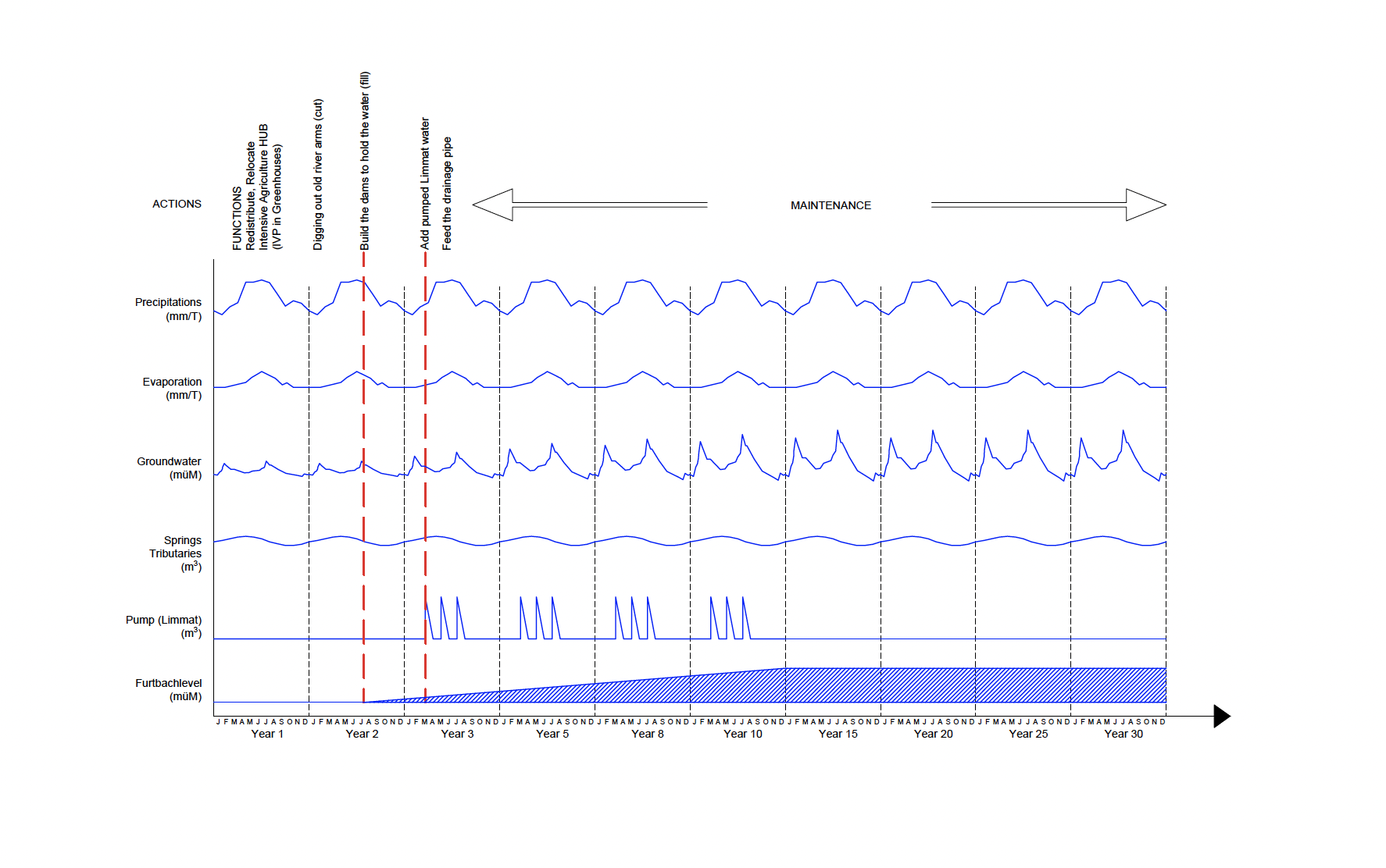
“Amelioration 4.0“ – Water Diagram over Time | Fanny Christinaz & Sophia Garner