
3D-Scan and Visualization by Matthias Vollmer, Shisendo Garden, Kyoto 2015
Under the banner of Landscape Topology, Digital Landscape Design and Analysis has become a core research project at the Chair of Professor Christophe Girot. Based on point cloud modelling techniques the project has allowed for considerable progress in matters of landscape modelling and representation. The chair has developed interactive models with this technology that enable boundless movement through virtual space. In addition, laser scan point cloud models when combined with ambient surround sound recordings produce a new kind of audiovisual landscape reality. In this project teaching and research at the Chair complement one another, working hand in hand at perfecting this nascent design technique.
TOPOLOGY APPLIED TO POINT CLOUD TECHNOLOGY
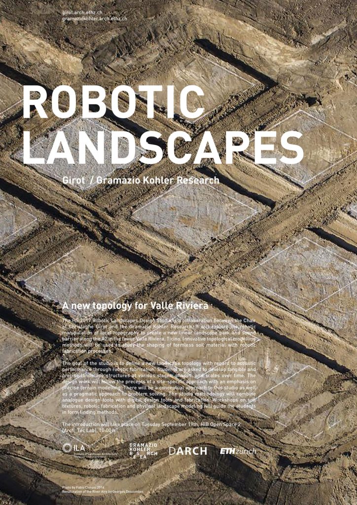
Robotic Landscapes
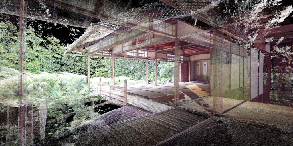
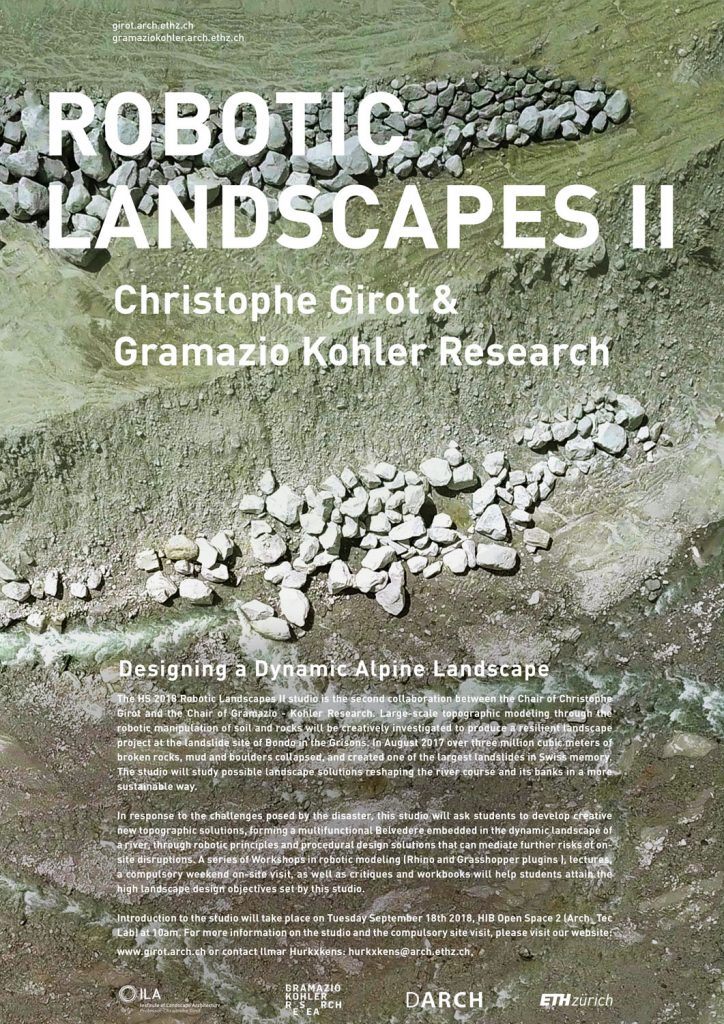
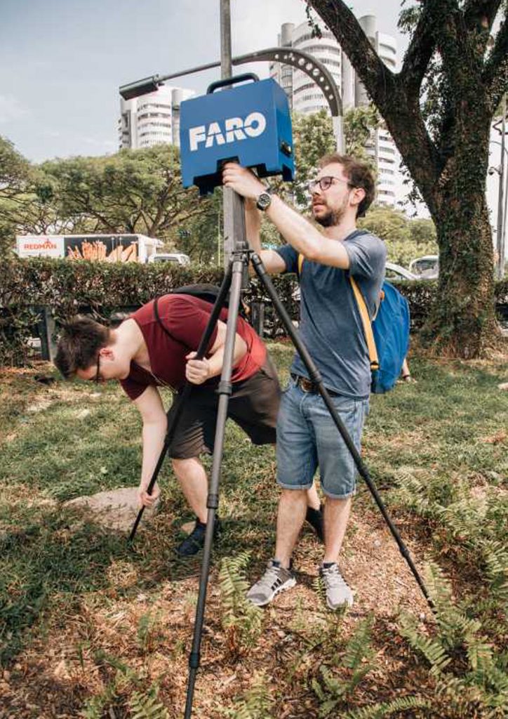
In matters of remote sensing today, the environment can now be reproduced in all its physical and material complexity with high definition point cloud models. Thanks to this knowhow and experience the chair has been invited to contribute in the current NCCR Research Project in Digital Fabrication of the Department of Architecture of the ETH. What is at stake is the topological manipulation of terrain through robotic processes based on point cloud modelling principles. Three Robotic Landscapes design-research studios have been developed as part of Ilmar Hurkxkens’s doctorate in close collaboration with the ETH Chair of Architecture and Digital Fabrication of Prof. Fabio Gramazio and Prof. Matthias Kohler, as well as Prof. Marco Hutter at the ETH Department of Mechanical Engineering. All three studios are situated in the context of difficult large-scale earth moving exercises in Switzerland. They build on recent advances in mobile robotic systems for excavators, AI and digital fabrication. By manipulating terrain with an autonomous excavator, the design-research studio studies the organization of spatial relationships and performances in terrain surface structures by shaping natural granular materials for levees and mounds. It takes a first, but very important step, towards defining new design methodologies and construction techniques for large scale robotic landscape fabrication applied to difficult situations such as mountain landslides, inland flooding and coastal protection.
Students of the Robotic Landscapes I design studio exploring the autonomous walking excavator of the Robotic Systems Lab, ETH Zurich
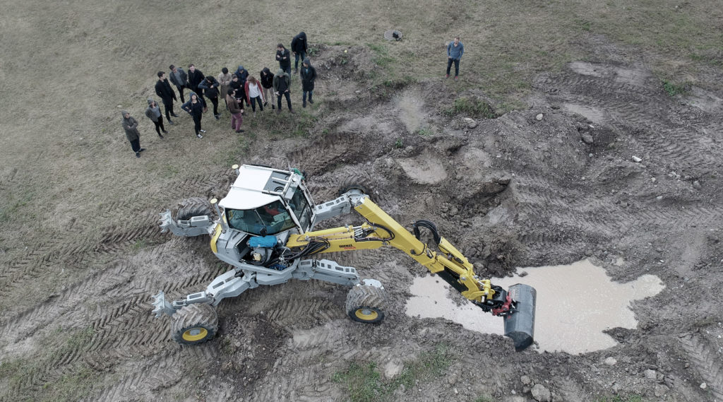
Illustration of a robotically build sound barrier along the A2 highway in the south of Switzerland from the Robotic Landscapes I design studio by students Maximilian Durel, Shohei Kunisawa and Nicolas Wild
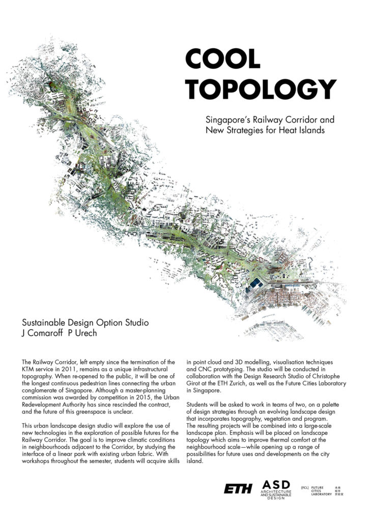
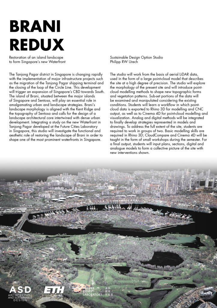
Green Trail Singapore
Research on the urban heat island effect currently being done by Philipp Urech at the Future Cities Laboratory in Singapore similarly uses advanced point cloud landscape modelling to make advances in this highly complex domain. The doctoral project is part of an ongoing interdisciplinary project at the Future Cities Laboratory for the module ‘Ecosystem Services in Urban Landscapes’. It employs point-cloud modelling techniques to look at the green corridor in Singapore in order to develop a method to optimize the physical form of a site and to simulate climatic phenomena. The method draws from sampled three-dimensional models of the entire southern segment of the green corridor including adjacent neighborhoods, precisely documenting certain physical and spatial characteristics of a place. A design-research studio has been developed as part of Philipp Urech’s doctorate and was conducted jointly at the ETH in Zurich and at the SUTD in Singapore in the Spring of 2018 to develop landscape designs that are more climate friendly and conducive to alleviating in part some of the heat island effect that Singapore is faced with.
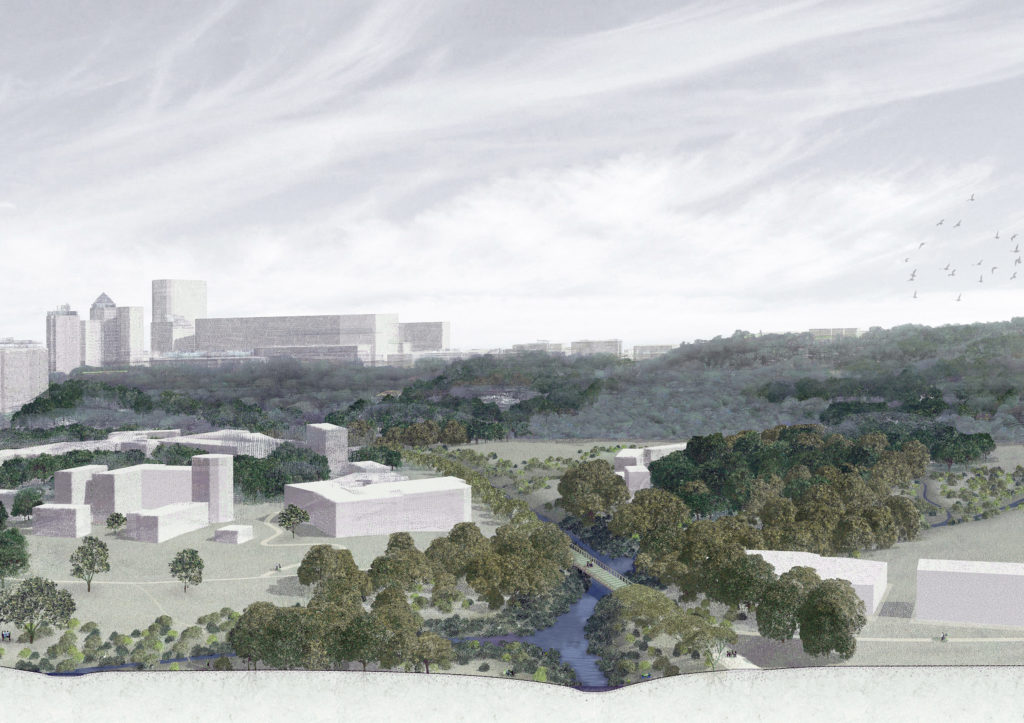
Section-perspective of a landscape design realized with point-cloud modelling on the Rail Corridor near Bukit Timah hill in Singapore
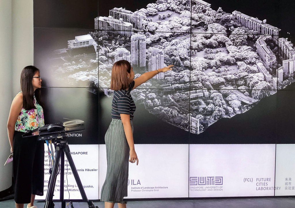
Detail point-cloud model designed during a ETH-SUTD joint workshop and presented at the Future Cities Laboratory in Singapore in March 2018
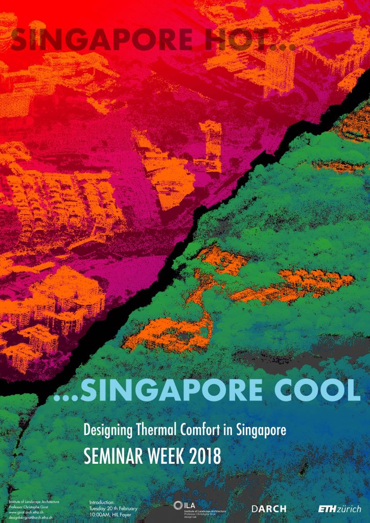
Introduction film of the design studio course in fall 2018 by Philipp Urech: “Singapore hot…Singapore Cool”.
POINT CLOUDS MODELS AND LANDSCAPE ACOUSTICS
The Landscape Visualizing and Modelling Laboratory (LVML) has developed an Audio-Visual Studio through funding of the Swiss National Science Foundation in collaboration with the Chair for Planning of Landscape an Urban Systems of Adrienne Grêt-Regamey (PLUS). In the AV Lab digital recording techniques enable sound to be geo-located and embedded in point cloud models. This enables the partial reconstitution of the acoustic qualities of a specific place at a specific time of day and season, and the creation of an acoustic “continuum” within a given model that powerfully enhances a sense of reality. This method has helped to investigate a combination of auditory and visual impressions that both shape and change our immediate perception of the environment – opening the way towards further research in matters of sound and noise simulation in contemporary society.
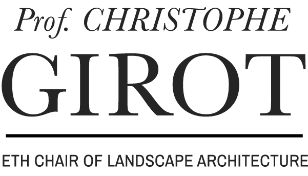
Kyoto Gardens
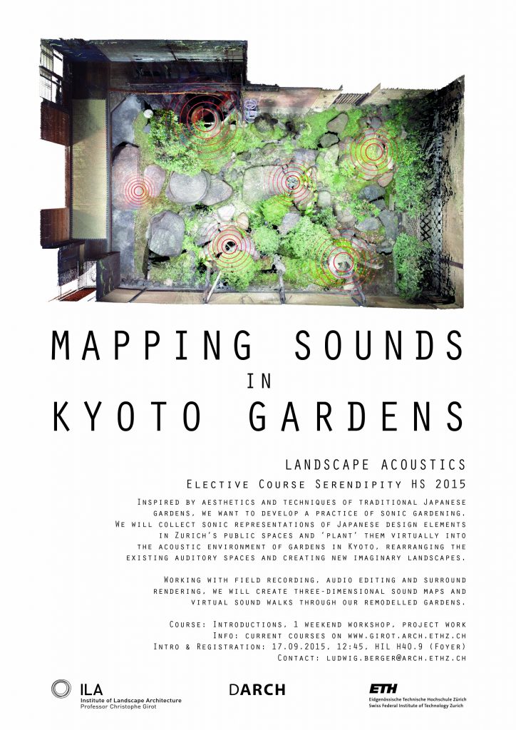
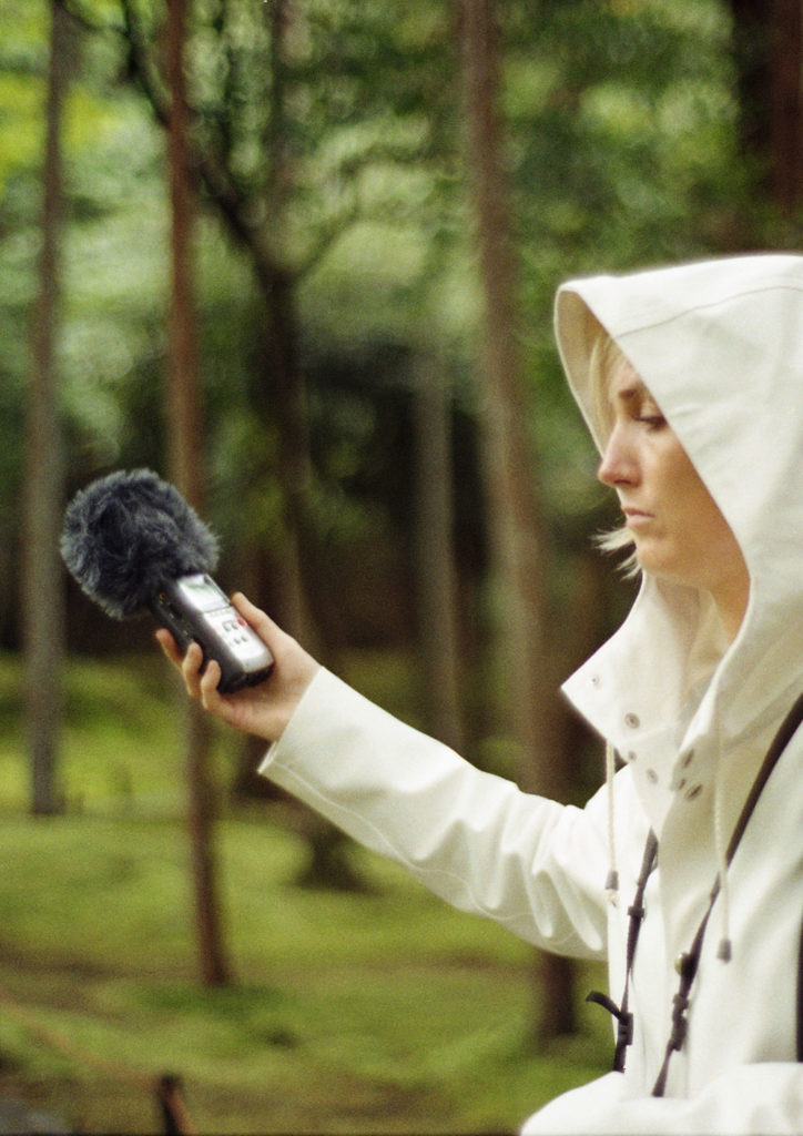
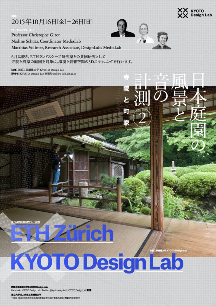
In 2017 Nadine Schütz completed her PhD project on the perception and implementation of Landscape Acoustics. One aspect of the research was part of an ongoing joint project with the Kyoto Institute of Technology in Japan, where the Chair was invited to share innovative research methods in landscape perception in a series of workshops with students from the KIT Design Lab. Through site specific surveys using ambisonic sound recordings combined with point cloud modelling of Japanese gardens in Kyoto, the aural and visual landscape qualities of each place were mapped by combining models with three-dimensional sound recordings. Landscape acoustics combined with point cloud modellingbrings a multimodal spatial experience of the place to the forefront, this is why one can say that Topology is helping to found a new a holistic approach to landscape architecture.
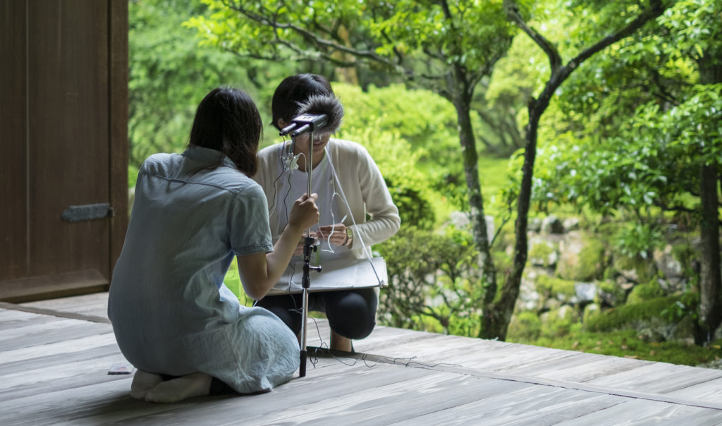
Image by Matthias Vollmer, Miidera Garden, Kyoto 2016
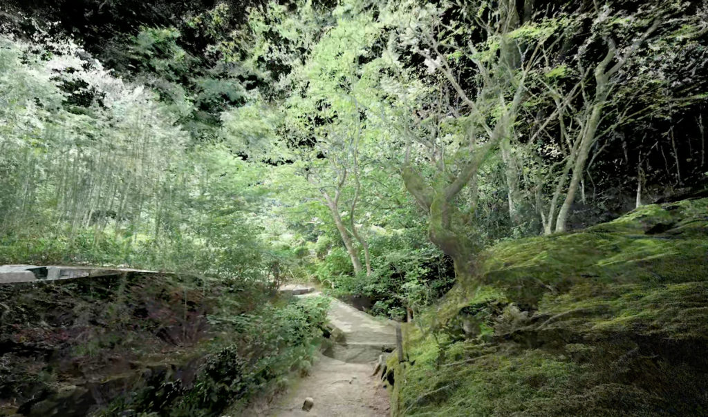
3D-Scan and Visualization by Matthias Vollmer, Shisendo Garden, Kyoto 2015
“Sequential Listening” – audiovisual pointcloud animation of Ninigi Garden, Kyoto 2015 . 3D-Scan and Visualization by Matthias Vollmer, Audiorecording and Composition by Ludwig Berger
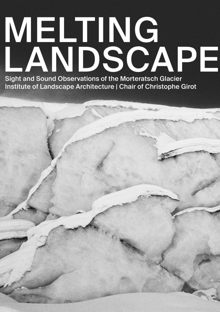
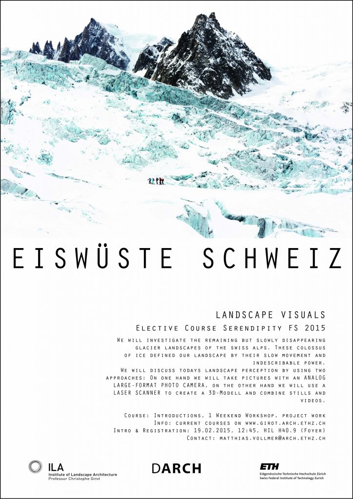
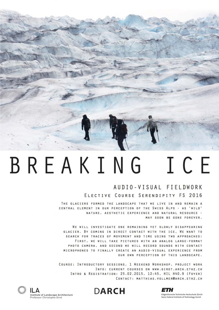
Melting Landscapes
Rapid ice melt has profoundly marked and changed many Swiss alpine regions in recent years. The remaining glaciers have become the iconic symbol of ongoing climate change in Switzerland. Over the course of three years the Chair documented the melting landscapes of the Morteratsch glacier with students and a team of researchers from the Media Lab. During workshops students learned how to scan the lower end of the glacier and made a point cloud model at two different melting states over the seasons. The point cloud models allowed the students to dive into the ice mass of the glacier and experience the physical scale of the place. Additionally, analogue photography was used to frame a portrait of the melt. Sound recordings were made by using submersible contact microphones which were set directly in the ice crust of the glacier. These recordings produced impressive sounds of the moving ice mass which contrasted with the eerie silence of large format the black and white pictures. A selection of photographs and sound works were produced and shown in an exhibition at ETH main hall in the Spring of 2018. The combination of sound and image turned the evanescent beauty of the glacier into an emotionally strong sensory experience. An award-winning LP vinyl album was produced combining image samples and sound.
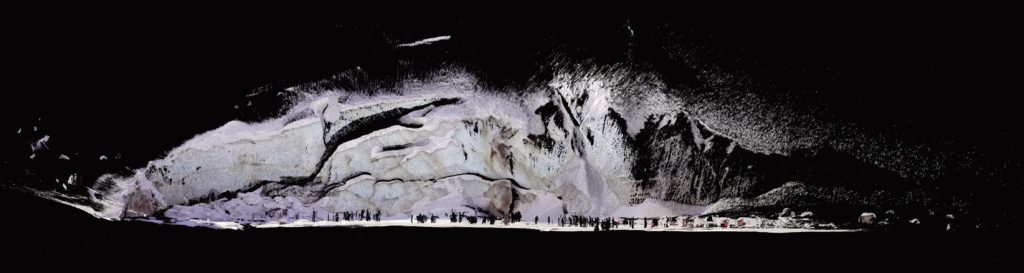
3D-Scan by Johannes Rebsamen and Regula Schweizer, Visualization by Matthias Vollmer, Morteratsch Glacier 2015
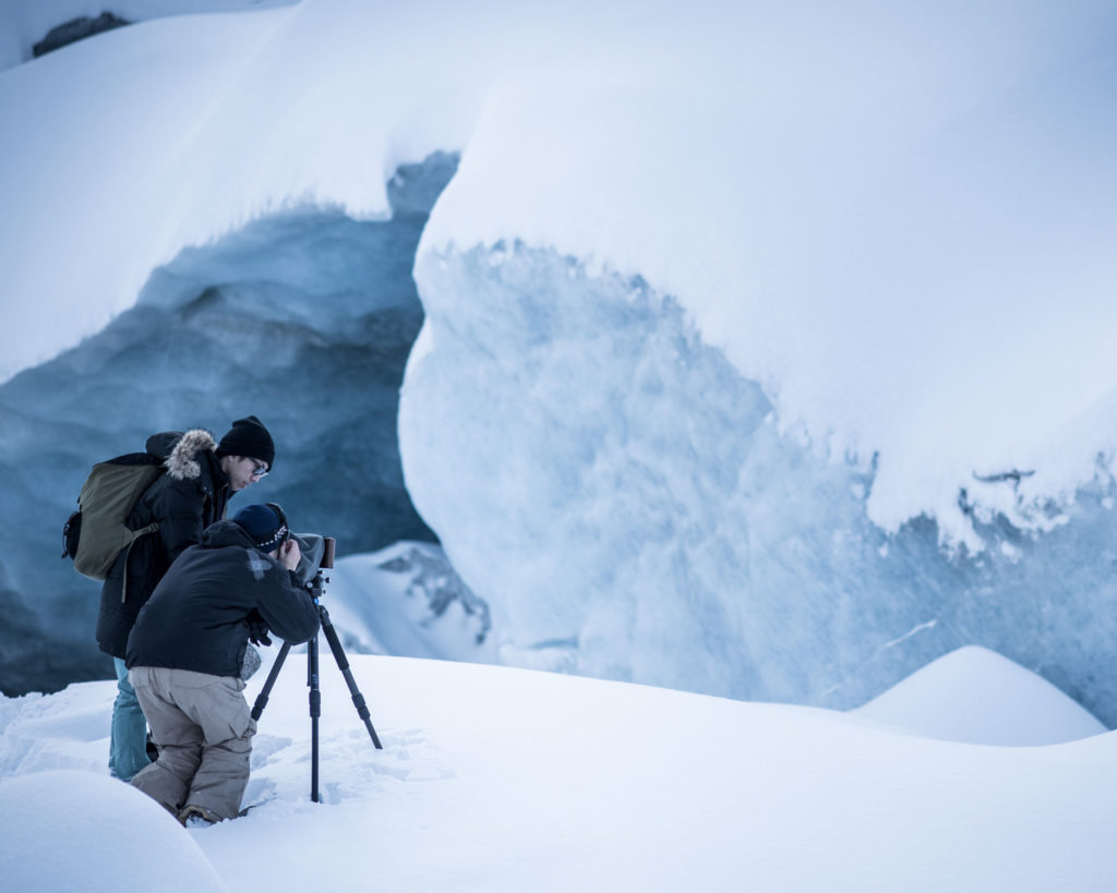
Image by Ralph Rosenbauer, Alpa of Switzerland
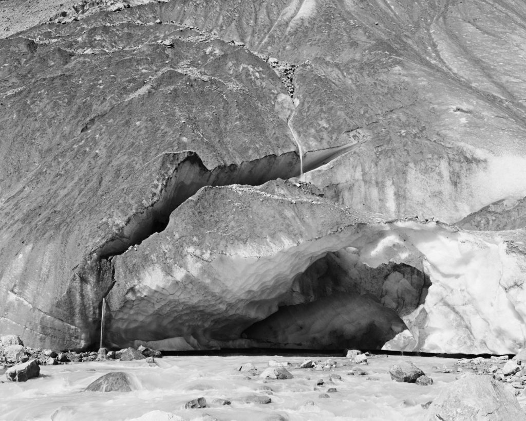
Image by Stephan René Mauser & Vasiliki Papadimitriou
3D-Scan by Johannes Rebsamen & Regula Schweizer and Visualization by Matthias Vollmer, Audiorecording and Composition by Ludwig Berger – Images and Soundrecordings by Students of the Elective Course

Further research in the domain of the Digital Landscape Design and Analysis project by the Chair of Landscape Architecture has been exhibited at a variety of institutions and events, including the Venice Biennale, the Rotterdam Biennale, the World Economic Forum in Davos, the Scientifica in Zürich and a Ted X Talk. The St. Gotthard Pass project in the Swiss Alps has been a core chapter in large scale point cloud modelling over the past ten years, and is currently being amended through technical support from the Swiss Federal Railway company. The underlying reality represented through point cloud technology shows a combination of extraordinary rock formations and riverbeds combined with villages and infrastructure – both above and below ground – thus creating a completely new perceptual dimension of contemporary alpine space. Other regions of the globe have also been investigated by the Chair using a similar modelling approach in Jakarta, in the Sonoran Desert of Tucson, and the Jordan River Valley at the border of Israel and Jordan.
On 11 November 2016, Christophe Girot spoke at the TEDx Talk in Zürich on “Point Cloud Modelling the Alpine Landscape”.
PROJECT TEAM
Prof. Christophe Girot, Johannes Rebsamen, Matthias Vollmer, Ludwig Berger, Ilmar Hurkxkens, Philipp Urech, Magdalena Kaufmann, Benedikt Kowalewski, Fujan Fahmi, Dennis Häusler, Ben Gitai, Isabelle Fehlman, Patrick Düblin
ORGANISATION
ETH Zurich DARCH – Landscape Modelling and Visualizing Laboratory Chair of Prof. Christophe Girot, Institute of Landscape Architecture